A Map of Fargo Presented by KFGO
$110.00
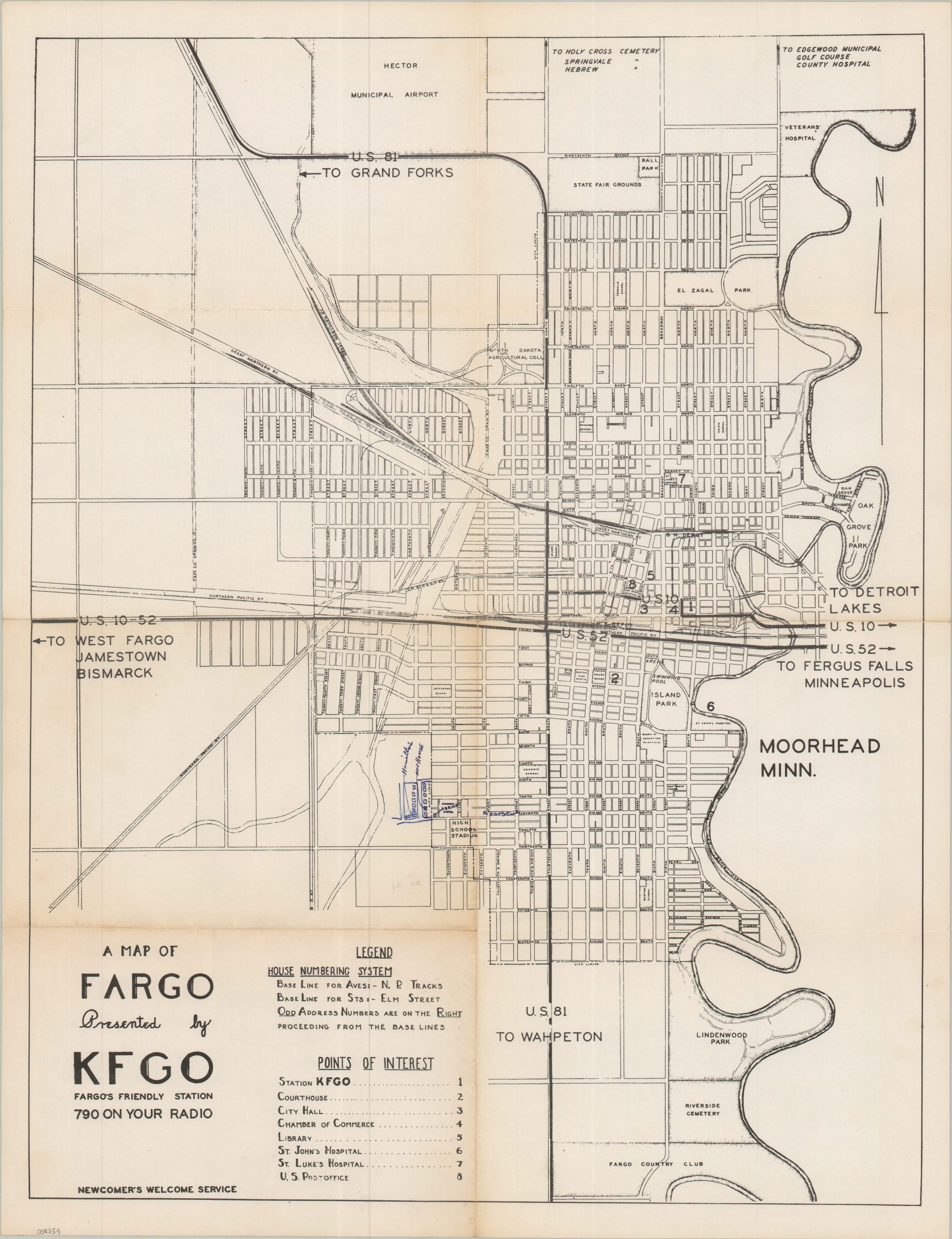
A handy map of the ‘Gateway to the West,’ courtesy of Fargo’s Friendly Station.
1 in stock
Description
This straightforward street plan of Fargo, North Dakota, was issued in the 1930s by KFGO, a local AM radio station. Eight different points of interest are numbered and labeled in the accompanying legend. Other interesting features include the North Dakota Agricultural College, the state fairgrounds, the Fargo Country Club, and Hector Municipal Airport. Two U.S. highways (81 & 52) bisect the city while the Red River runs alongside, separating it from adjacent Moorhead, Minnesota. A previous owner has marked their neighborhood in blue ink.
Map Details
Publication Date: c. 1935
Author: KFGO
Sheet Width (in): 16.90
Sheet Height (in): 21.90
Condition: B+
Condition Description: Single-sided map creased and slightly worn along old folds. The two segments in the lower left have toned moderately (see scan) and there is some old handwriting in blue ink. About good condition overall.
$110.00
1 in stock