A Map of Exploration in the Spanish Southwest 1528 – 1793
$75.00
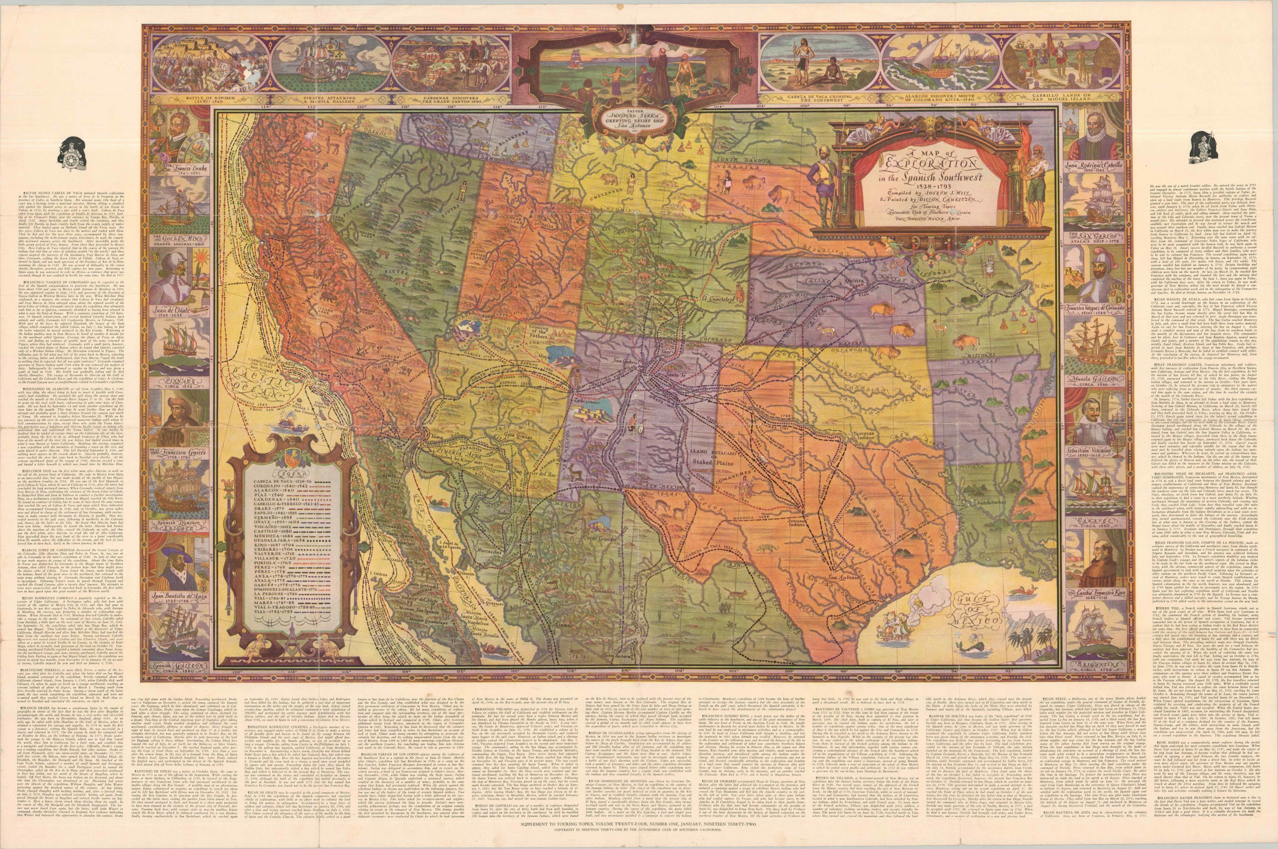
A clever blend of history, mythology, and advertisement.
1 in stock
Description
This large and colorful map of the western United States was published by the Automobile Association of Southern California in 1932. It shows the routes of early explorers during the approximately 2 and a half centuries that the vast region was under Spanish dominion. Thirty different expeditions, ranging from Cabeza de Vaca to Pierre Vial, are noted according to the legend in the lower left. Text in the borders provides a summary of the major players and events, many of which are depicted pictorially around the map.
Compiled by Joseph J. Hill, with artwork by Dillon Auritzen and editing by Phil Townsend Hanna.
Map Details
Publication Date: 1932
Author: Joseph J. Hill
Sheet Width (in): 42.25
Sheet Height (in): 28
Condition: B
Condition Description: Large single-sided color printed sheet with heavy wear along old folds, including marginal splits (mostly repaired), small spots of loss at fold intersections, and moderate creasing. About good condition overall.
$75.00
1 in stock