A Map and Bus Guide of Honolulu
$125.00
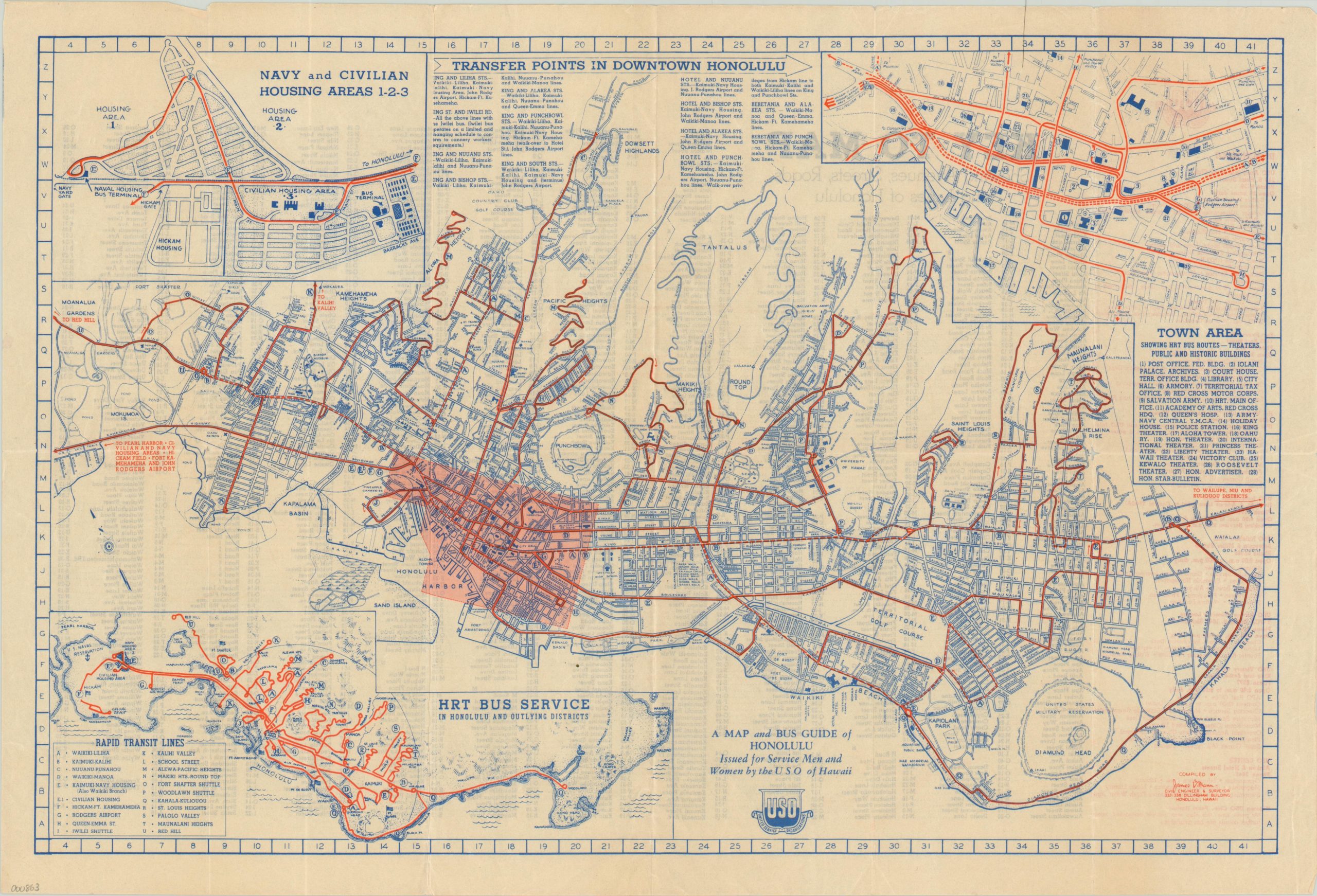
Transportation map of Oahu hotspots for WWII servicemen and women.
Description
This map of Honolulu was compiled c. 1944 by civil engineer/surveyor James B. Mann and published by the Honolulu Rapid Transit and Land Company on behalf of United Service Organizations (USO).
It shows a basic street map of the city with bus routes overlaid in red. Locations of interest are individually labeled and include recreational areas, military installations, and civic buildings. Three inset maps are present; including one which shows the area of the southern end of the island from Pearl Harbor to Koko Crater. The second and third inset maps are large scale representations of Navy and Civilian Housing Areas and downtown Honolulu, again with local bus routes emphasized in red.
This map goes a long way towards explaining why Honolulu was such a desirable assignment for many men and women in the armed forces during WWII – an easily accessible transportation system, numerous opportunities for leisure and gorgeous scenery being just a few reasons.
Map Details
Publication Date: c. 1944
Author: James B. Mann
Sheet Width (in): 21.25
Sheet Height (in): 14.50
Condition: A-
Condition Description: Faint wear along fold lines and minor crinkling to the sheet. A few small nicks in the outer edge, otherwise excellent.
$125.00