A Guide to Frankfurt Am Main
Occupied Frankfurt in the months immediately following the end of the war.
Out of stock
Description
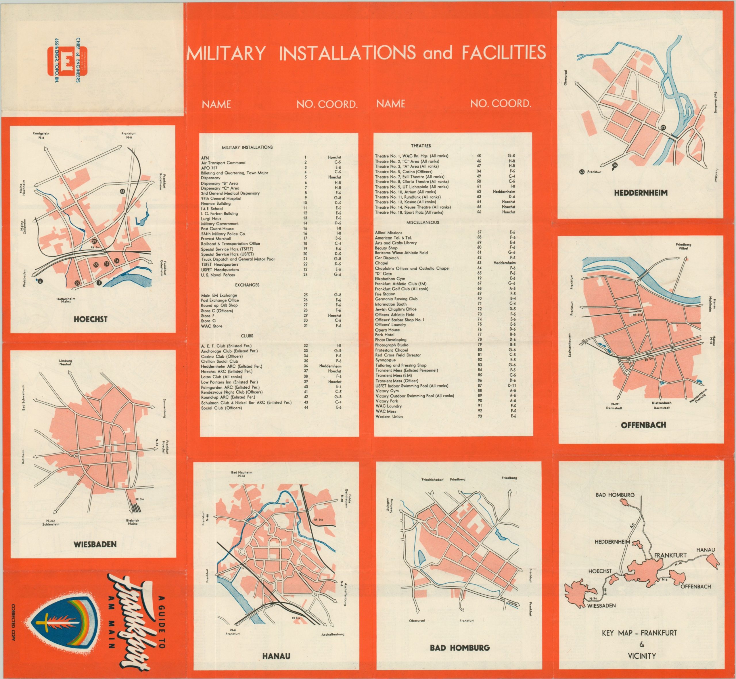
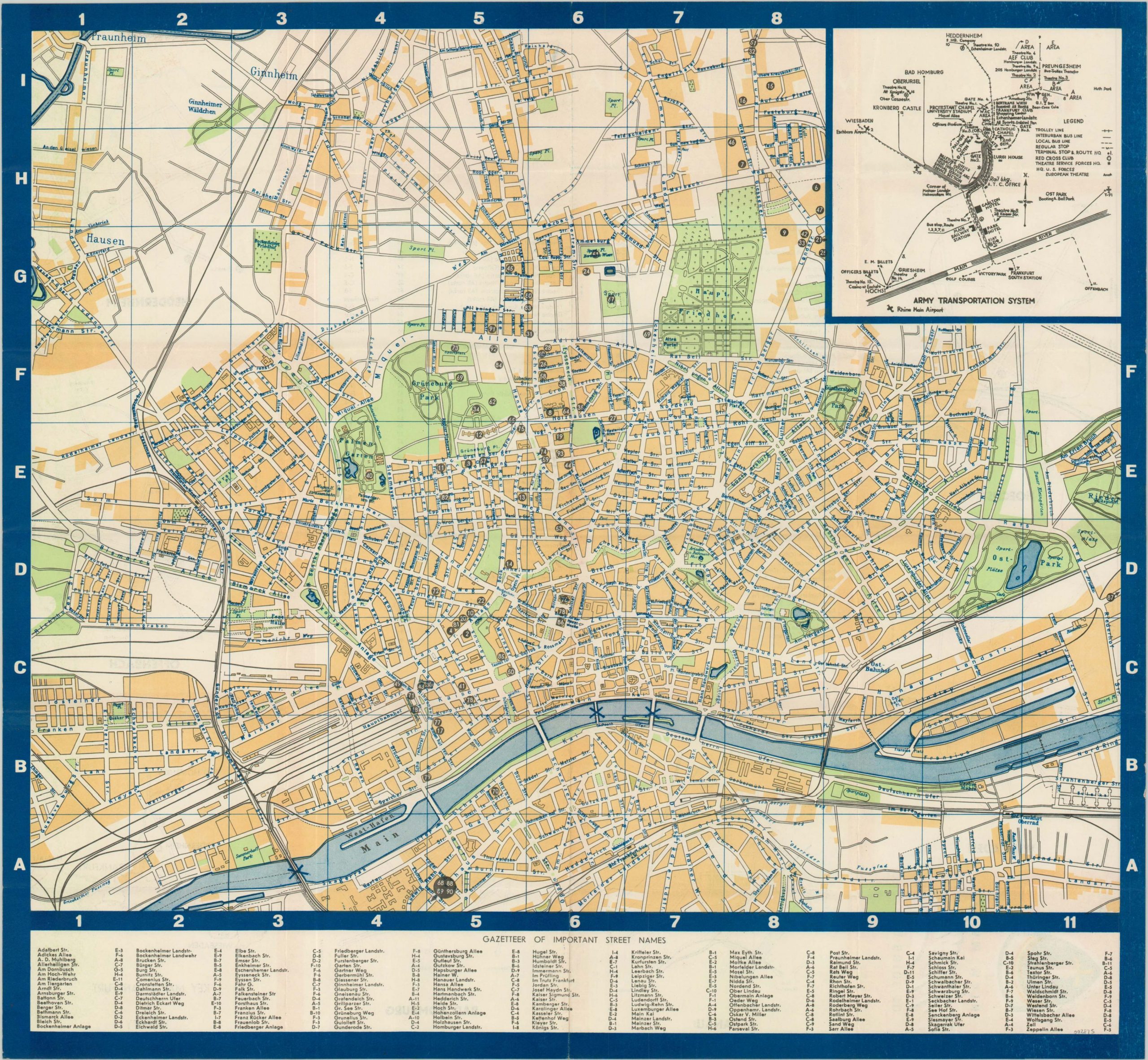
Following Germany’s capitulation in August of 1945, Allied powers divided the conquered Third Reich into four separate zones of occupation (one for England, France, the United States and Russia). The American Zone of Occupation was concentrated in the south, and its headquarters were located in the former IG Farben Building in Frankfurt am Main. As one can image, there remained a significant military presence in the city, and this English-language map was issued to assist with local transportation.
The verso includes simple outlines of several notable suburbs, as well as an index of military installations and facilities. The guide was published in 1946 by the 655th Engineer Topographic Battalion.
Map Details
Publication Date: 1946
Author: 655th Engineer Topographic Battalion
Sheet Width (in): 21.40
Sheet Height (in): 19.50
Condition: A
Condition Description: Lightly creased along originally issued fold lines, but otherwise in near fine condition.
Out of stock


