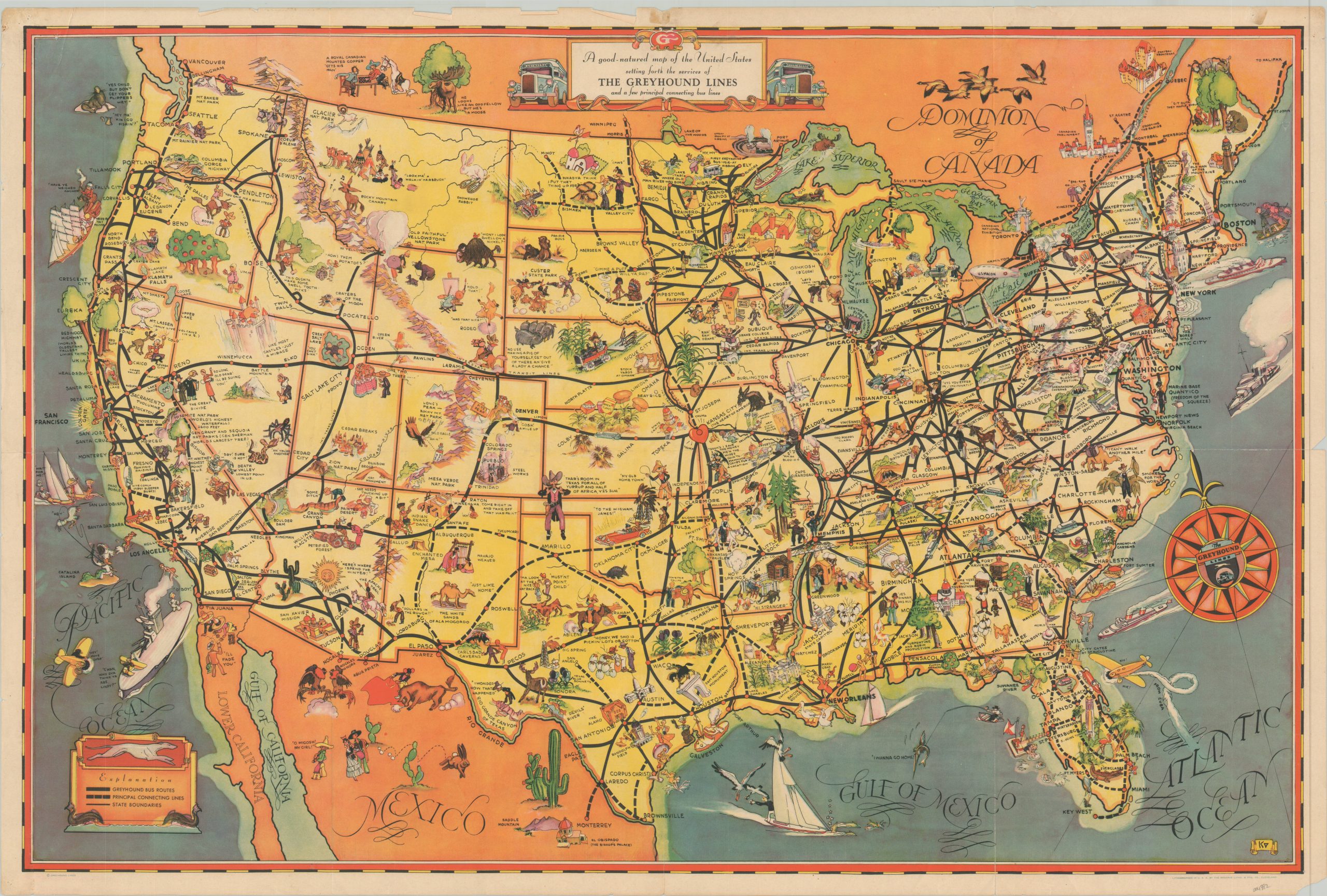
A Good Natured Map of the United States setting for the services of the Greyhound Lines
Uncommon version of Greyhound’s pictorial map issued in conjunction with the 1933 World’s Fair in Chicago.
Out of stock
Description
This beautiful pictorial map of the United States highlights the coast-to-coast access made available by the bus routes in operation by Greyhound Lines. Connecting routes are shown with hashed lines and reflect an extended reach across the American Southwest, the Dakotas, and throughout Florida. Illustrated vignettes dotted throughout the image reflect contemporary cultural perceptions of the 1930s and show historic sites, notable industries, recreational activities, and unfortunate stereotypes.
All of America’s (and part of Canada’s) diverse beauty is on vibrant display, deliberately designed to encourage ridership. Published by the Greyhound Lines in 1933, as noted by the Century of Progress Exposition icon used to represent Chicago. The World’s Fair hosted in the city that year drew thousands of visitors from across the country, and the map would have been issued to promote Greyhound busses as an alternative to railways or automobiles.
Map Details
Publication Date: 1933
Author: Greyhound Lines
Sheet Width (in): 29.6
Sheet Height (in): 19.6
Condition: B
Condition Description: Faint damp staining visible on the left side of the sheet and moderate wear along the outer edges, including pinholes in the corners, and some scattered discoloration. Several areas of separation along former fold lines have been repaired and reinforced on the verso with archival tape. About good condition overall.
Out of stock