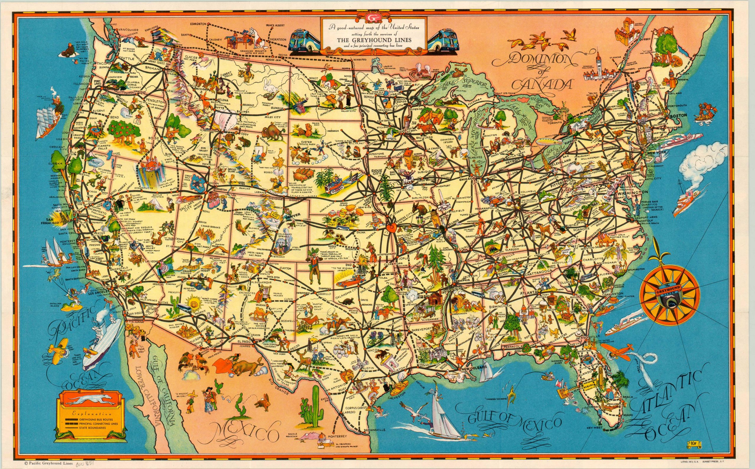
A Good Natured Map of the United States Calling Forth the Services of the Greyhound Lines
Comical promotional map of the United States by Greyhound Lines reflecting the social and cultural atmosphere of America in the late 1930’s.
Out of stock
Description
Outlining the connecting routes of the United States and parts of Mexico and Canada, this Greyhound Bus map includes comical illustrations and commentary on areas of interest throughout the continent. From the “Bored Walk” in Atlantic City to a longhorn hat rack in Texas, the whole image is dotted with intricately designed, colorful vignettes that would appeal to an audience in the 1930’s. America’s ethnic and regional perceptions of itself are made manifest by these caricatures throughout the map, whose illustrations condone the social and racial stereotypes denoted in the map’s pictorials—Native American Indians snake dancing, African-Americans picking cotton—all captioned with down home, folksy lingo.
This map has been published in several different sizes and iterations; this reduced version in conjunction with the 1939 World’s Fair hosted in New York. The iconic symbols of the fair – the Trylon and Perisphere – can be seen outside the city.
Map Details
Publication Date: c. 1938
Author: Greyhound Lines
Sheet Width (in): 19.00
Sheet Height (in): 12
Condition: A+
Condition Description: The map is in pristine condition as originally issued
Out of stock

