A Good-Natured Map of Alaska showing the services offered by “The Alaska Line”
$225.00
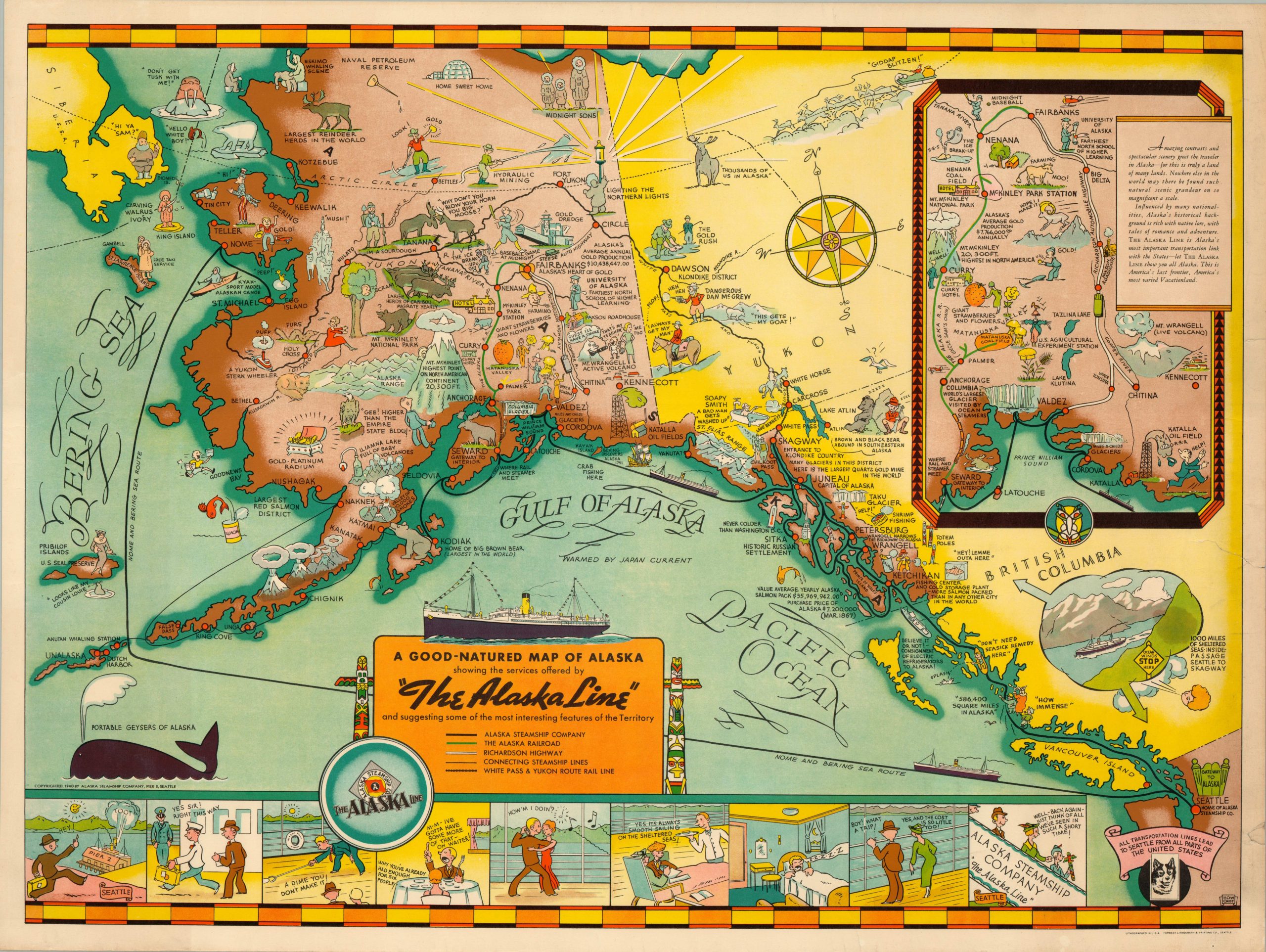
1940 edition of Edward Camy’s colorful promotional map of Alaska.
1 in stock
Description
The bright colors, amusing illustrations and light-hearted commentary seen throughout this map of Alaska were deliberately designed by artist Edward Camy to help change public perceptions about “The Last Frontier.” A comic strip along the bottom of the sheet highlights the convenience, amenities, and low cost of a trip from Seattle; home of the Alaska Steamship Company and labeled as “The Gateway to Alaska.”
The routes undertaken by the Alaska Line can be seen snaking along the coast and far out into the Bering Sea, while interior railroads and an inset map of the Richardson Highway show complementary avenues that allow travelers access to the interior of the territory. The image is rife with humor; including Santa Claus, portable geysers (whales), and cheeky wildlife.
The map was first issued in 1934 with a slightly different color scheme and re-issued in 1939 in the tones seen here. This version is from 1940 and identical to that of 1939, except for the updated steamship route that circumvents Dutch Harbor. This is likely because, in 1940, construction of military bases on the island began to offset the impending Japanese threat in the Pacific. Blank on verso.
Map Details
Publication Date: 1940
Author: Edward Camy
Sheet Width (in): 29.20
Sheet Height (in): 22.00
Condition: B+
Condition Description: The map is in very good condition. Wear is most evident along the right edge, where there is one chip in the margin and a few tears, one of which extends about 2" into the image and has been repaired on the verso. One spot visible in the lower right inset. A few faint wrinkles from where the map was previously rolled, but otherwise in fine shape with bright color.
$225.00
1 in stock