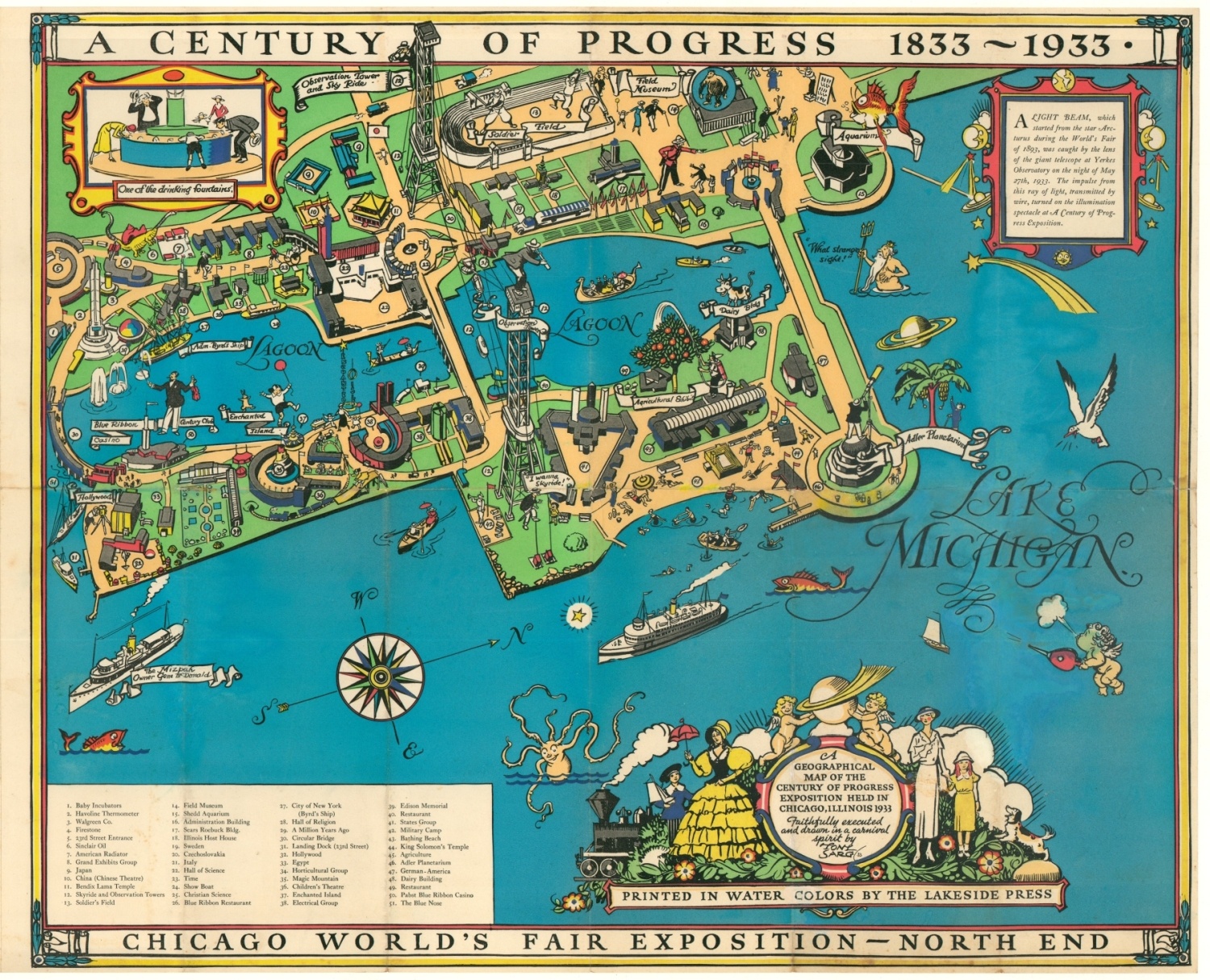
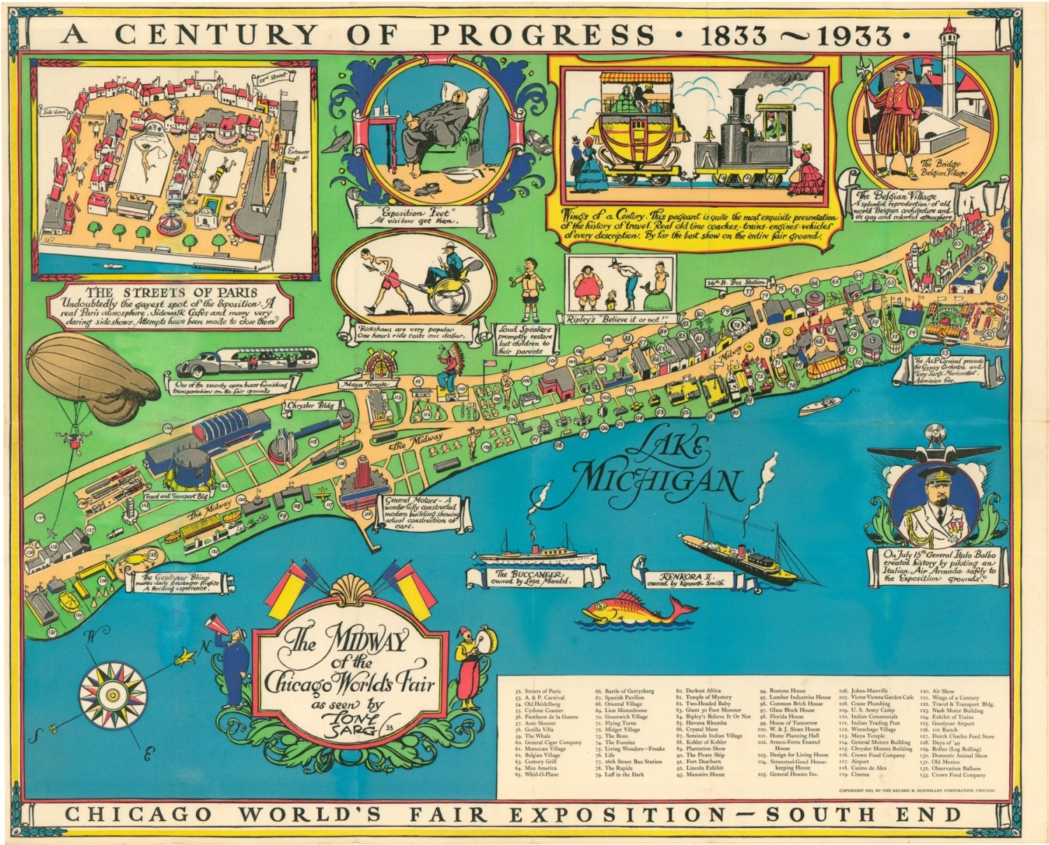
A Geographical Map of the Century of Progress Exposition Held in Chicago, Illinois 1933
Rare pictorial view of the Century of Progress created by the multi-talented Tony Sarg.
Out of stock

Description
The 1933 World’s Fair in Chicago, known as the Century of Progress Exposition, was designed to highlight the host city’s tremendous growth since its incorporation as a town in 1833. The theme was technological innovation, and the motto was “Science Finds, Industry Applies, Man Adapts.”
Despite the ravages of the global Great Depression, dozens of countries participated in the fair, as well as nearly every state in the Union. Nearly fifty million visitors attended the fair while it was open, and it proved so popular that it was extended for a second season in 1934.
This beautifully illustrated panorama of the fairgrounds, nestled between downtown and Lake Michigan, was created by Tony Sarg in 1933 to be sold as a souvenir to the throngs of descending tourists. The primary image, broken into the Midway and Lagoon, features dozens of buildings, exhibits, and attractions that are individually outlined and numbered according to a legend in the lower center. Filling many of the surrounding negative spaces are a variety of insets that show specific, often amusing, details about the fair (see ‘Exposition Feet’ and the ‘loudspeakers’).
The invariable march of technological progress is emphasized throughout the map and (quite literally) from the fair’s start to finish. A text box in the upper right notes that the Century of Progress was switched ‘on’ using a beam of light emitted from the star Arcturus, allegedly during the preceding World’s Fair in 1893. Figures around the title cartouche highlight the development of clothing, while several vignettes highlight the latest developments in transportation technology.
The map was drawn by the talented illustrator Tony Sarg and published in Chicago by The Rueben H. Donnelley Corporation. Sarg created similar maps for the 1939 World’s Fair in New York using his same distinctive style.
Map Details
Publication Date: 1933
Author: Tony Sarg
Sheet Width (in): 52.5
Sheet Height (in): 21.25
Condition: B
Condition Description: Two sheets, professionally restored and mounted on linen for preservation and stability. Several areas of damp staining throughout both sheets have been artfully filled with wash color, and affected text has also been replaced with contemporary script. Generally the affected areas are visible in the blue waters of Lake Michigan, but there are a few spots along the border, in the title block, and near the Sky Ride.
Out of stock