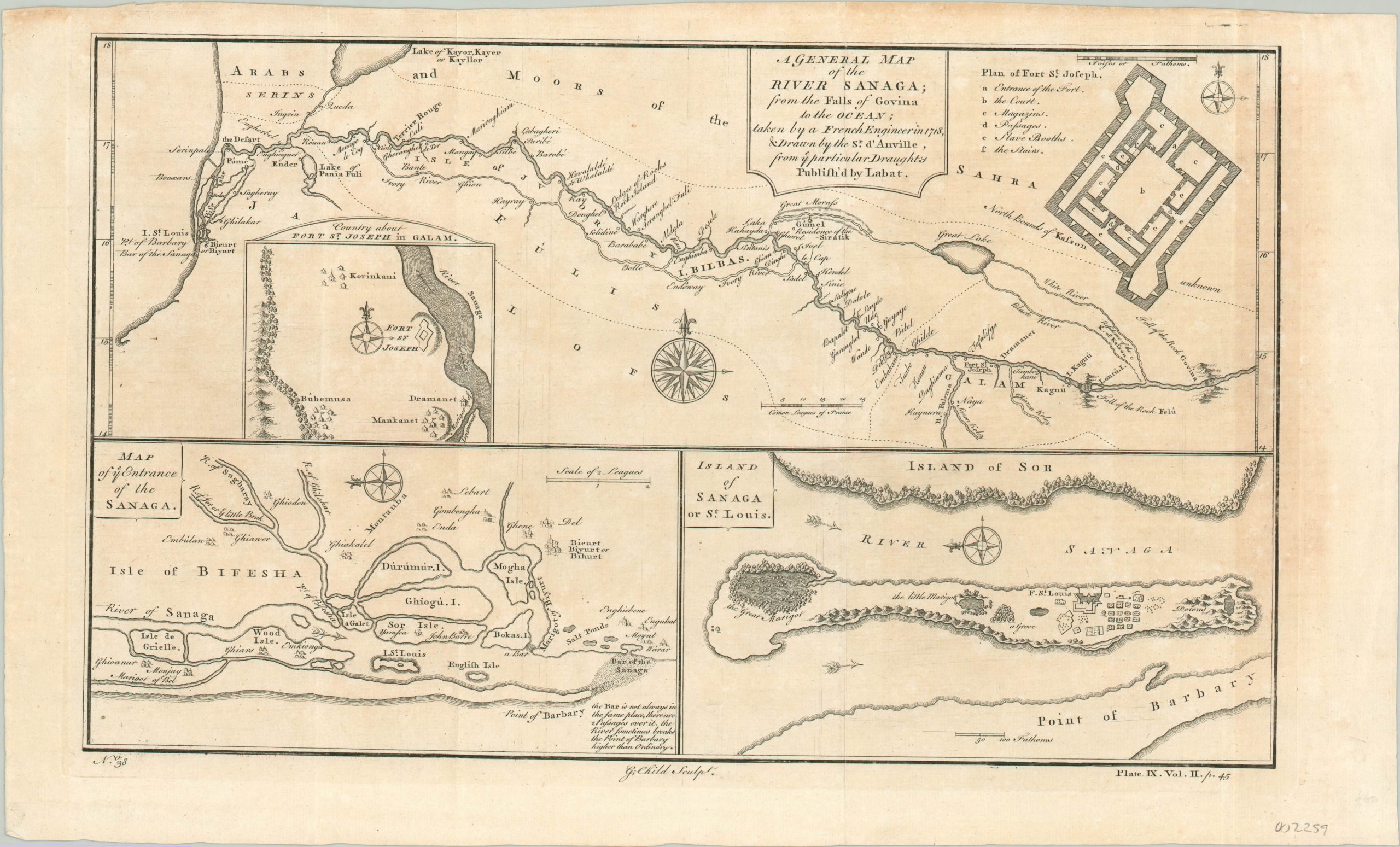
A General Map of the River Sanaga
$60.00
Multi-faceted map of the Senegal River
1 in stock
Description
In 1659, the French established the Fort of Saint Louis on a small island at the mouth of the Senegal River. From that forward position, they were able to eventually dominate economic control of the river’s interior and established a large colonial presence in West Africa. This sheet, an English adaptation of an earlier issue by the renowned French cartographer Jean Baptiste Bourguignon d’Anville, shows a variety of maps and views that highlight the early stages of this process.
The upper half is dedicated to the course of the Senegal between the Atlantic Coast and the falls at Govina. Fort St. Joseph can be seen about 3/4 of the way down the river, while two insets detail an outline (including slave ‘booths’) and the immediate surroundings of the fort. The lower half of the sheet shows the entrance to the Senegal, as well as a large scale plan of the island of Saint Louis.
Map Details
Publication Date: c. 1740
Author: Jean Baptiste Bourguignon d'Anville
Sheet Width (in): 17.80
Sheet Height (in): 10.60
Condition: B+
Condition Description: The sheet is moderately toned, most evidently on the right side of the sheet. Light creasing along two vertical fold lines, but remains in good condition. A crisp impression on a strong sheet.
$60.00
1 in stock

