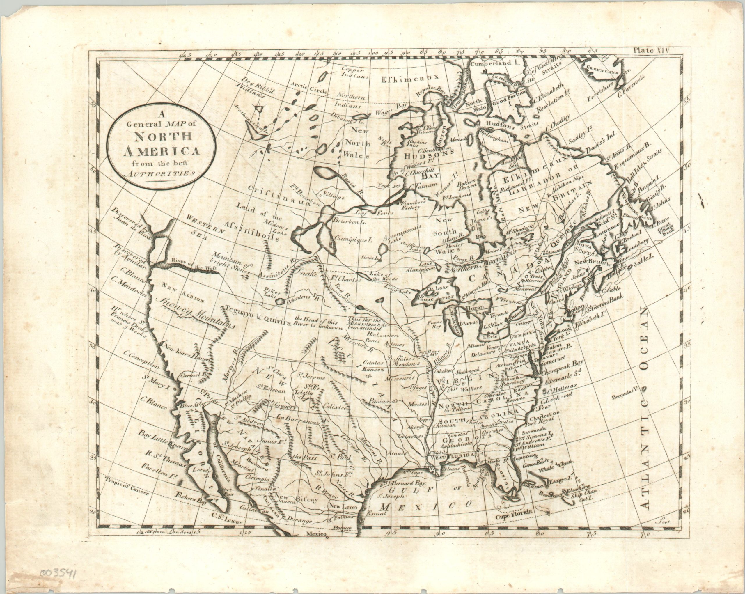
A General Map of North America from the best Authorities
$195.00
North America according to the first encyclopedia printed in the United States.
1 in stock
Description
This terrific map of North America, published near the end of the 18th century, embodies the end of an era across the continent. The fledgling United States are shown with colonial claims extending to the Mississippi River. Though the Northwest Ordinance had passed, the Northwest Territory has yet to materialize on the map.
European powers controlled much of the remainder, with British Canada to the north defined with somewhat ambiguous dotted lines. Even more murky are the delineations between French Louisiana and Spanish New Mexico, following unnamed rivers and mountain ranges into the interior of a largely mythical western America. Of particular interest are the River of the West with the Western Sea immediately above, the legendary Spanish region of Quivira, and a number of fictitious lakes connecting the Hudson’s Bay. Despite the inaccuracies, the cartographer did include a number of annotations describing various sources and unknown lands.
The map was published in 1795 in an early edition of Thomas Dobson’s Encyclopedia. Irked by its pro-British attitudes on certain articles, Dobson edited the third edition of the Encyclopedia Britannica and published a slightly altered version in Philadelphia beginning in 1789. It was quite popular, with buyers including George Washington, Thomas Jefferson, and Alexander Hamilton.
Map Details
Publication Date: 1795
Author: Thomas Dobson
Sheet Width (in): 10.50
Sheet Height (in): 8.40
Condition: B+
Condition Description: Light spotting and a bit of faint offsetting visible throughout the image. Faint edge wear consistent with age.
$195.00
1 in stock

