
A Fun-Roving Map of Pine Creek: The Grand Canyon of Pennsylvania
A pictorial invitation to the ‘Grand Canyon of Pennsylvania.’
Out of stock
Description
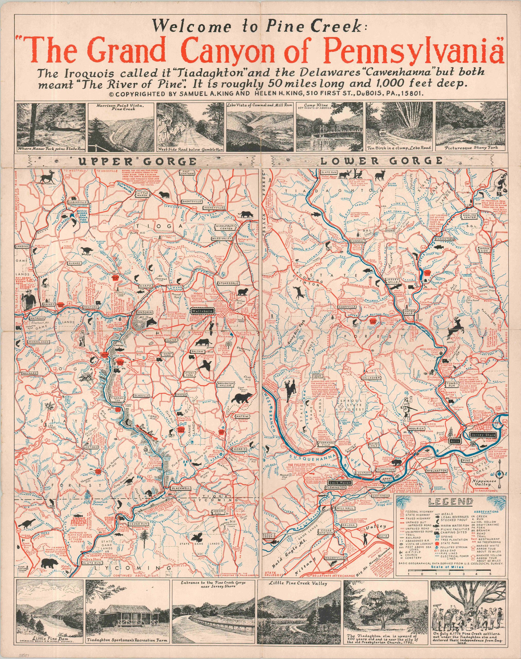
This eye-catching map outlines the numerous outdoor recreations and natural attractions available throughout Pennsylvania’s Pine Creek Gorge. A dual-image divided into the Upper and Lower Gorge follows the course of the Pine Creek and the west branch of the Susquehanna River, offering basic geographic data provided by the U.S.G.S.
The legend in the lower right identifies the different lines and symbols used to identify fishing spots, campsites, and various transportation routes (including hiking trails). Stay away from polluted streams (marked with a skull and crossbones)! Boxed illustrations along the top and bottom show local highlights (including the national Taxidermist’s Association Hall of Fame!) and insets of the Black Forest and Foster Joseph Sayers Reservoir.
The lovely visual guide was designed by a local couple and proud Pennsylvania residents, Helen and Samuel King. Printed in 1969 by Gray’s Printing Company of Falls Creek, PA. The map is one of a number designed by the married couple in DuBois, PA that cover popular outdoor areas across Pennsylvania like Cornplanter’s Kingdom and ‘God’s Country’.
Map Details
Publication Date: 1969
Author: Helen and Samuel King
Sheet Width (in): 23.10
Sheet Height (in): 29.00
Condition: B+
Condition Description: Color printed map on a single-sided sheet, moderately worn along original folds. Several areas of splits have been repaired and reinforced on the verso with archival tape. Good condition overall.
Out of stock