
A Correct Draught of the North Pole and of all the Countries hitherto Discovered…
Assessing the possibilities of a Northwest Passage in the mid-18th century.
Out of stock
Description
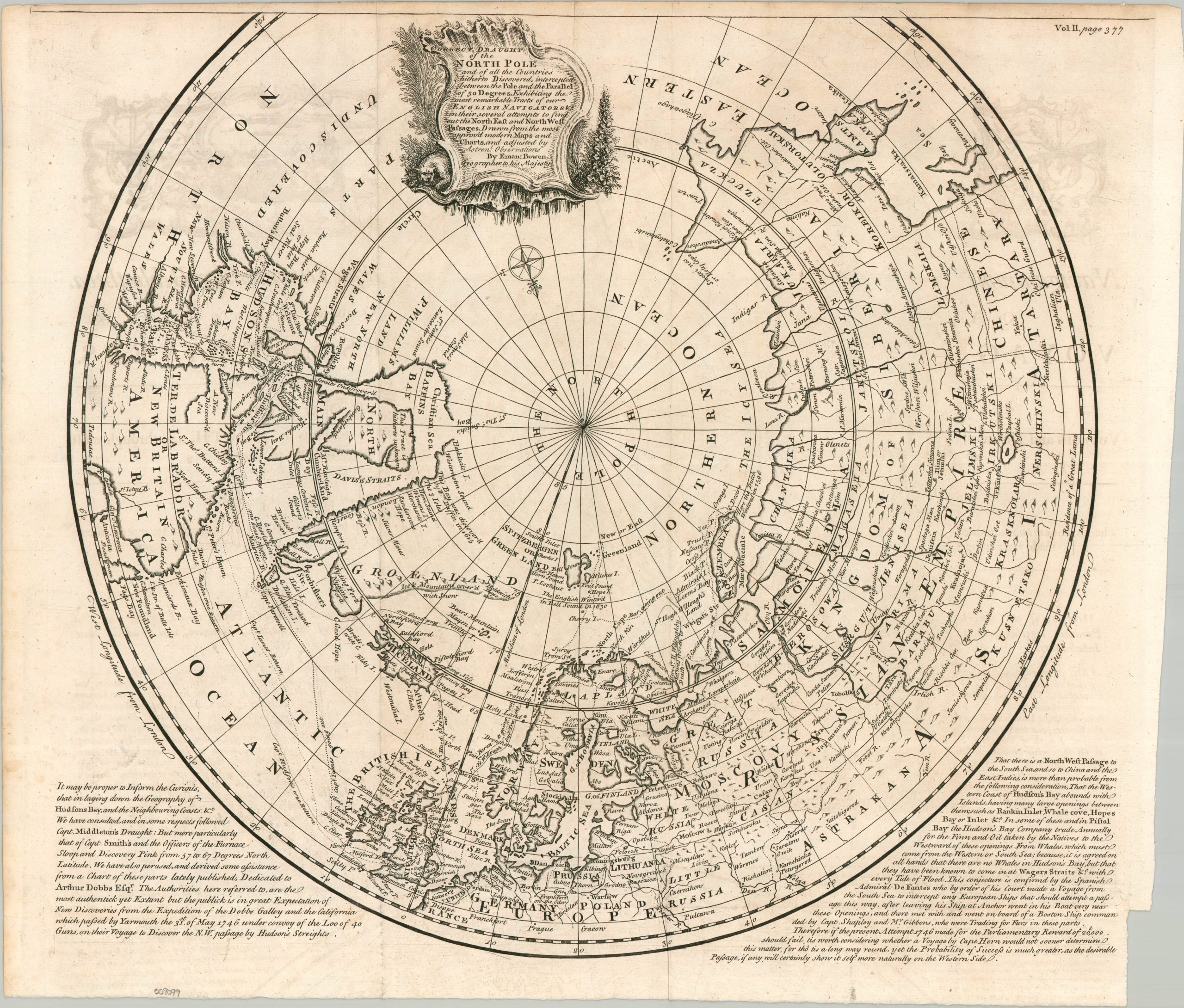
This deeply engaging map of the Northern Hemisphere, centered around the still-undiscovered North Pole, was published in London around 1747 by Emanuel Bowen, Royal Geographer to King George II. In such a prestigious position, Bowen had access to a wide range of geographic reports, charts, and travel accounts, allowing him to produce one of the most detailed depictions of the Arctic available at the time. The map’s authority is reinforced by the tracks of numerous explorers, several of them English.
To a contemporary audience, the most intriguing information lay above the Arctic Circle, where incomplete coastlines of Greenland and Canada still offered hope for a navigable passage between the Atlantic and Pacific. An apparent opening in Baffin Bay, possible channels north of Spitsbergen, and the ambiguous Wager Strait represent several tantalizing possibilities that had yet to be conclusively resolved. Labels identify remote settlements, geographic features, Inuit communities, and other details, while a large region west of Hudson Bay is bluntly labeled “Parts Undiscovered,” a frank admission of the enormous gaps remaining in European geographic knowledge.
Of particular relevance to the map is the recently concluded Northwest Passage expedition of 1741-42. Commander Christopher Middleton sailed HMS Furnace into Hudson Bay and thoroughly investigated its northern and western shores, concluding that the bays and inlets he encountered did not offer a navigable deep-water passage. Arthur Dobbs, an Irish politician and prominent advocate for Arctic exploration, was convinced Middleton was mistaken. Their dispute erupted into a bitter pamphlet war and generated several speculative theories about possible passages, including the proposed Wager Strait. Parliament subsequently added considerable financial incentive to the search through the Northwest Passage Act of 1745, offering a remarkable £20,000 reward for the successful discovery and navigation of a Northwest Passage. Bowen directly references the controversy in the lower-left text panel, while the adjacent paragraph summarizes the historical and geographical evidence that contemporaries believed supported the existence of a passage.
Map Details
Publication Date: c. 1747
Author: Emanuel Bowen
Sheet Width (in): 18.60
Sheet Height (in): 16.10
Condition: B+
Condition Description: Copperplate engraved map iwth a dark impression on a folded sheet of watermarked paper. Irregular margins, as issued. Faint 'ghost' impressions visible in the upper corners and a bit of light spotting, but overall in good to very good condition.
Out of stock