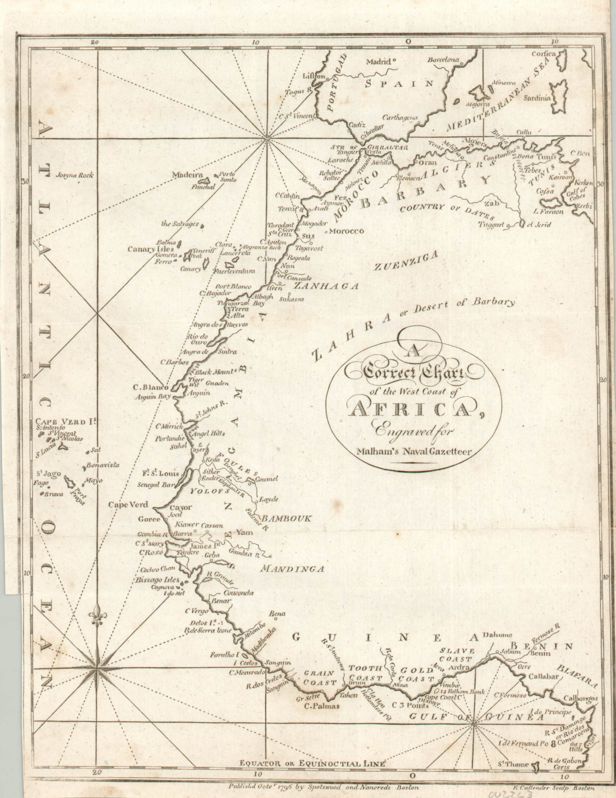
A Correct Chart of the West Coast of Africa, Engraved for Malham’s Naval Gazetteer
$150.00
One of the earliest charts of West Africa published in the United States.
1 in stock
Description
This interesting coastal chart covers a portion of the western Mediterranean Sea and the Atlantic Ocean between central Spain and the Gulf of Guinea. Interior detail is largely absent save for the ‘Zahra’ desert, a few scattered regional names, and the title cartouche.
Greater attention is given to place names along the coast; including navigable rivers, islands, capes, and notable landmarks. Of particular interest are the coastal outposts at Goree, Fort Saint Lous, Mina, and Cape Coast Castle. These were among the most notorious locations for the export of African slaves to the Caribbean, Brazil, and southern United States. Some, though not all, northern states had outlawed the practice by the time of publication.
The map was originally issued in London by John Malham in the Sept. 26, 1795 issue of his Naval Gazetteer, but this particular issue was published the following year in Boston by Spotswood and Nancrede. Engraved by B. Gallender. Reference: McCorkle (18th C. Geography Books) #251
Map Details
Publication Date: 1796
Author: John Malham
Sheet Width (in): 7.40
Sheet Height (in): 9.80
Condition: B+
Condition Description: Faint scattered spotting throughout the image, most visible in the center and in the corners on the left side of the sheet. Trimmed edges that are slightly uneven, but remains in good condition. A crisp impression on a strong sheet.
$150.00
1 in stock