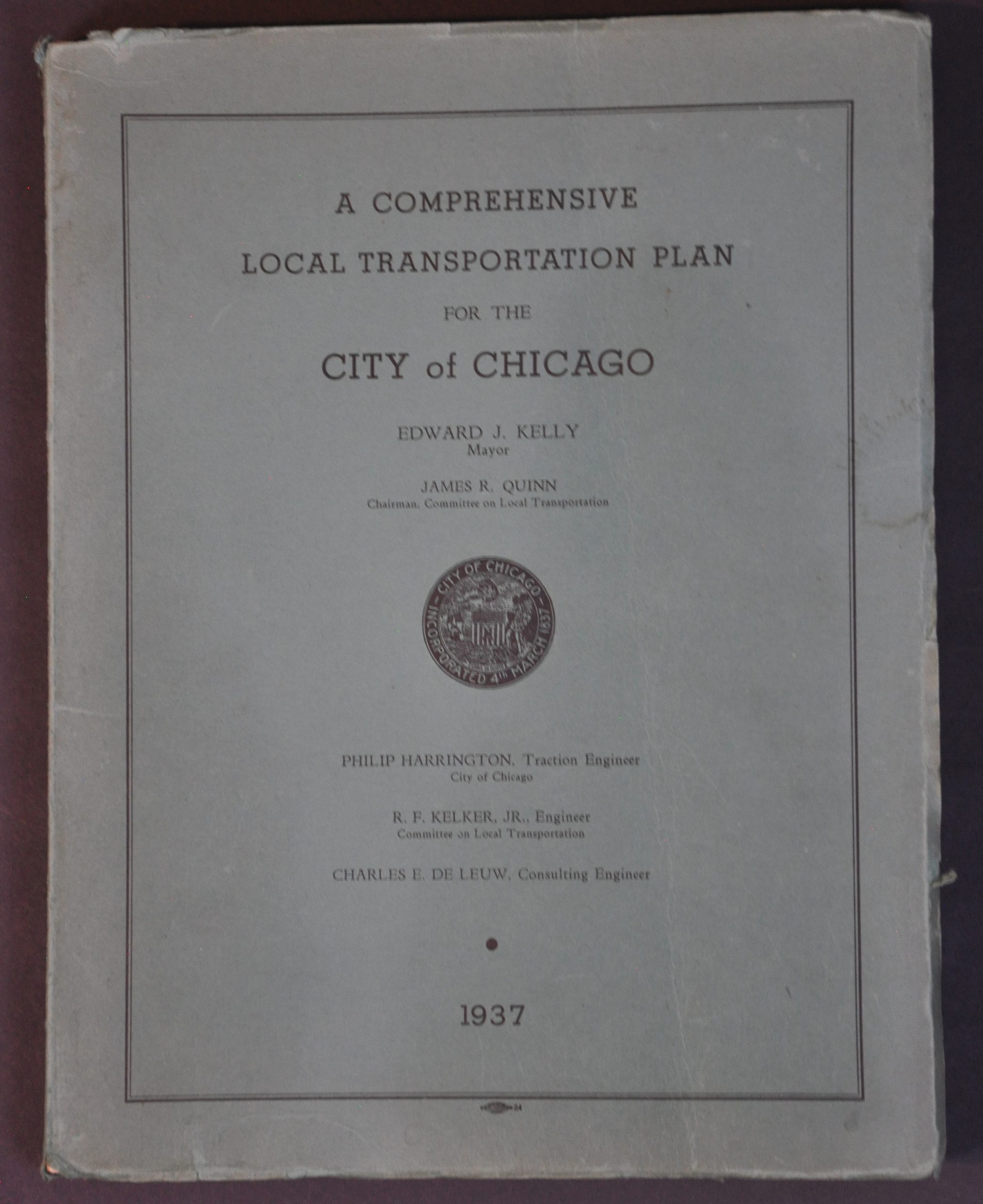
A Comprehensive Local Transportation Plan for the City of Chicago
$350.00
An ambitious proposal to unify Chicago’s transit system a full decade before the organization of the CTA.
1 in stock

Description
This fascinating report about Chicago’s transportation system in the 1930s was compiled by a trio of engineers – Peter Harrington, R.F. Kelker Jr., and Charles De Leuw and compiled for the City Council’s Committee on Local Transportation. It presents a complex and somewhat harebrained scheme for uniting the three primary operators of Chicago-area transit – the Chicago Surface Lines, the Chicago Rapid Transit Company, and the Chicago Motor Coach Company – while bringing Windy City transportation into the automobile era.
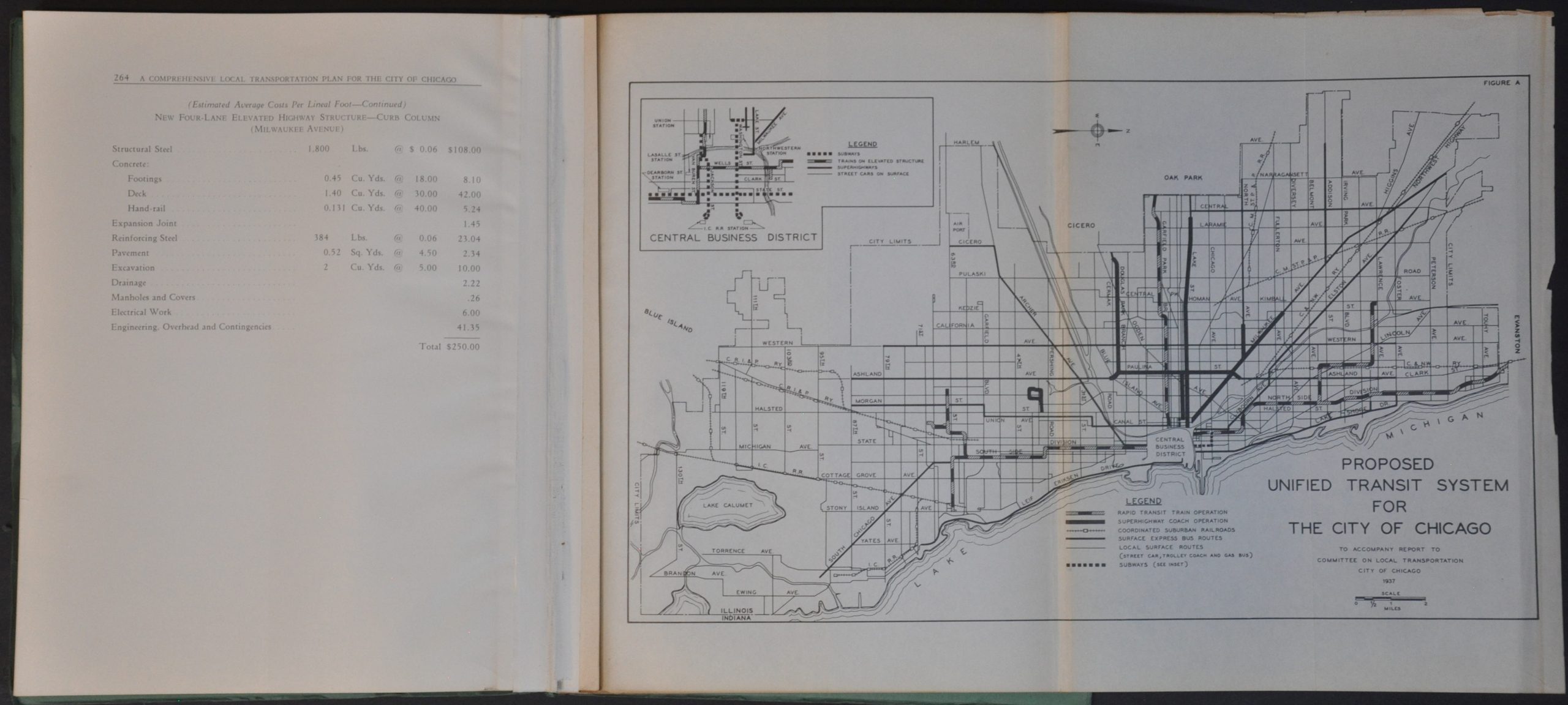
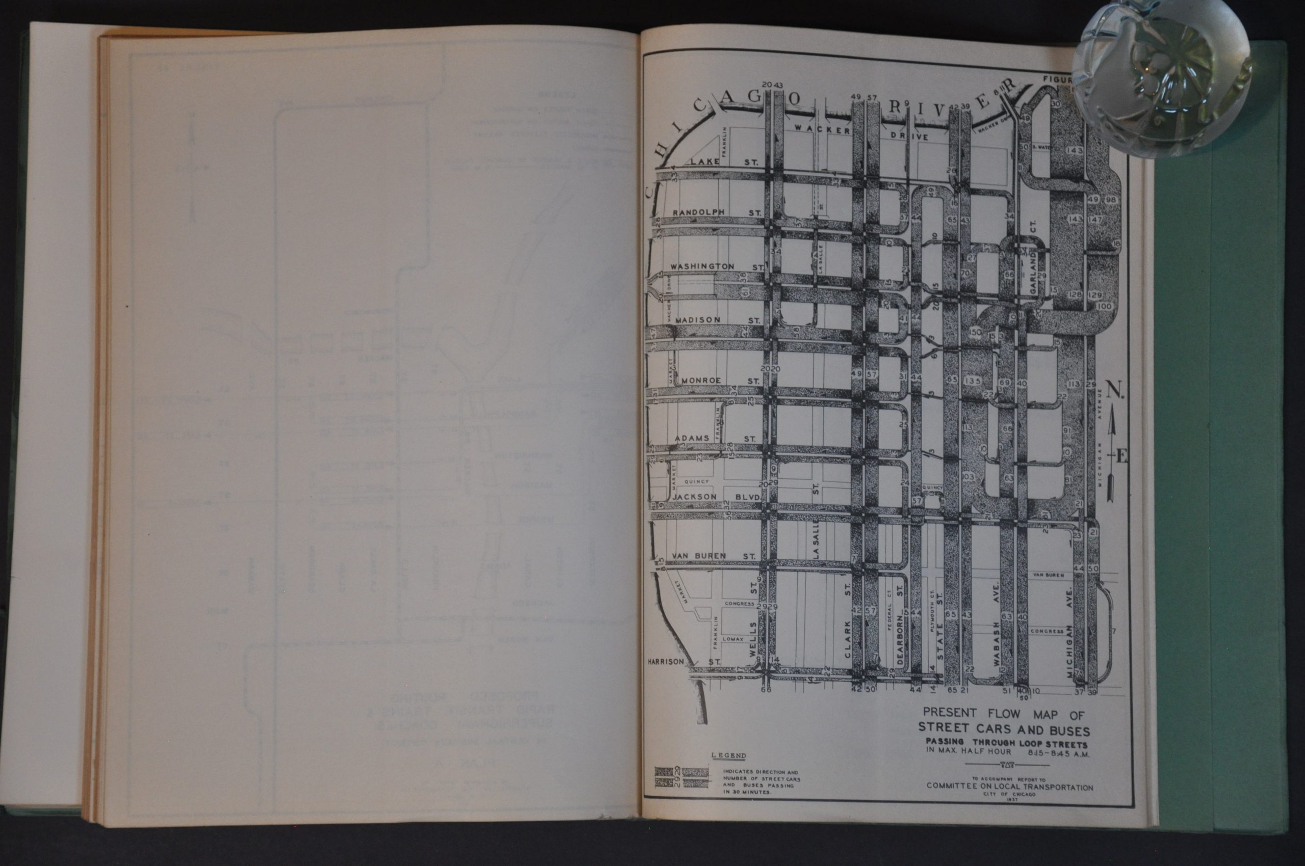
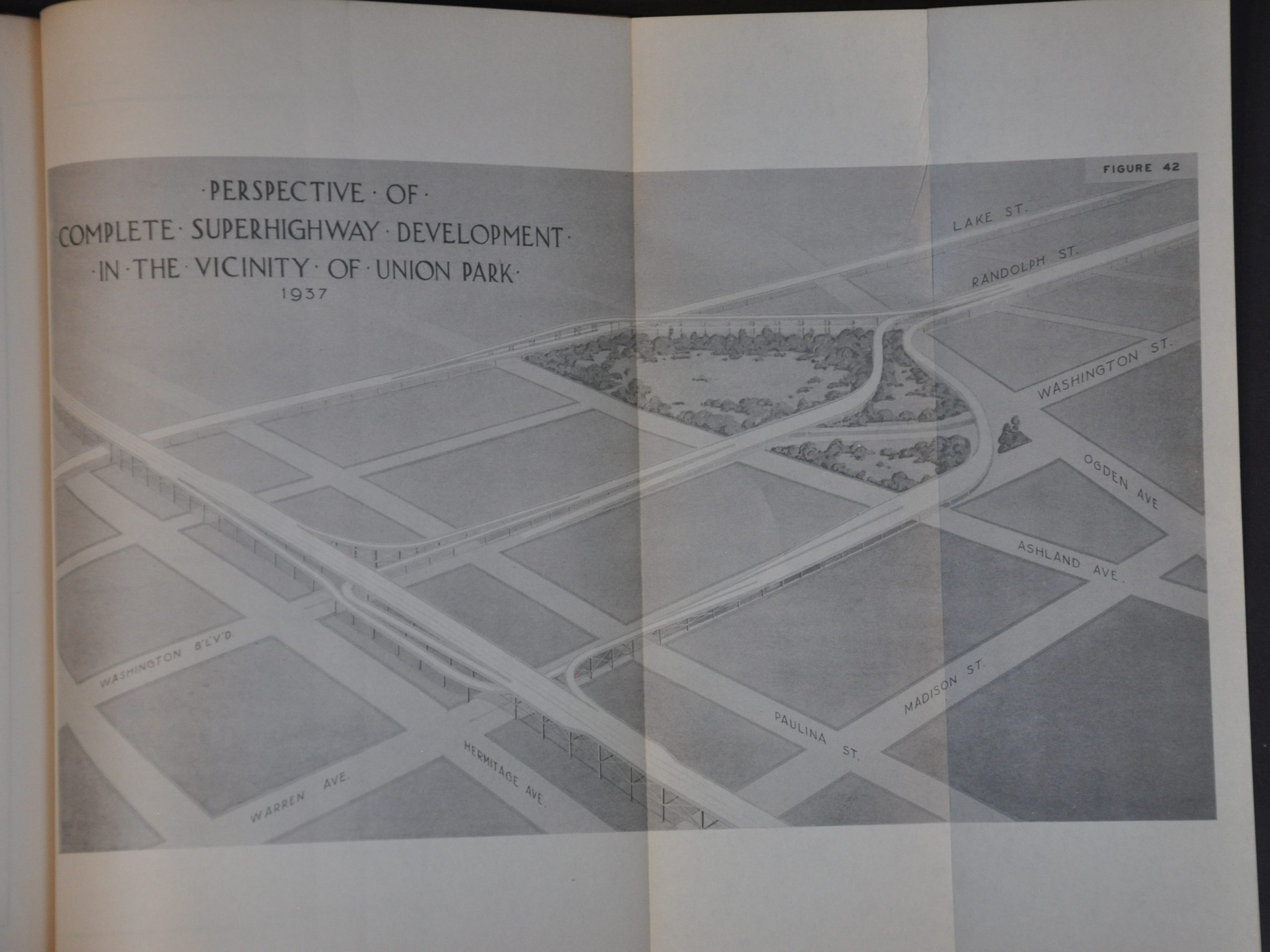
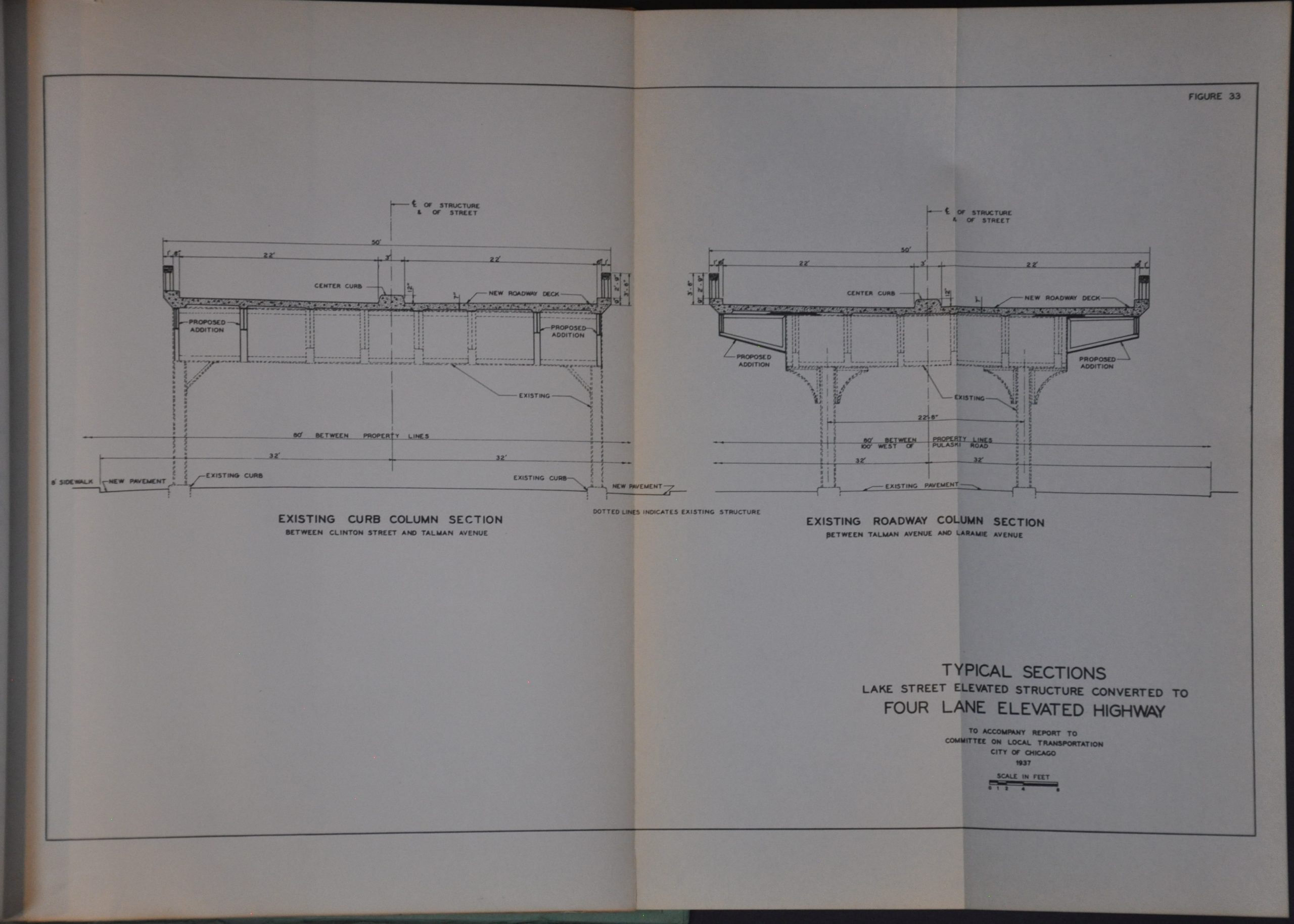
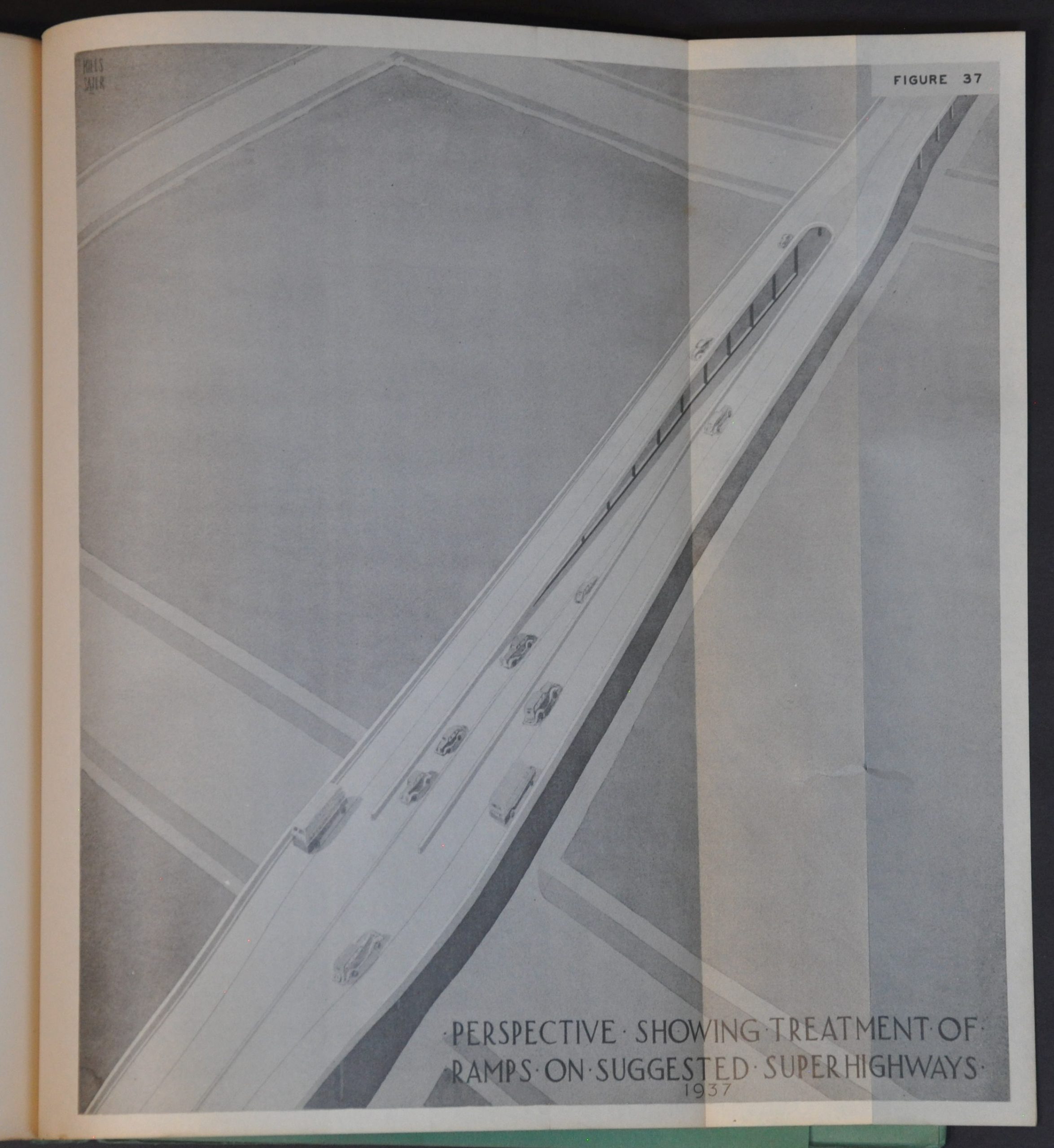
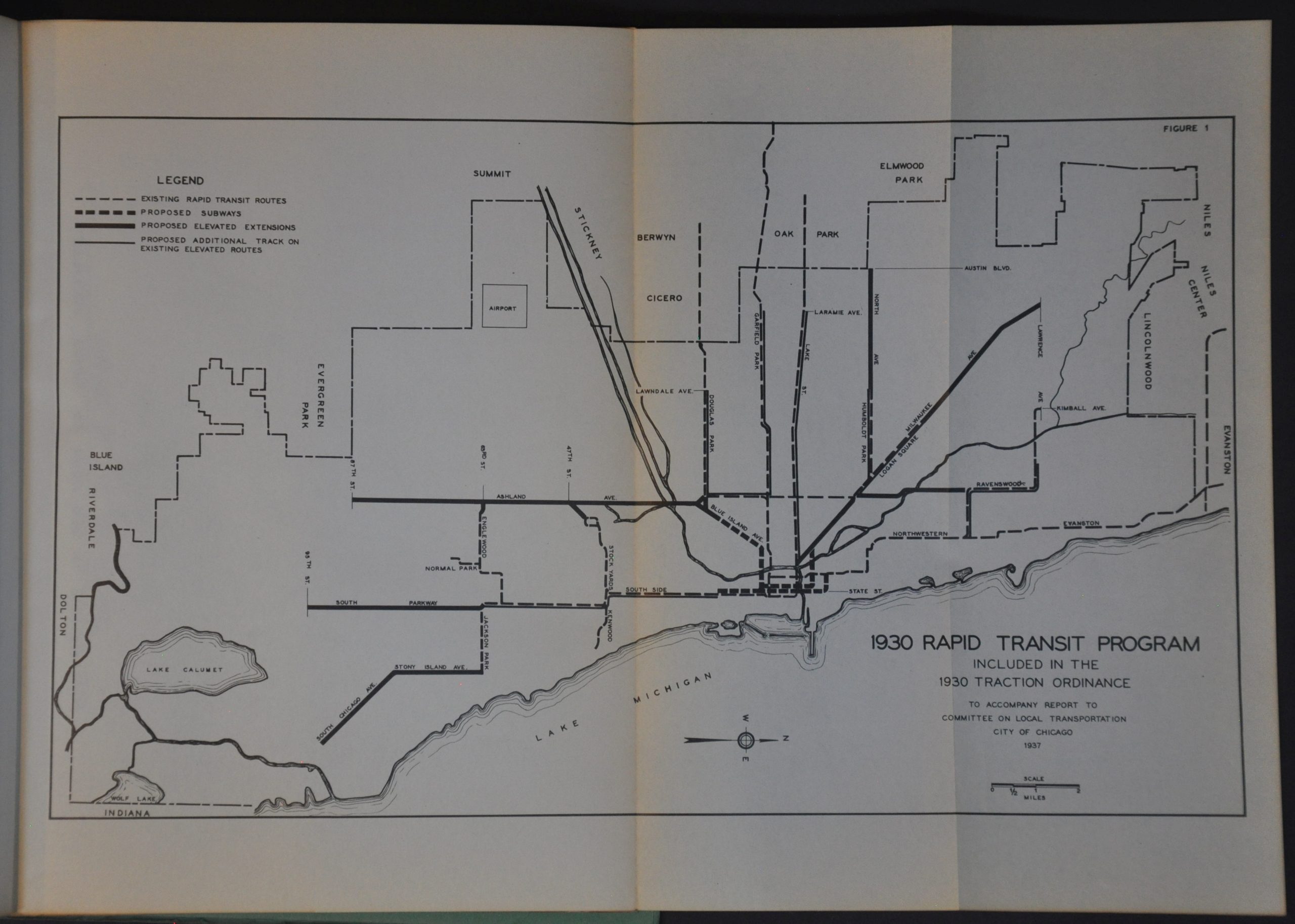
Recommendations for improving efficiency, modernizing the system, building new facilities, and route consolidation are accompanied by numerous tables of financial statistics, flowcharts, traffic maps, construction drawings, and profile views. Of particular interest are various elements of a proposed plan to convert the Lake Street ‘L’ into a downtown ‘superhighway’ to reflect changing trends in transportation preferences. The stylized views foreshadow the massive multi-lane interstates that would bifurcate many of Chicago’s neighborhoods and suburbs during the 1950s and 1960s.
Map Details
Publication Date: 1937
Author: Peter Harrington, R.F. Kelker Jr., and Charles De Leuw
Sheet Width (in): 8.50
Sheet Height (in): 11.25
Condition: A-
Condition Description: 264 pp. of text, plus fifty-nine illustrated maps, charts, and diagrams appended to the rear (some of which are large fold-outs). Contents are faintly toned and show the odd creased corner, consistent with age and light prior use. Bound tightly with string into original green paper wraps, which show moderate wear and a slightly loose spine. Good condition overall.
$350.00
1 in stock