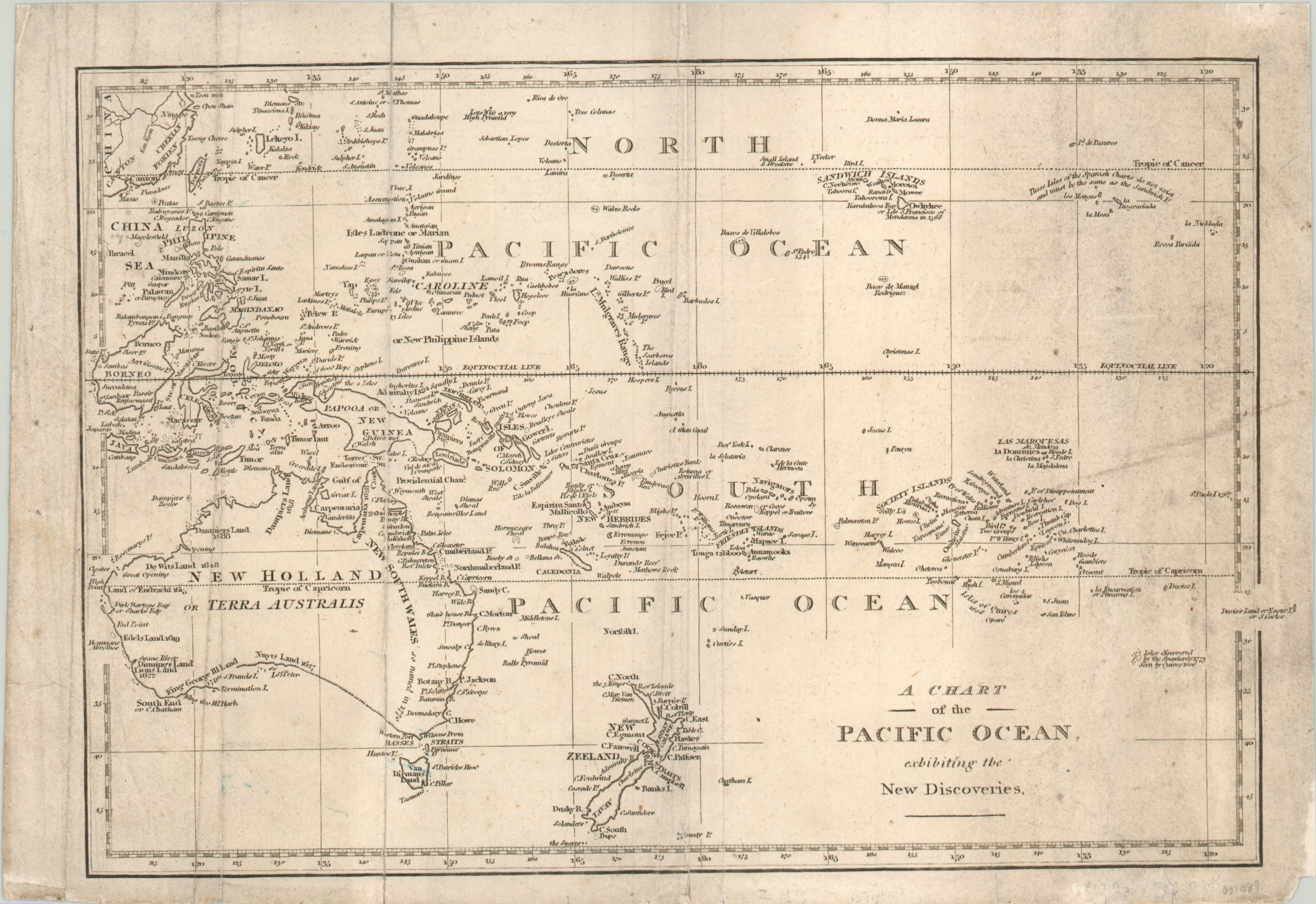
A Chart of the Pacific Ocean Exhibiting the New Discoveries.
An English chart of the Pacific Ocean reinforcing British territorial claims.
Out of stock
Description
This is an interesting chart of the Pacific Ocean; including southeast China, Australia, Indonesia, Papua New Guinea and the Philippines. As the title proclaims, it shows the latest discoveries in the region, many of which are dated. The most recently available include King George III Land (1790) along the southern coast of Australia, Chatham Island (1791), and an insular Tasmania (1799).
The publication date is derived from the ambiguous southern border of Australia, which wouldn’t be completely circumnavigated by Matthew Flinders until 1802. Elsewhere in the Pacific are numerous islands with phonetic spellings which contrast sharply with the otherwise distinctly European names. The cartographer also points out spurious Spanish claims east of the Sandwich Islands (Hawaii). It is believed this map was engraved by George Robinson in London.
Map Details
Publication Date: c. 1800
Author: G.G. Robinson?
Sheet Width (in): 14.50
Sheet Height (in): 10.00
Condition: B
Condition Description: Moderate wear along the centerfold and two additional vertical fold lines on the left side of the sheet. Moderate discoloration evident on the right side of the sheet. Some separation and wear spots have been repaired and reinforced on the verso. Faint blue markings visible near Tasmania. Remains in good condition and very presentable.
Out of stock