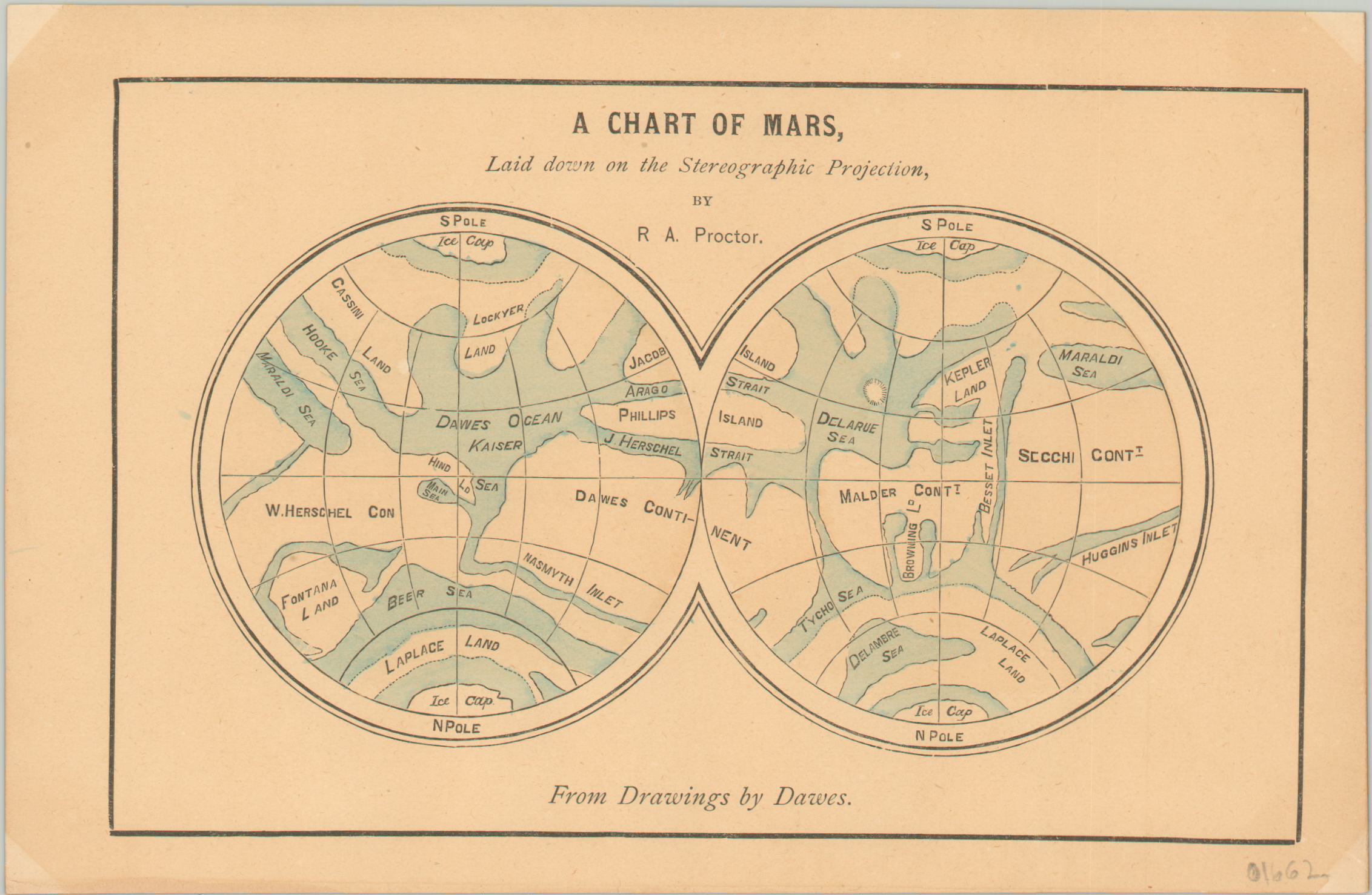
A Chart of Mars, Laid down on the Stereographic Projection
$150.00
One of the earliest attempts to map the planet of Mars.
1 in stock
Description
Though astronomers had known about the Red Planet for hundreds of years, it wasn’t until the 19th century that technology progressed to the point where distinctive physical features were identifiable. German astronomers Johann Mädler and Wilhelm Beer created the first ‘true’ map of Mars in 1831, when they applied a series of permanent geographic elements to a global grid system.
Richard Proctor continued their work in the late 1860’s, basing his maps off the observations of astronomer William Dawes. Dawes, and other greats in the field of astronomy like Cassini, Tycho, Malder, and Herschel, are the namesake of geographic features on Proctor’s map, seen here on a version published around 1870. The image also features a prominent ‘Kaiser’s Sea’ – perhaps revealing his preference in the ongoing conflict between Prussia and France. In any case, Proctor’s nomenclature would be largely superseded by that of Giovanni Schiaparelli, an Italian astronomer who first mapped Mars in 1877.
Map Details
Publication Date: c. 1870
Author: R.A. Proctor
Sheet Width (in): 7.50
Sheet Height (in): 4.75
Condition: A
Condition Description: Slightly toned sheet with the corners faded from where previously matted. Otherwise in fine condition.
$150.00
1 in stock

