
A Chart of Manhattan
The Waldorf Astoria, right in the heart of New York City.
Out of stock
Description
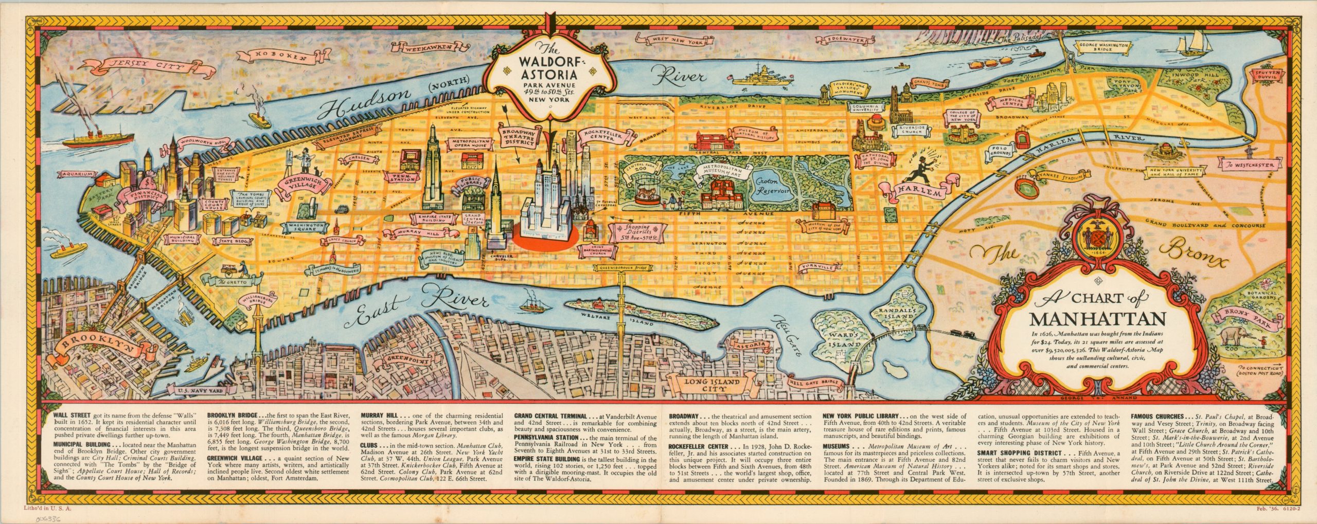
This lovely pictorial map of Manhattan was illustrated by the talented George Annand in 1936. It was distributed to promote the world-famous Waldorf Astoria Hotel, recently relocated after the original building was razed to make way for the Empire State Building (then, the tallest in the world).
The brand-new structure occupying a full block along Park Avenue is boldly presented in the center of the image, surrounded by (mostly smaller) vignettes highlighting other locations of interest across the city. Greenwich Village, Yankee Stadium, the Bronx Zoo, Central Park, and the Rockefeller Center are just a few of the many attractions easily within reach of guests of the luxury hotel.
Emblematic of the Golden Age of Pictorial Maps, the image also captures the zeitgeist of the era (for better and worse). The Harlem Renaissance is recognized, though depicted as a harshly stereotypical Black man. The Ghetto is similarly represented by a Jewish peddler. The apparent swindling of Native Americans is also celebrated in the text within the title cartouche. Industrialization is a trend to be celebrated, reflecting economic vibrancy amid the waning years of the Great Depression.
Map Details
Publication Date: 1936
Author: George Annand
Sheet Width (in): 22.75
Sheet Height (in): 9
Condition: A-
Condition Description: Light creasing along originally issued folds and faint wear along the outer edges of the sheet. A few small spots visible in the lower left, away from the image but entering the lower panel of text. Soiling on the front panel does not affect the map. Very good condition overall.
Out of stock