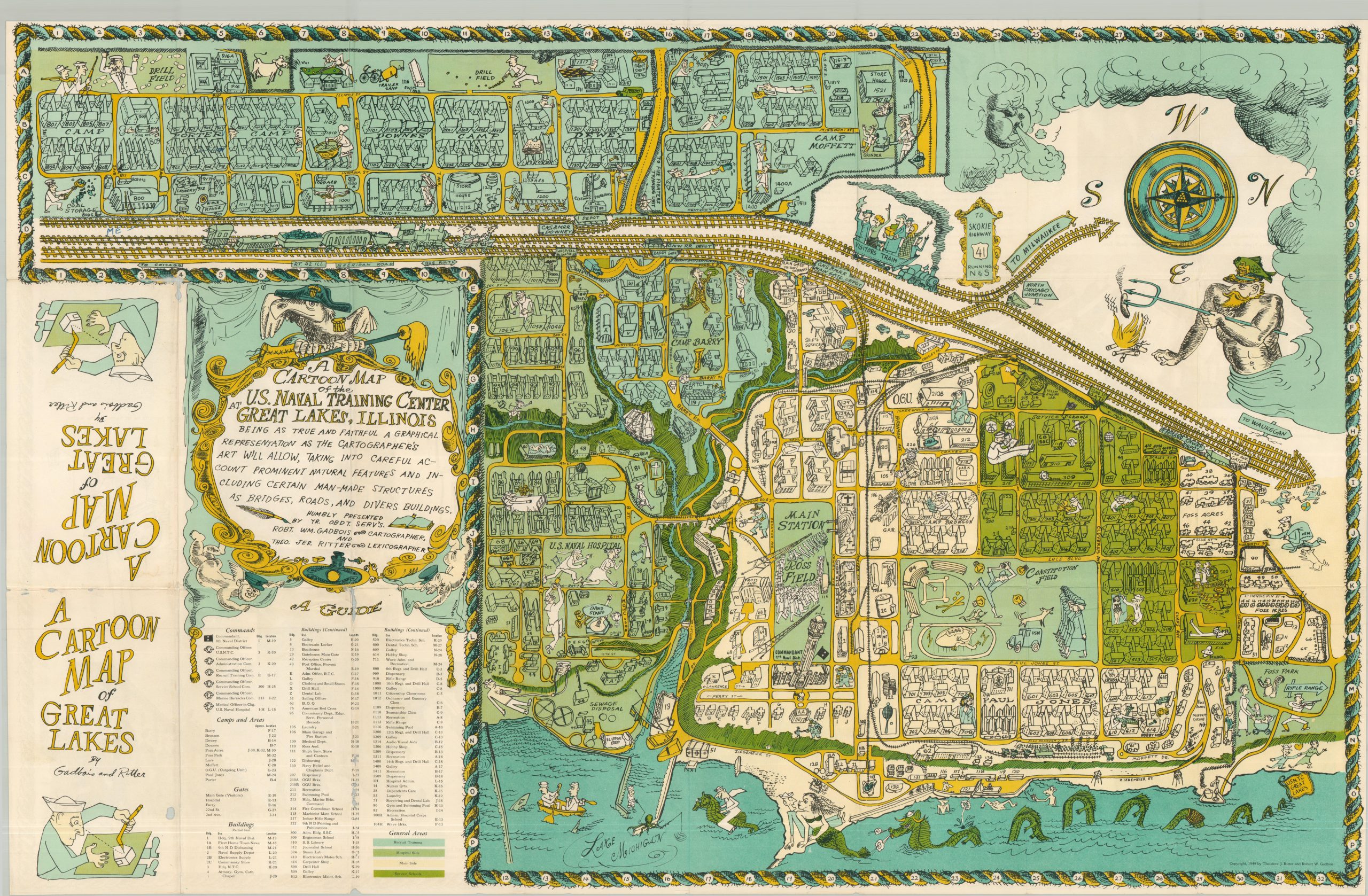
A Cartoon Map of the U.S. Naval Training Center at Great Lakes, Illinois
Amusing pictorial map of the Navy’s only bootcamp in the United States.
Out of stock
Description
Situated just north of Chicago, the U.S. Naval Training Center first opened in 1911 and is the largest training center in the United States for naval personnel, including the Navy Seals. This post-WWII map was produced with the sailor in mind – evincing a period of relative calm less than five years after the war had ended. Naval humor is evident throughout the map, from the seamen cherubs and mop-wielding bird in the title cartouche to chasing nurses and mermaids along the shores of Lake Michigan.
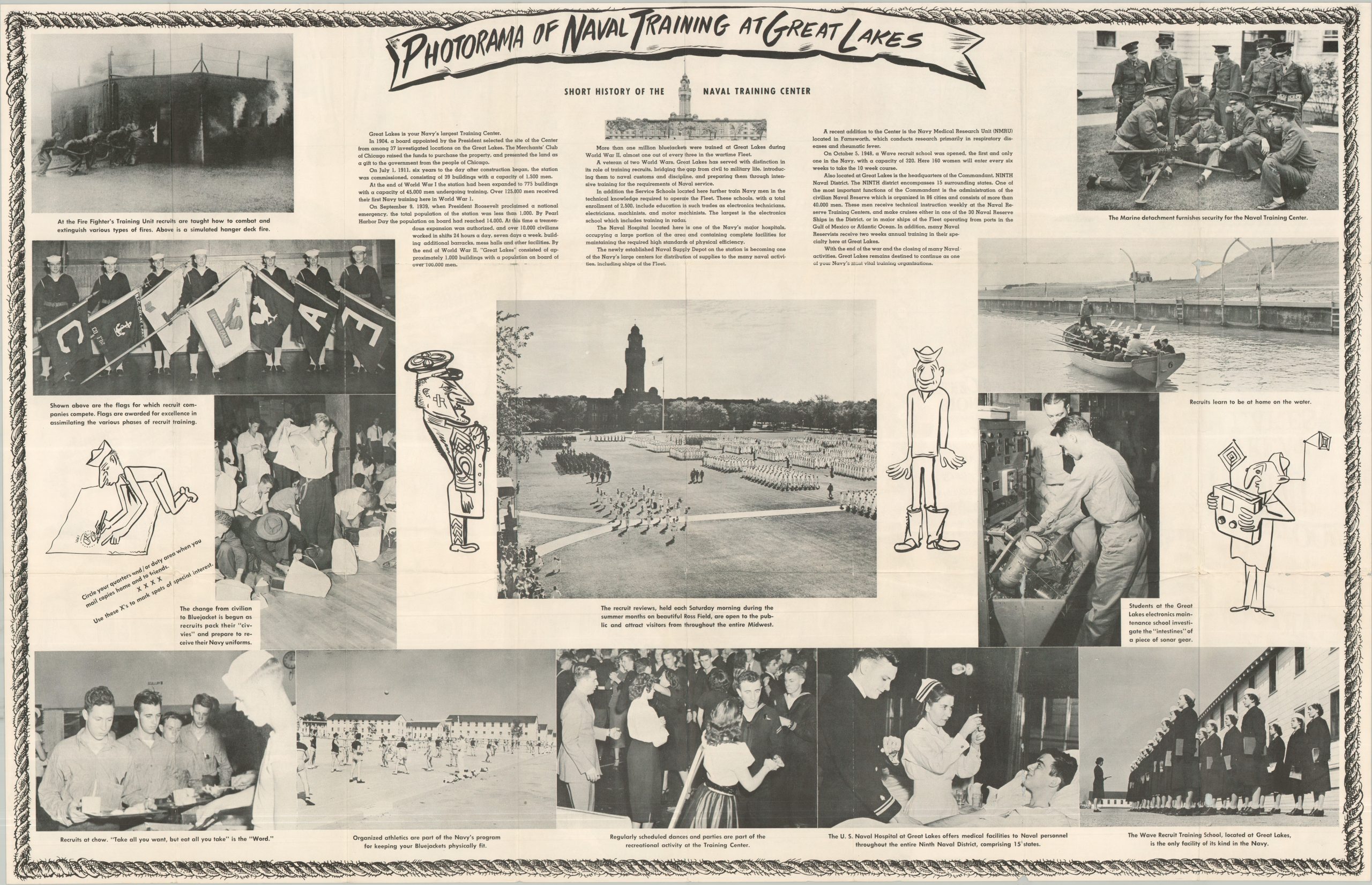
Nearly 100 buildings, camps, and command posts are individually illustrated and listed in the map legend, and color coding is used to segregate areas for schooling, recruitment, convalescence and administration. Windheads, sea monsters, and tall ships allude to maps produced during the “Golden Age of Cartography” and appear alongside dozens of comical vignettes satirizing everyday aspects of naval life; the drill field, insect infestations, the sick bay, and recreational activities. The verso includes photographs and a brief history/overview of life at the training center.
Map Details
Publication Date: 1949
Author: Theodore Ritter & Robert Gadbois
Sheet Width (in): 34.00
Sheet Height (in): 22.00
Condition: B+
Condition Description: Double-sided map brochure with creasing and light wear along old folds. A small holes in the front cover, about the size of a pencil eraser, and very minor loss along the upper fold at at fold joints.
Out of stock