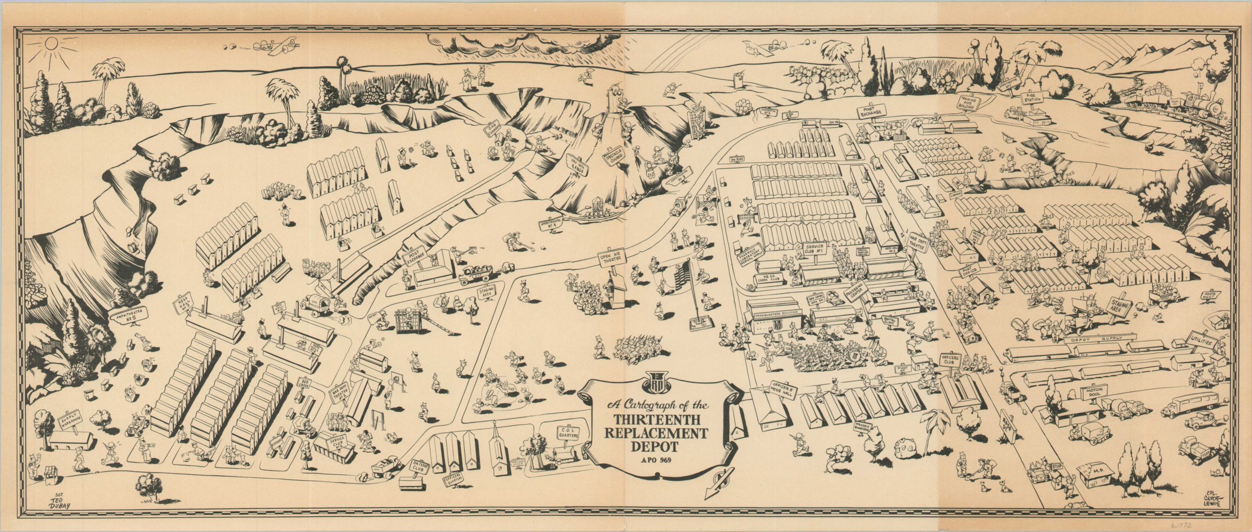
A Cartograph of the Thirteenth Replacement Depot
$315.00
Scarce pictorial map of a wartime rehabilitation facility in Hawaii.
1 in stock
Description
This charming pictorial map offers a stylized aerial view of the U.S. Army’s Thirteenth Replacement Depot, located near the Schofield Barracks on the island of Oahu. The installation was designed to treat wounded soldiers and return them to active duty or process them for reassignment, so many of the figures exhibit some level of martial vigor.
Various camp buildings and facilities like service clubs, officers’ quarters, mess centers, and medical clinics are labeled throughout the image. Firing ranges and obstacle courses juxtapose the amphitheaters and sporting fields.
A truncated version of the map was originally designed in 1944 by Pvt. Clyde Lewis. This example, likely issued the following year, has expanded to show the depot’s significant growth. Everything to the left of the open-air theater (near the center of the page) was added to the original image, along with an additional credit to Sgt. Ted Dubay.
Earlier example at Geographicus. WorldCat notes only one example of the map, located at Texas A&M University. OCLC# 1391845560.
Map Details
Publication Date: 1945
Author: Cpl. Clyde Lewis and Sgt. Ted Dubay
Sheet Width (in): 22
Sheet Height (in): 9.25
Condition: B
Condition Description: Heavy toning visible on the far right panel and in the upper left corner. Creased along two vertical fold lines and a few tiny tears along the edges of the sheet. About good condition overall. Blank on verso.
$315.00
1 in stock

