1941 Spring Edition Texas Highway Map
$50.00
The roads of Texas on the eve of America’s entry into World War II.
1 in stock
Description
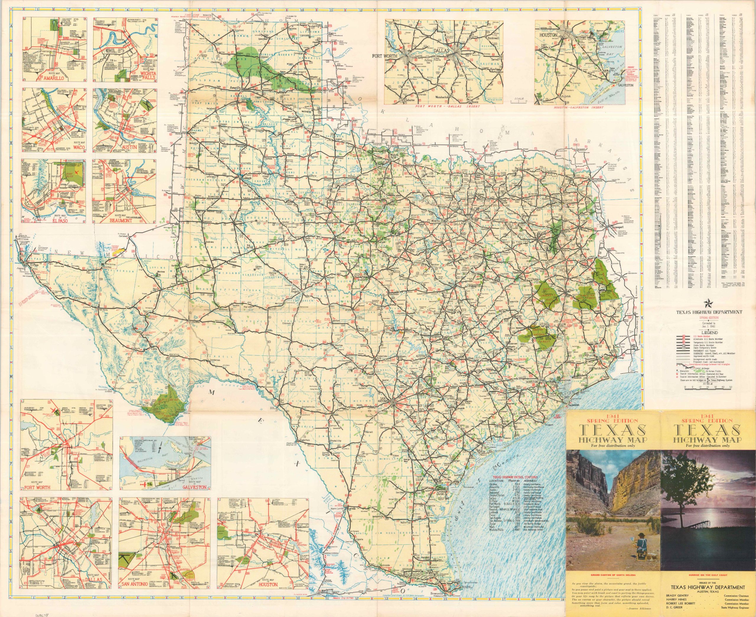
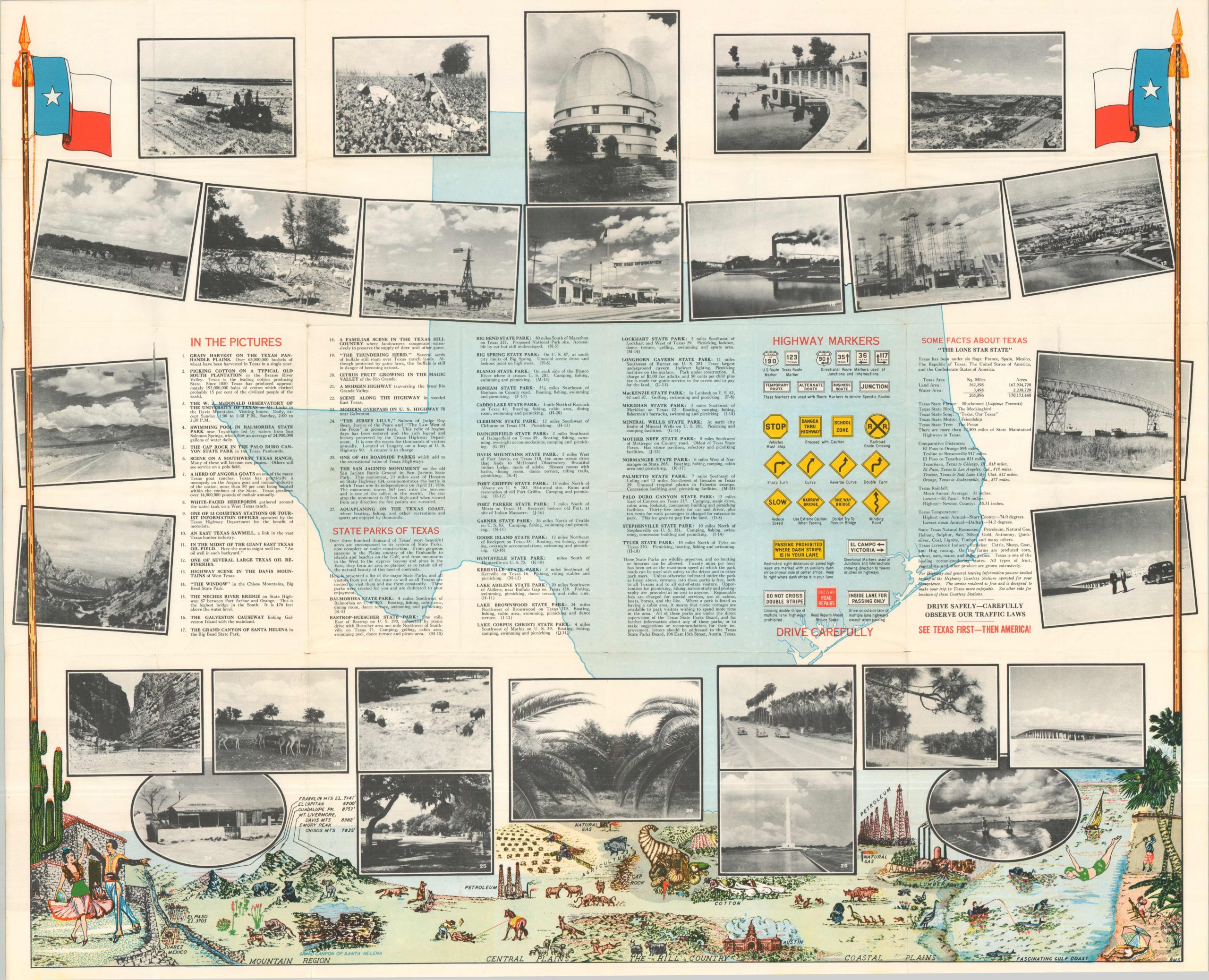
This informative road map of Texas was published in early 1941 by the Highway Department, a convenient resource for motorists traveling to or through the Lone Star State. Bright green overprinting identifies the bounty of outdoor recreation, while a soft blue emphasizes waterways and topography. Numerous insets provide details about major metropolitan areas like Houston, Dallas-Fort Worth, San Antonio, and Galveston. The verso is a bit more lively, with numerous captioned photographs, an illustrated landscape, and ‘Some Facts About Texas.’
Map Details
Publication Date: 1941
Author: Texas Highway Department
Sheet Width (in): 31.80
Sheet Height (in): 26.10
Condition: B
Condition Description: Double-sided map brochure with light wear along original folds and moderate toning along the horizontal seams. A few small repaired tears with no image loss. Small holes at fold intersections and a bit of further discoloration along the outer edges of the sheet. About good condition overall.
$50.00
1 in stock