1919 Auto Road Map with Mileage…
$109.00
Marked trails in a 150-mile radius around Philadelphia.
1 in stock
Description
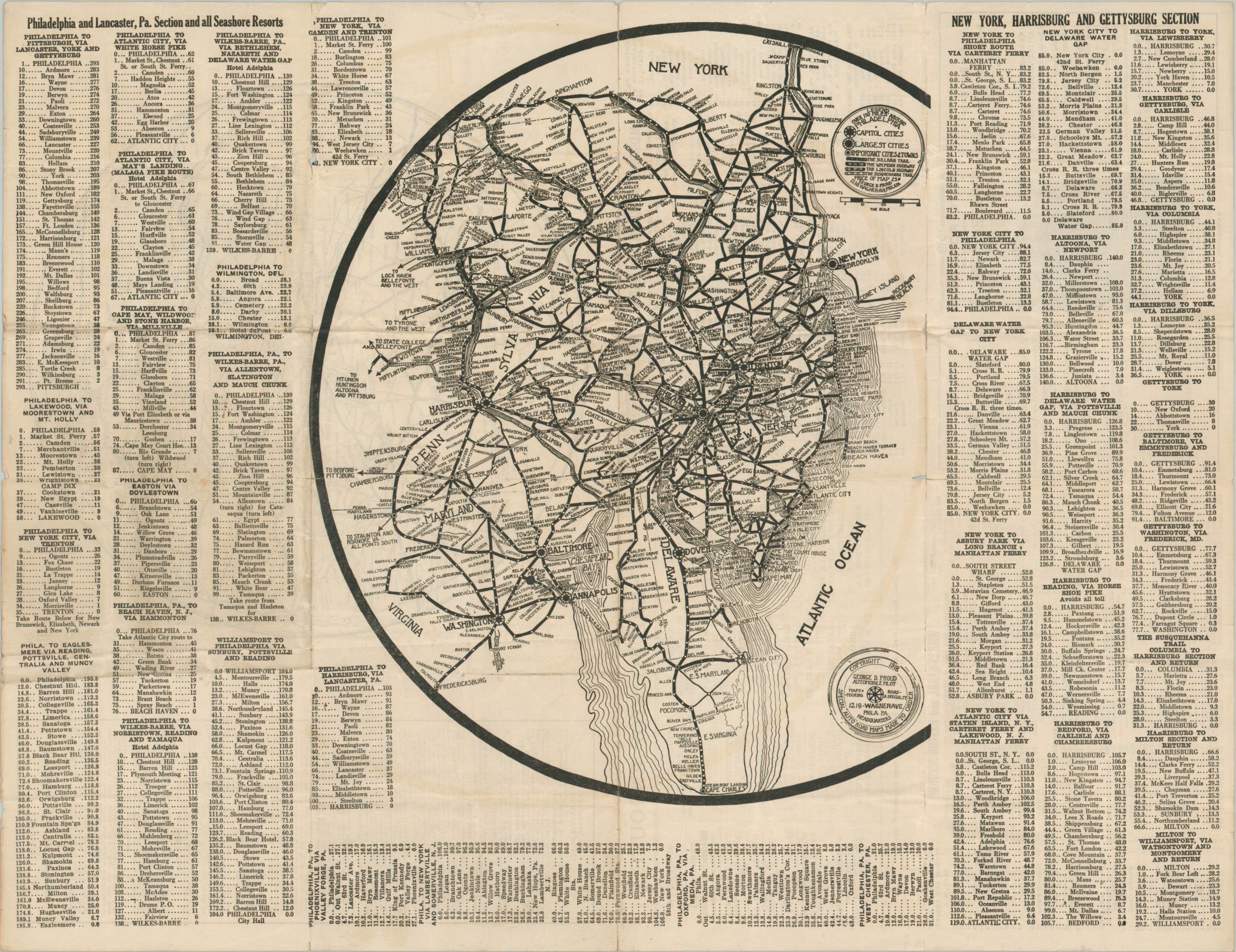
This early road guide shows an interesting perspective of the highway system around Philadelphia, Pennsylvania during World War I. The stylized image is reminiscent of earlier railroad maps, with distorted state borders and lines that are crammed with individual stops.
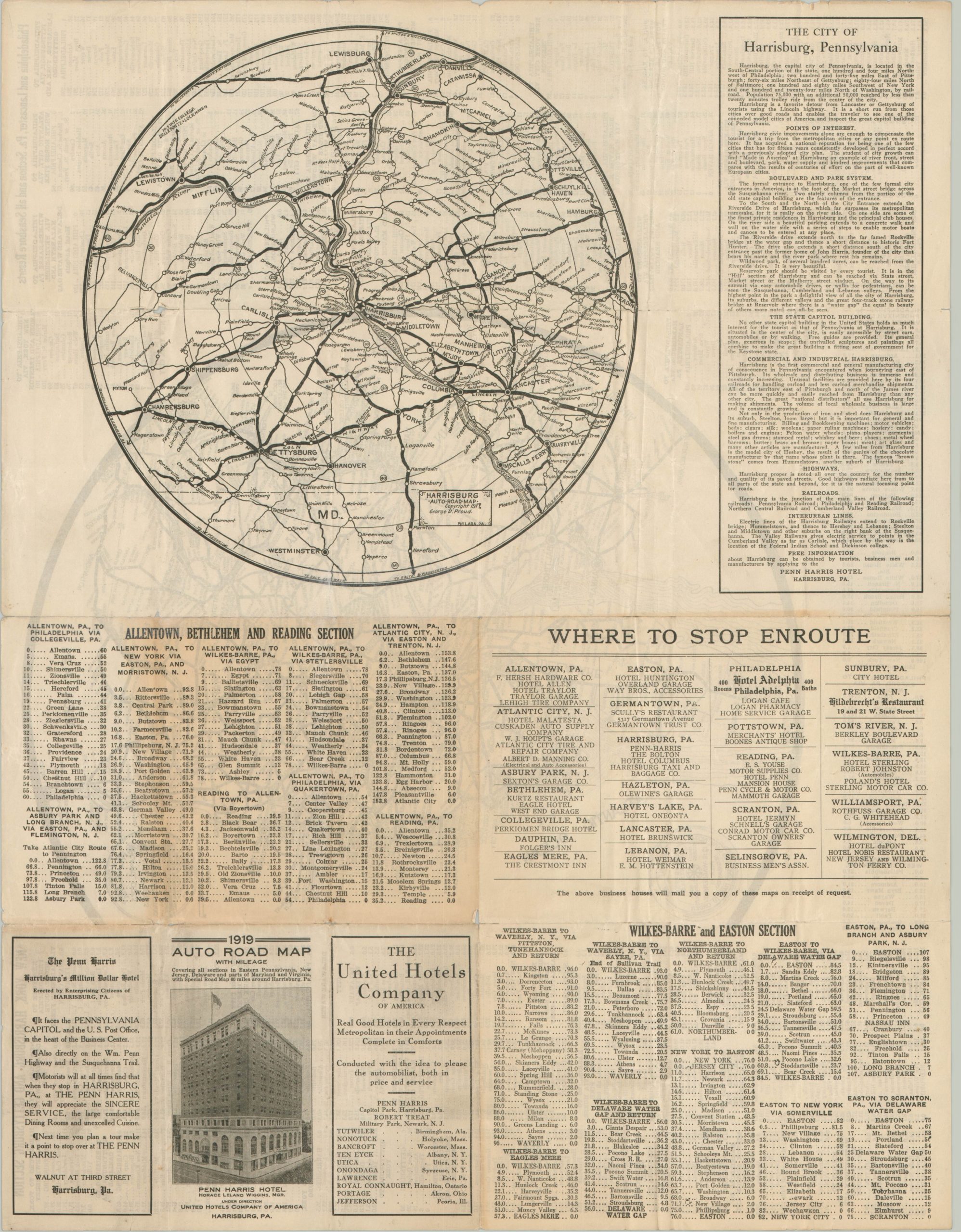
Four separate routes are identified, all predating the numbered highway system – The Sullivan Trail, Lincoln Highway, William Penn Highway, and The Susquehanna Trail. Surrounding the map are itineraries with corresponding distances between some of the larger cities and popular seashore resorts. This relatively inefficient system would soon be replaced by overlaying distance values directly on the map. The verso presents additional itineraries, contemporary advertisements, and a similar map, though with the content restricted to sixty miles around Harrisburg.
The two maps were designed and copywritten by George Proud in 1917 and 1918 and published the following year on behalf of the Penn Harris Hotel in Harrisburg. According to the tire-shaped cartouche, Proud was an ‘automobile pilot’ who created custom, made-to-order road maps at a period when motor tourism was still in its infancy. I’ve been able to identify six of his maps in WorldCat dating from 1917 to 1925, though no copies of this example are noted.
Map Details
Publication Date: 1919
Author: George D. Proud
Sheet Width (in): 21.75
Sheet Height (in): 16.75
Condition: B
Condition Description: Former pocket map with heavy wear along fold lines. Moderate discoloration and about 8" of separation, repaired with archival tape, also present along fold lines. The outer edges show several small edge tears and some light wrinkling.
$109.00
1 in stock