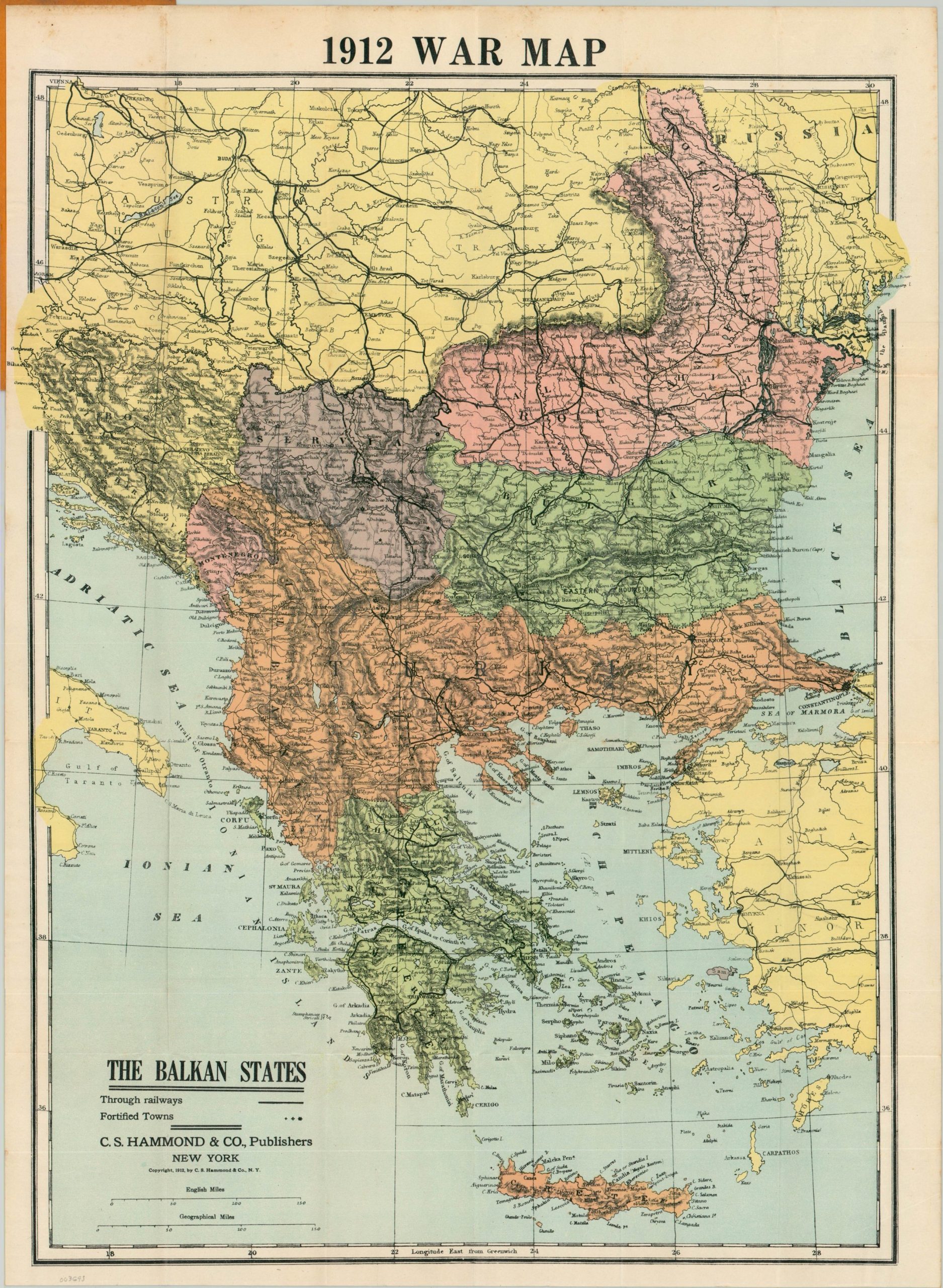
1912 War Map New Map of the Balkan States
$279.00
The beginning of the end of the Ottoman Empire.
1 in stock
Description
This detailed map of the Balkan Peninsula was published in New York City by C.S. Hammond and Company in late 1912, shortly after the outbreak of war between the Balkan League and the Ottoman Empire. Railways and fortified cities are shown according to the legend in the lower left, while the political boundaries reflect pre-war borders.
Turkish territory (orange) stretches from the Black Sea to the Adriatic, though its authority was often undermined throughout the early 20th century. Encouraged by Russia, the nations of Greece, Montenegro, Bulgaria, and Serbia concluded a series of treaties in 1912 and formed an alliance with the intention of overthrowing Ottoman rule. The resulting First Balkan War was an overwhelming success for the European powers, who absorbed the vast majority of remaining Ottoman territory east of Constantinople.
Disagreements over the spoils would lead to the outbreak of the Second Balkan War in 1913. The conflict was one of several dominos that eroded Turkish military power and contributed to the outbreak of the First World War.
Map Details
Publication Date: 1912
Author: C.S. Hammond & Co.
Sheet Width (in): 17.10
Sheet Height (in): 23.75
Condition: A
Condition Description: Pocket map in near fine condition. Lightly creased along original fold lines and affixed to the orange paper wraps (slightly soiled).
$279.00
1 in stock

