
Orange Blossom Trail
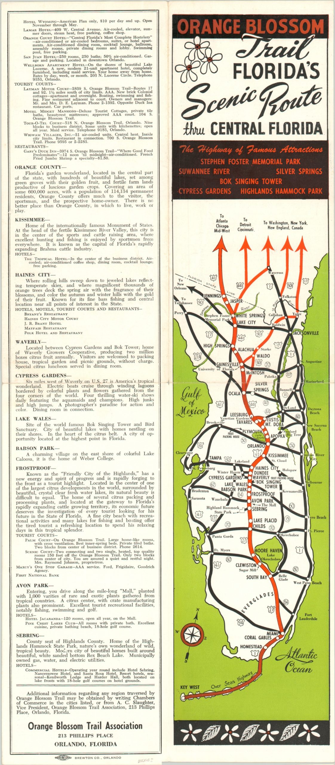
Route map of the Orange Blossom Trail through Central Florida.
Out of stock
Description
The moniker “The Orange Blossom State” wasn’t given by accident. Florida’s first orange trees were allegedly planted by Ponce de Leon around 1500 and have become intertwined with the state’s identity ever since. The Orange Blossom Trail Association looked to capitalize on that familiarization by issuing this map of their proposed route through Central Florida – the state’s “most scenic highway”.
The group was organized to represent various entities along the neatly packaged and promoted chain of highways (primarily U.S. 441) from Jennings to Miami. Text on the side and along the verso outline some of the highlights of the towns participating in the association.
Map Details
Publication Date: c. 1948
Author: Orange Blossom Trail Association
Sheet Width (in): 8.00
Sheet Height (in): 18.20
Condition: A-
Condition Description: Originally issued fold lines exhibit some wear.
Out of stock