
Map of the Canadian Silver Fields
$110.00
Encouraging investment during the Cobalt silver boom.
1 in stock
Description
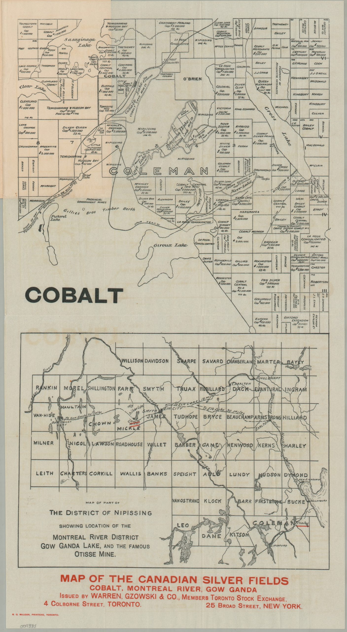
This cartographic prospectus captures the speculative frenzy of Northern Ontario’s early 20th-century silver boom. The upper half of the sheet presents a cadastral map of Coleman Township and the area around the mining boomtown of Cobalt, with owners’ names and their respective capitalization provided for many plots. Prominently featured are the lines of the Temiskaming & Northern Ontario Railway, whose construction led to the discovery of silver deposits in 1903.
Immediately below is a “Map of Part of the District of Nipissing Showing Location of the Montreal River District, Gowganda Lake, and the Famous Otisse Mine,” reflecting the search for silver farther afield.
The sheet was issued around 1910 by Warren, Gzowski & Company, financial brokers and members of the Toronto Stock Exchange. Its focus on the Gowganda district, the site of a rush beginning around 1908, supports this date. Printed in Toronto by R.G. McLean.
Map Details
Publication Date: c. 1910
Author: Warren, Gzowski & Co.
Sheet Width (in): 10.90
Sheet Height (in): 19.90
Condition: A
Condition Description: Black and red map printed on thin paper, folded and affixed to original stiff paper wraps. Creasing along folds and a bit of faint wear and soiling on the covers, but overall in near fine condition.
$110.00
1 in stock