
Map of Hutchinson, Kansas
$80.00
The ‘Hutchinson Engineering Club Railway Map’
1 in stock
Description
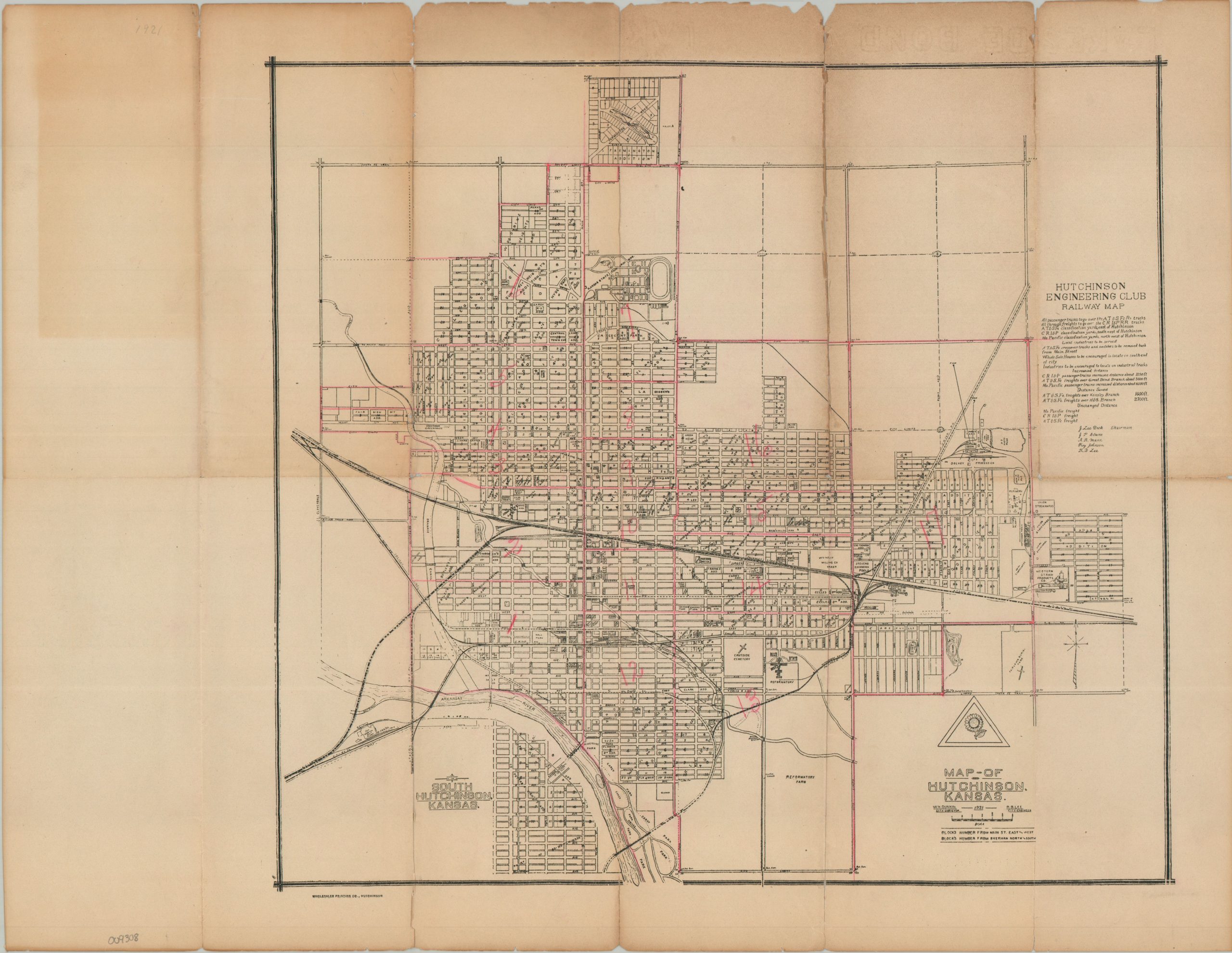
This detailed street plan of Hutchinson, Kansas, outlines the city’s extensive railroad network in the early 1920s. Lines of the Atchison, Topeka & Santa Fe Railroad, the Chicago, Rock Island & Pacific Railroad, and the Missouri Pacific are carefully noted throughout, with text in the upper right providing additional details about passenger and freight operations. Various features and locations of interest are labeled, including a Reformatory Farm, Union Stockyards, Carey Park, and the Kansas State Fairgrounds. Hand-applied pink markings appear to divide the city into numbered wards.
The map was locally produced, compiled by City Surveyor W. H. Dunkin and City Engineer R. B. Lee in 1921 and printed in Hutchinson by the Wholesaler Printing Company. Its detailed depiction of railroad facilities, city streets, civic institutions, and ward boundaries provides a useful snapshot of Hutchinson during a period when the city was an important regional railroad and agricultural center.
Map Details
Publication Date: 1921
Author: W.H. Duncan and R.B. Lee
Sheet Width (in): 21.75
Sheet Height (in): 17.00
Condition: B
Condition Description: Black and white map with pink markings printed on toned, brittle paper. Numerous fold splits repaired on the verso with archival tape. About good condition overall.
$80.00
1 in stock