
Austin-Topolobampo Pacific
$350.00
Ambitious plans to rival America’s transcontinental railroads by using a shorter route through Mexico.
1 in stock
Description
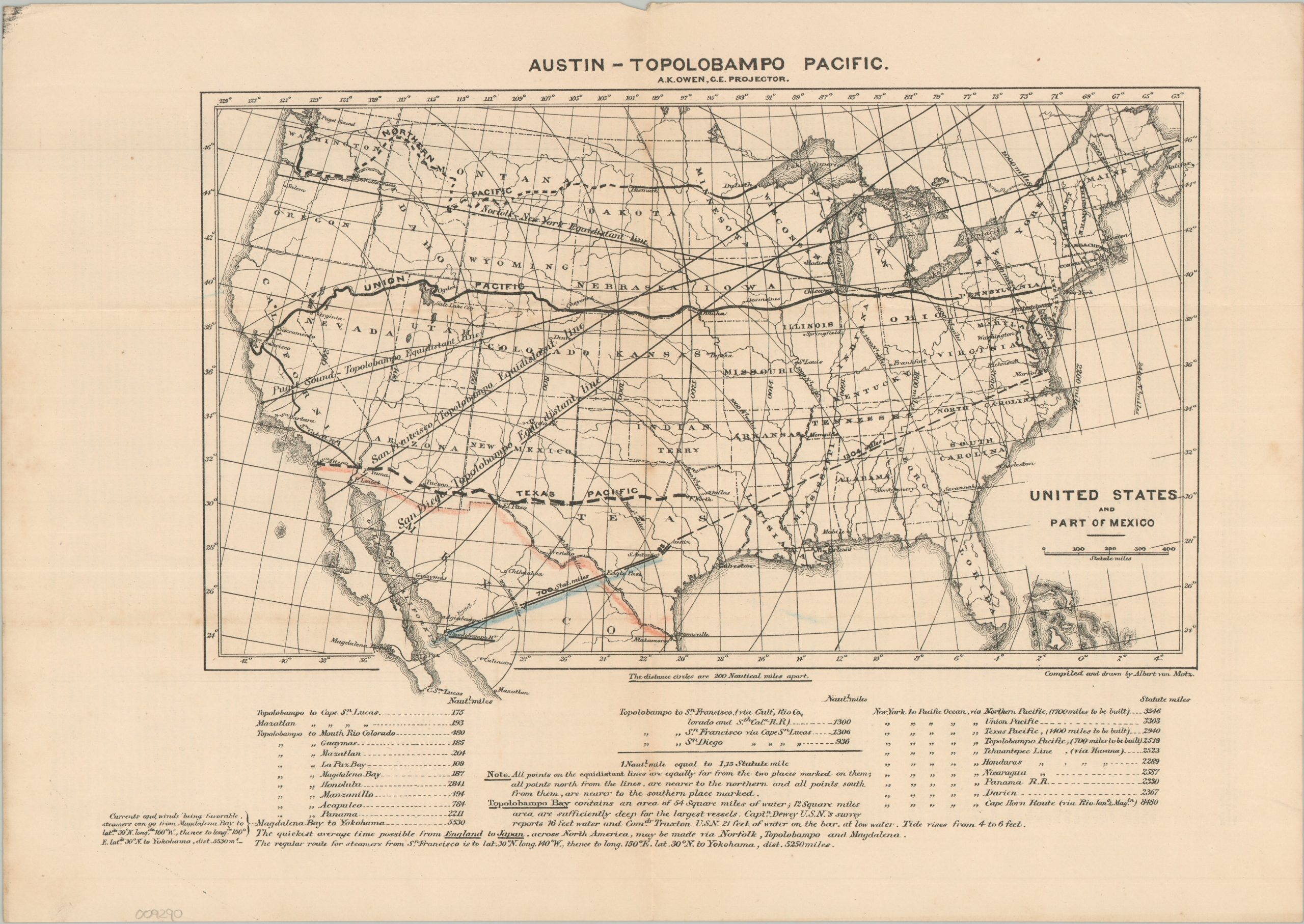
This uncommon and ephemeral prospectus captures a grand scheme envisioned by Albert Kimsey Owen, a civil engineer who was convinced that Mexico’s Topolobampo Bay presented an unrivaled opportunity for the development of a major Pacific shipping terminus. A map, created by Albert von Motz, boldly presents a remarkably straight 735-mile route between Austin and Topolobampo, with San Antonio as its only major intermediate stop. The appeal was geography: Owen argued that this connection between America’s agricultural heartland and Pacific markets would be considerably shorter than existing routes to California. This advantage is emphasized through a series of somewhat misleading “equidistant lines” bisecting the map, while tables along the lower margin further reinforce the apparent proximity of distant markets. Text declares that “the quickest average time possible from England to Japan, across North America, may be made via Norfolk, Topolobampo, and Magdalena.”
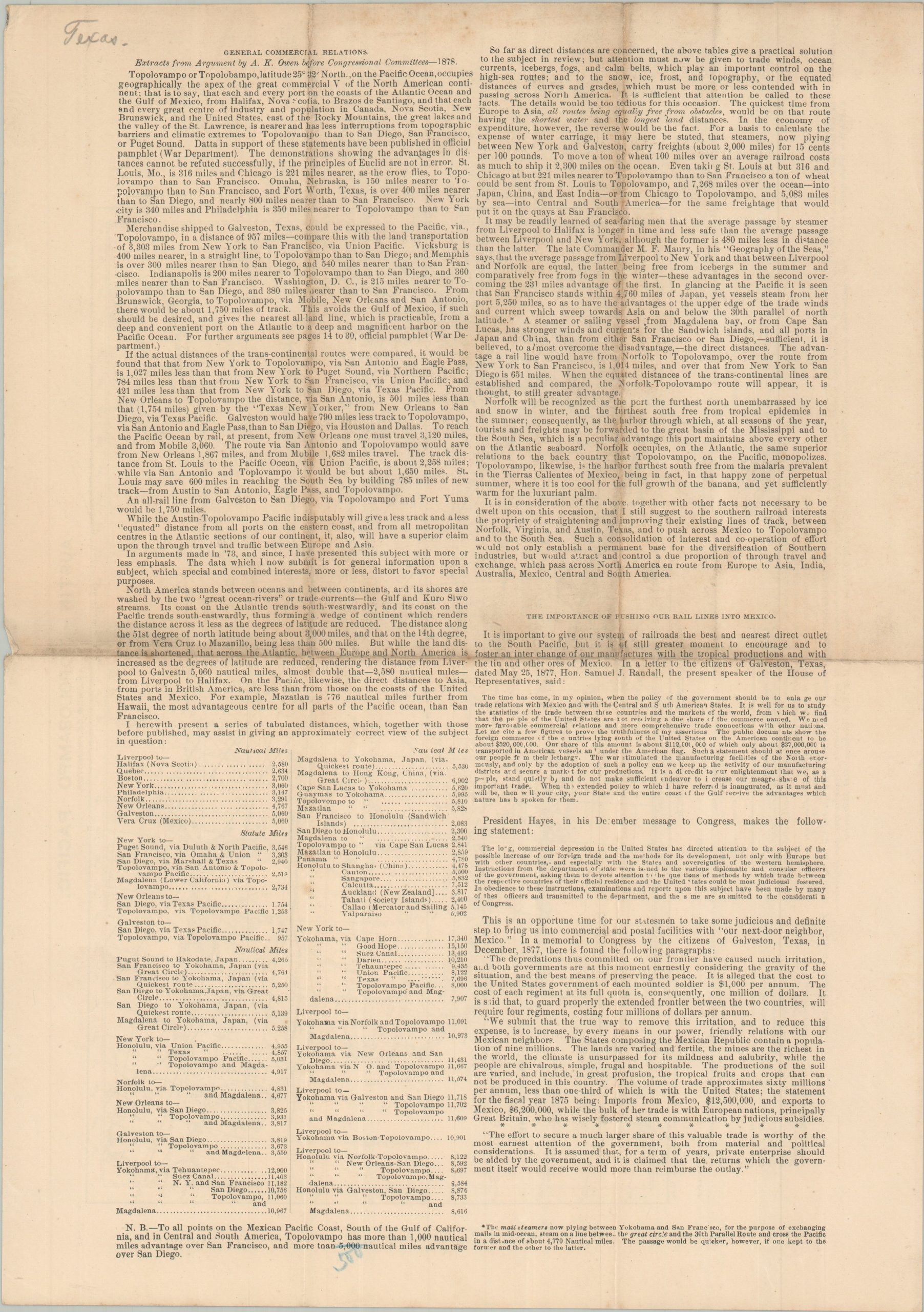
The verso presents extracts from Owen’s arguments before Congress in 1878, combining geopolitics, economic considerations, transportation statistics, and projected travel times to make the case for federal support. The prospectus is consequently less a practical railroad plan than a carefully constructed argument for the feasibility and strategic importance of Owen’s proposed transcontinental route. The enormous distance was only one of the project’s challenges: the proposed line would have crossed some of the most difficult terrain in northern Mexico, while its success depended upon substantial investment and cooperation between the United States and Mexico.
Owen’s plans for Topolobampo extended far beyond mere economic prospects and personal fortune. Raised in Pennsylvania in a Quaker family and a veteran of the Union Army, he envisioned the new port city as a utopian cooperative community in which residents would participate collectively in the development of the railroad and share in its eventual profits. He published a pamphlet, Integral Co-Operation, which outlines a system in which cooperative enterprise, rather than competition, would organize the economic and social life of the settlement. For Owen, the railroad was therefore not simply a means of moving goods to the Pacific, but the foundation for an entirely new model of community and economic development.
Map Details
Publication Date: c. 1879
Author: Albert von Motz
Sheet Width (in): 15.90
Sheet Height (in): 11.40
Condition: B+
Condition Description: Double-sided prospectus, creased and worn along old folds. A toned vertical centerfold visible on the map, with further toning on the verso that does not affect the image. Good condition overall.
$350.00
1 in stock