
Drive U.S. 66 Across the Scenic West
$95.00
A trip across Route 66 – the Main Street of America – during the early 1950s.
1 in stock

Description
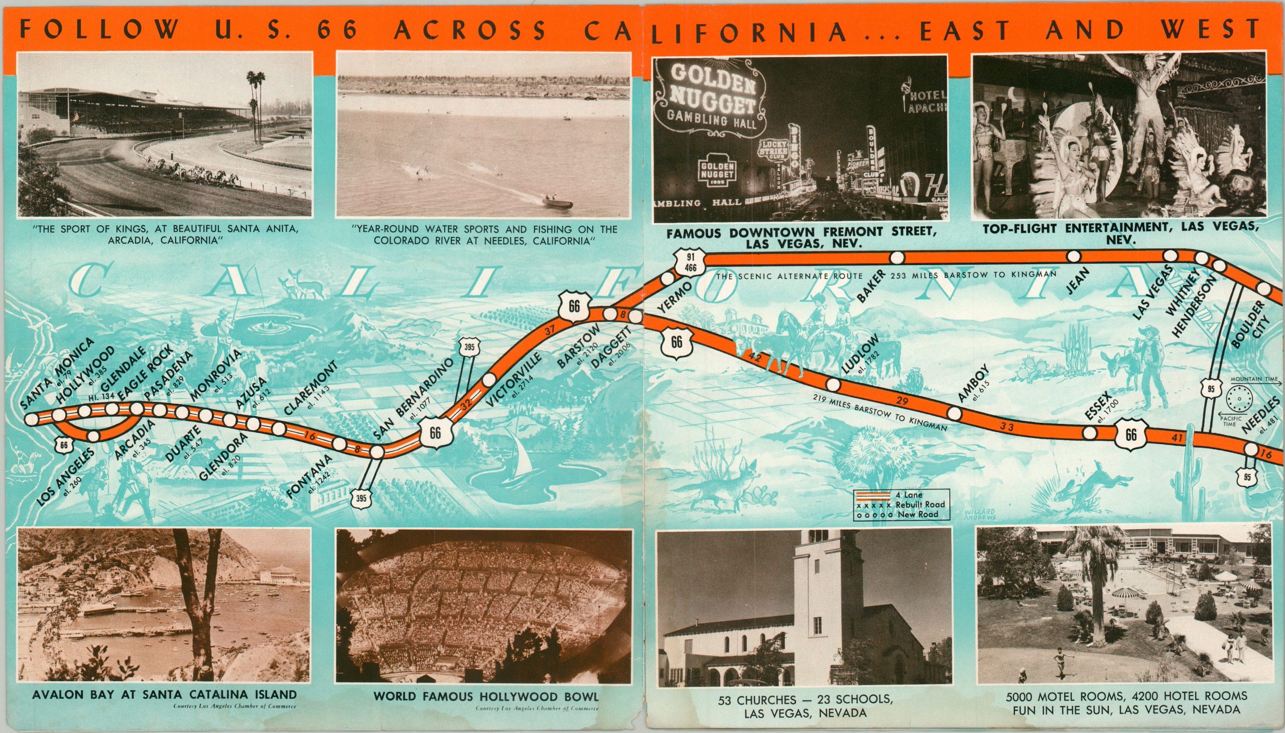
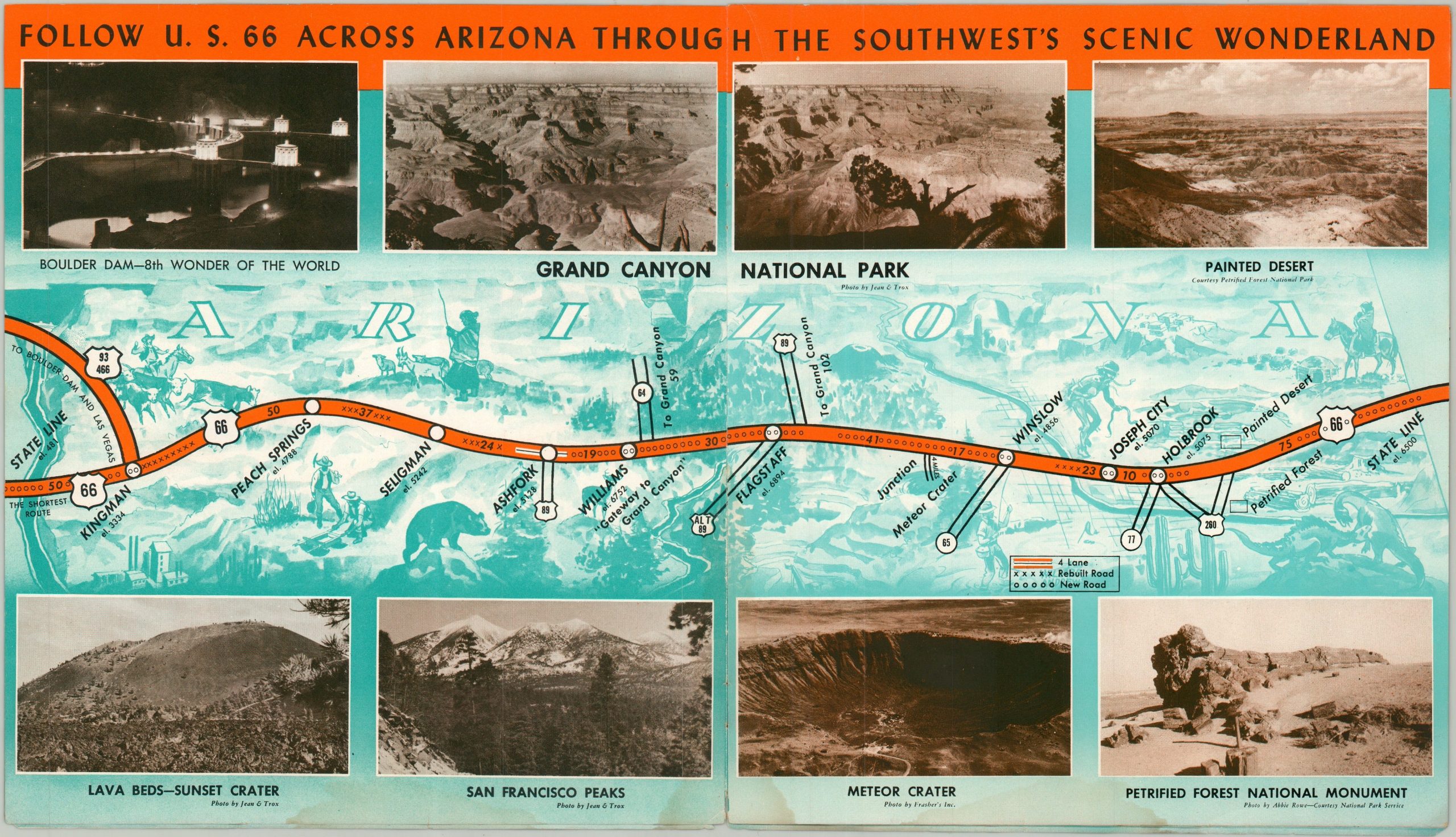
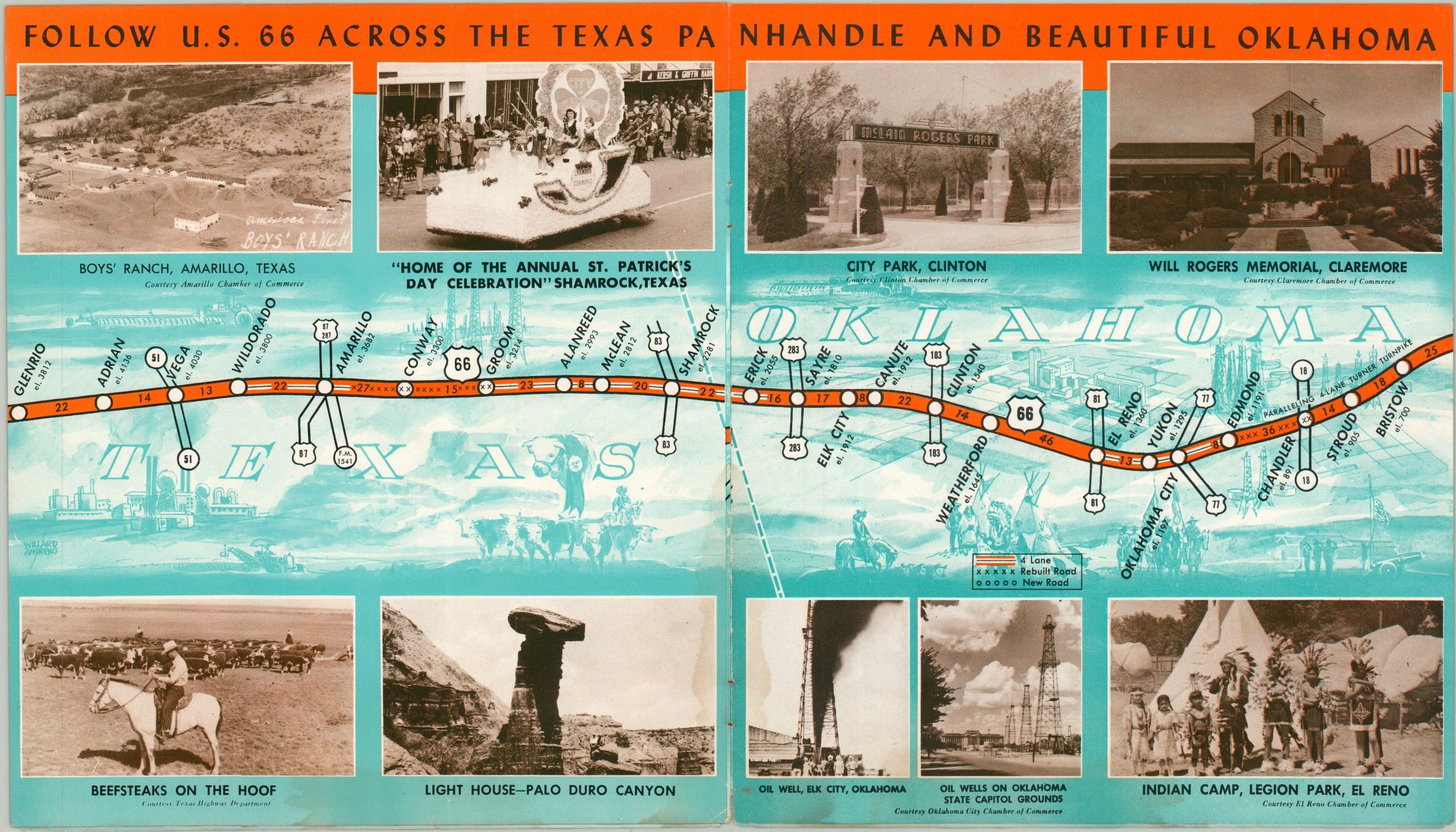
Perhaps one of the most famous numbered highways in all of America, Route 66 runs from the shores of Lake Michigan in Chicago to the Santa Monica Pier in California. The approximately 2,400-mile route (~800 miles of which are 4-lane) can be seen in full in this brochure, issued around 1954 by the U.S. 66 Highway Association of Clinton, Oklahoma.
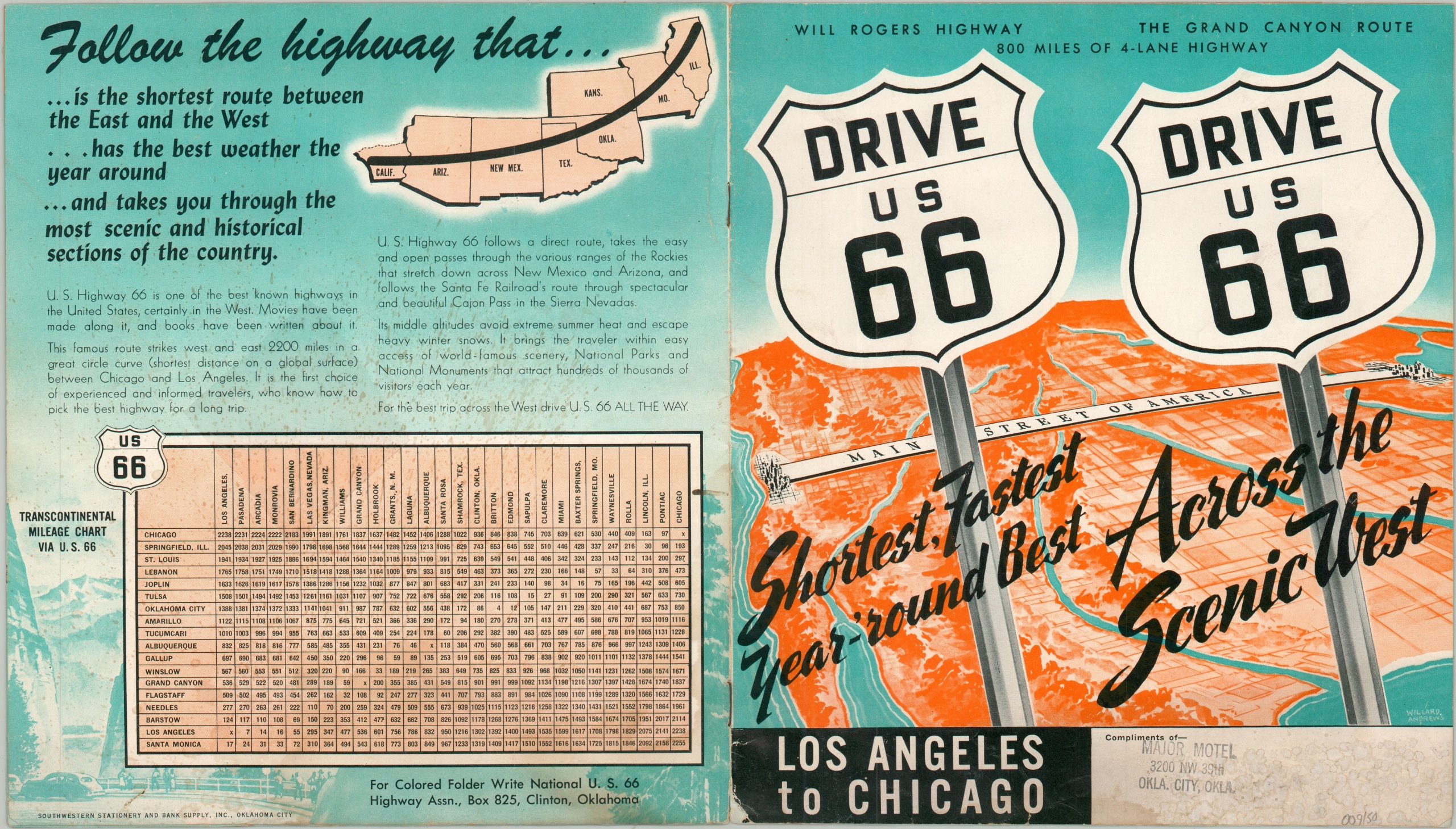
Atop a pictorial base designed by Willard Andews, each double page presents a simple strip map of the highway through its respective states: California, Arizona, New Mexico, Texas, Oklahoma, Kansas, Missouri, and Illinois. Distances are noted between points along the route, while the upper and lower margins contain crisp photographic views of local attractions and points of interest visible along the way. The final page features a transcontinental mileage chart alongside promotional text highlighting the advantages of taking Route 66 over competing east-west corridors:
“It brings the traveler within easy access of world-famous scenery, National Parks, and National Monuments that attract hundreds of thousands of visitors each year. For the best trip across the West drive U.S. 66 ALL THE WAY.” Undated, but the presence of the Turner Turnpike (Oklahoma) and the new cutoff between Kingman and Yucca (Arizona) indicates an earliest possible year of 1953.
Printed in Oklahoma City by Southwestern Stationery & Bank Supply, Inc. A prominent rubberstamp on the front cover indicates this example was distributed with the compliments of the Major Motel, also located in Oklahoma City.
Map Details
Publication Date: c. 1953
Author: U.S. 66 Highway Association
Sheet Width (in): 15.80
Sheet Height (in): 8.90
Condition: B
Condition Description: 12 pp. bochure with stapled binding, folded over once. Moderate wear along visible along pictorial wrappers, including some curling around the edges, tearing along the spine, and surface soiling. Light wrinkling throughout and the last few pages show some dampstaining along the spine. Each page contains a 2 sheet strip map showing a portion of Route 66 between Illinois and California. Good condition overall.
$95.00
1 in stock