
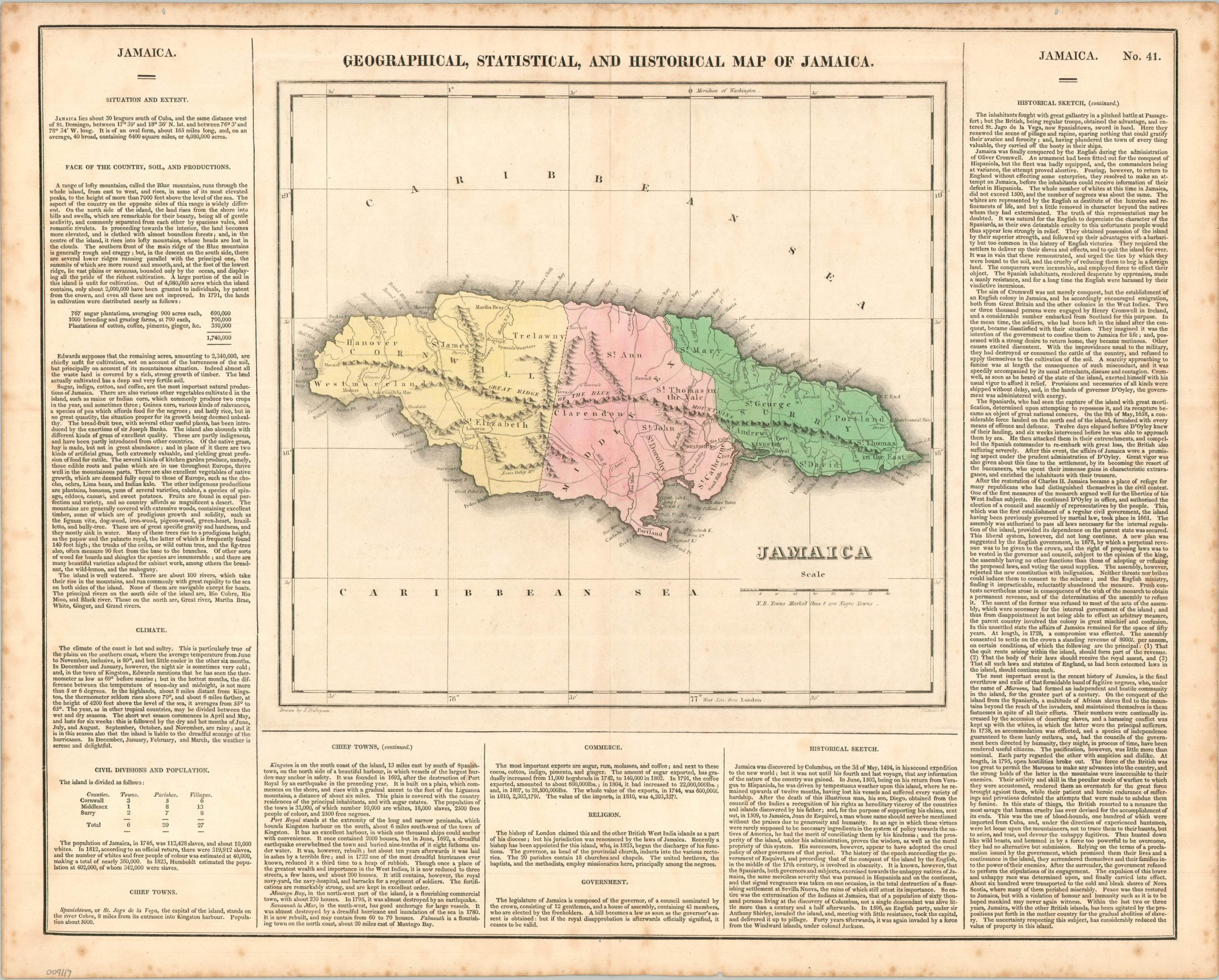
Geographical, Statistical, and Historical Map of Jamaica
$100.00
Fascinating historical map of Jamaica highlighting the island’s tumultuous racial history.
1 in stock
Description
This detailed map of Jamaica uses bright hand color to distinguish between the island’s three counties, each named after a counterpart back in England. The rugged topography is depicted pictorially, while towns, barracks, and numerous geographic features are individually labeled. Several settlements are noted with a small cross, identifying them as “Negro Towns” according to the key beneath the title. These refer to the few remaining strongholds of escaped African slaves, who began establishing small outposts in the mountainous interior almost immediately after they began to be imported to the island’s plantations.
Called maroons, the tenacious survivors would wage an ongoing series of conflicts with the Spanish, then the British colonial occupiers. The Second Maroon War is covered in some detail in the accompanying text, which excoriates the British for the cruel use of bloodhounds and the false promises of the peace negotiations – American hypocrisy at its finest. Population statistics also highlight the racial tension, as black slaves wildly outnumbered the white overlords. “In 1823, Humboldt estimated the population at 402,000, of whom 342,000 were slaves.”
The map was drawn by J. Finlayson and engraved by P.E. Hamm. It was issued as sheet number 41 in the 1826 edition of Carey & Lea’s Complete Historical, Chronological, and Geographical American Atlas.
Map Details
Publication Date: c. 1826
Author: Carey & Lea
Sheet Width (in): 22.00
Sheet Height (in): 17.75
Condition: B+
Condition Description: Engraved map with original hand color. Moderate marignal wear, including scattered foxing and several small tears. A bit of spotting within the image. Good condition overall.
$100.00
1 in stock