
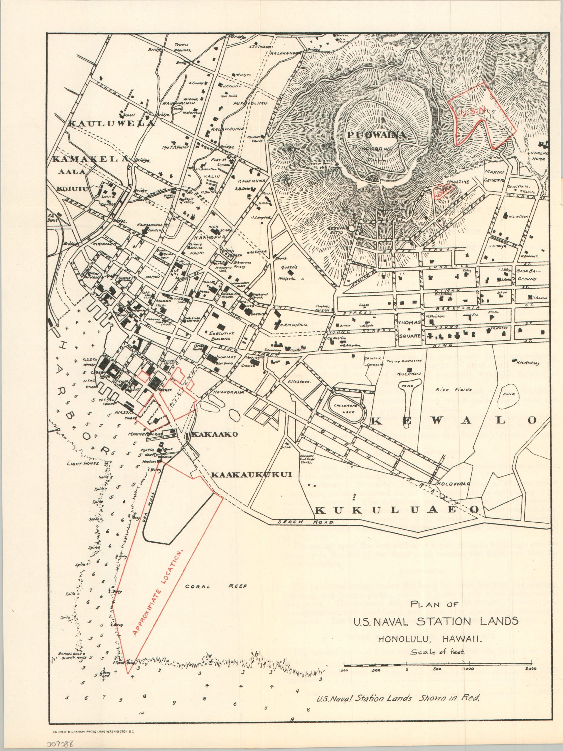
Plan of U.S. Naval Station Lands Honolulu, Hawaii
$225.00
The U.S. Navy’s presence in Honolulu before the establishment of Pearl Harbor.
1 in stock
Description
This somewhat modest street plan of Honolulu, Hawaii, was published by the Government Printing Office in 1901 as part of a Congressional report on U.S. Navy expenditures. Dozens of structures are outlined and labeled throughout the image, including individual landholders, along with neighborhoods, geographic features, and coastal details. Red overprinting outlines the modest property assigned to the U.S. Naval Station, Honolulu, which was established in 1899, following the American annexation of Hawaii the previous year.
The accompanying text lists less than $4,500 in expenditures for repairs and maintenance – less than 10% of the amount allocated to the naval station at Guam – and provides a striking illustration of the limited American naval presence in Hawaii at the turn of the century. This would soon change. While the Honolulu station initially consisted primarily of coaling facilities, repair shops, and a few administrative buildings, Congress authorized more than $3 million for dredging and construction at nearby Pearl Harbor in 1908, setting in motion the transformation of Hawaii into the principal U.S. naval base in the Pacific.
Source: U.S. Navy History
Map Details
Publication Date: 1901
Author: Andrew & Graham Photo Litho
Sheet Width (in): 9.50
Sheet Height (in): 11.90
Condition: A-
Condition Description: Single-sided sheet, creased along old folds and extracted from a broken and busted Congressional report. Includes a single sheet of accompanying text. Good to very good condition overall.
$225.00
1 in stock