
Pakistan Tourist Map
$145.00
Government tourist map of Pakistan from the reign of Ayub Khan.
1 in stock
Description
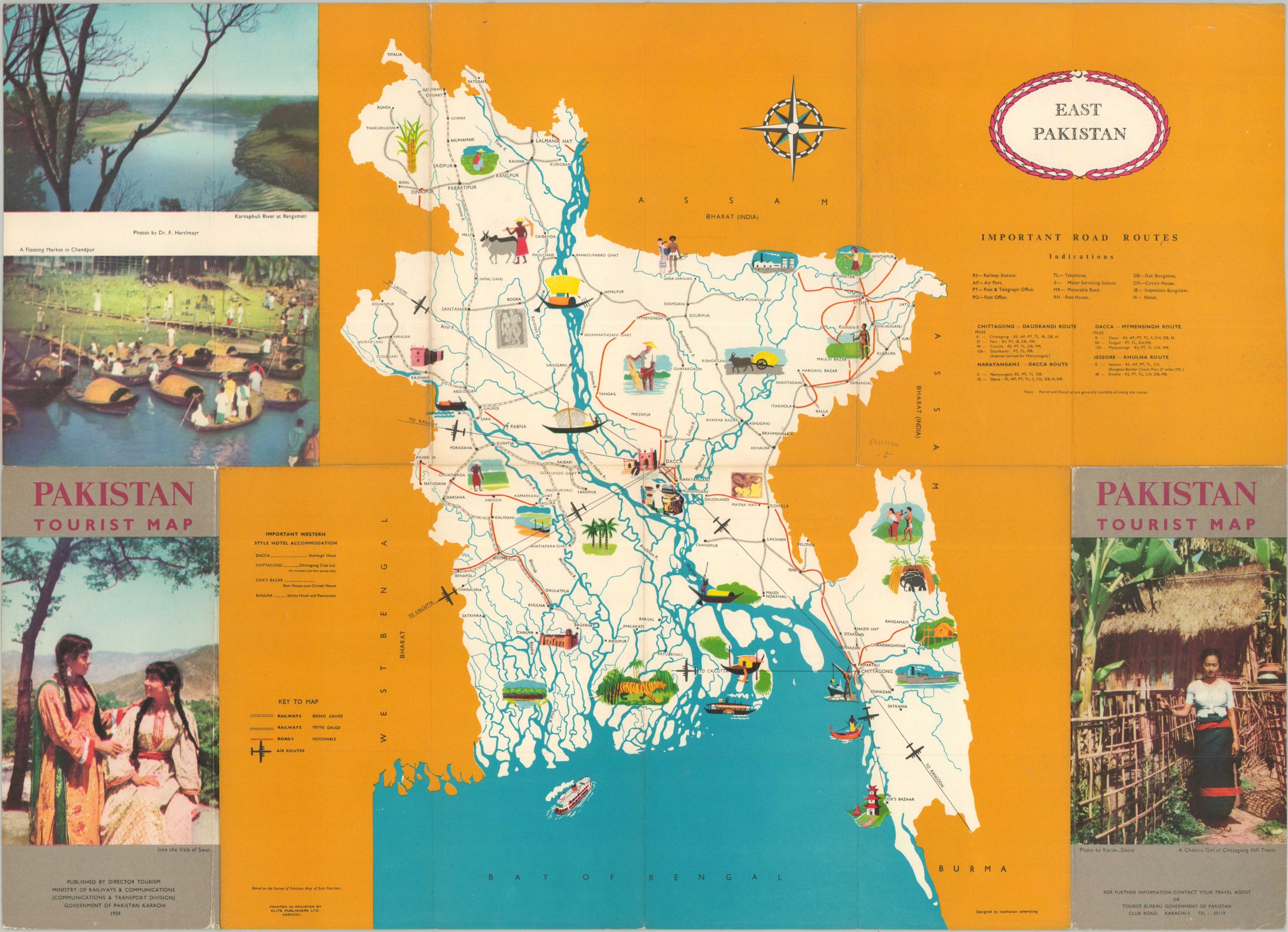
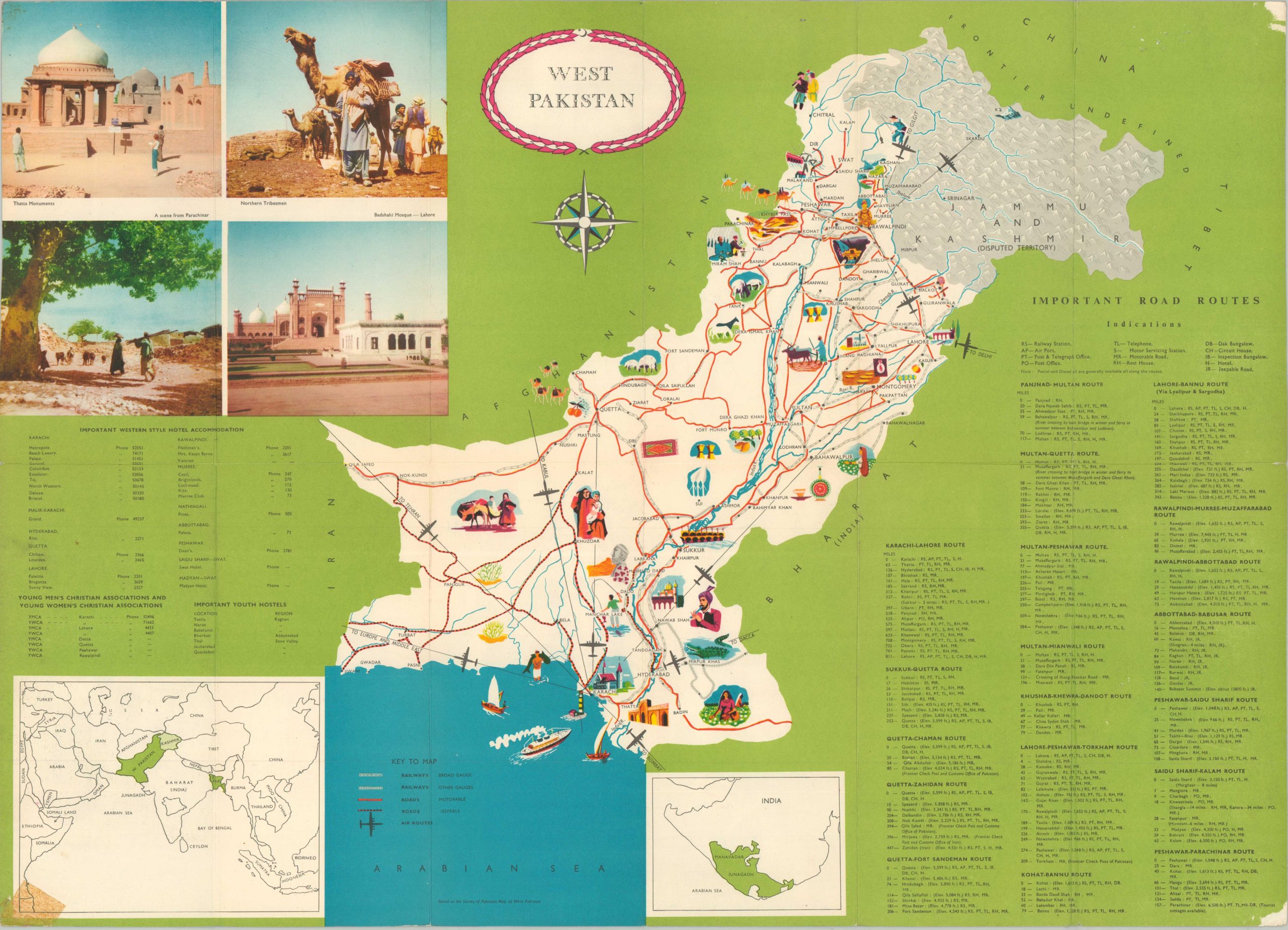
Produced under the official sanction of the Government Tourist Bureau, this vibrant 1959 tourist map provides an engaging overview of Pakistan during its early years of independence. The double-sided sheet is divided between West Pakistan and East Pakistan (now Bangladesh), illustrating the two parts of the nascent nation, separated by over 1,000 miles of Indian territory. The eye-catching image identifies primary railroads, all-weather roads, and early air routes, providing a clear snapshot of the various transportation options available. Both sides are richly illustrated with colorful pictorial vignettes that showcase regional attractions, from the archaeological ruins of Mohenjo-Daro and the Khyber Pass in the West to the tea gardens and tiger-inhabited rainforests of the East. Accompanying lists offer details on important road routes and Western-style hotel Accommodations – the disparity between East and West is notable.
The map was designed by Manhattan Advertising, using a base map created by the British Ordnance Survey. Printed in 1959 in Karachi by Eastern Publishers, Ltd. Both firms reflect the ‘soft power’ exercised by the United States during the Cold War. Beautiful women on the front covers were also deliberate – the ‘Exotic East’ on display for a primarily male audience. At the time of publication, Pakistan was navigating its first year under military rule following a coup d’état by General Ayub Khan. This “Revolution” aimed to end years of political instability and corruption, resulting in a period of centralized governance that heavily prioritized rapid industrialization and Western-aligned economic development. The map’s modern aesthetic highlights the regime’s effort to present a stable and “business-friendly” image to the international community.
Map Details
Publication Date: 1959
Author: Manhattan Advertising
Sheet Width (in): 26.20
Sheet Height (in): 18.80
Condition: B
Condition Description: Double-sided pictorial tourist map with vibrant printed color. Moderate wear along original folds and along the outer edges of the sheet. Minor loss and creasing in the corners, along with old cellophane tape. About good condition overall.
$145.00
1 in stock