
Sketch of the Public Surveys in New Mexico
$250.00
Mapping New Mexico at the height of the American Civil War.
1 in stock
Description
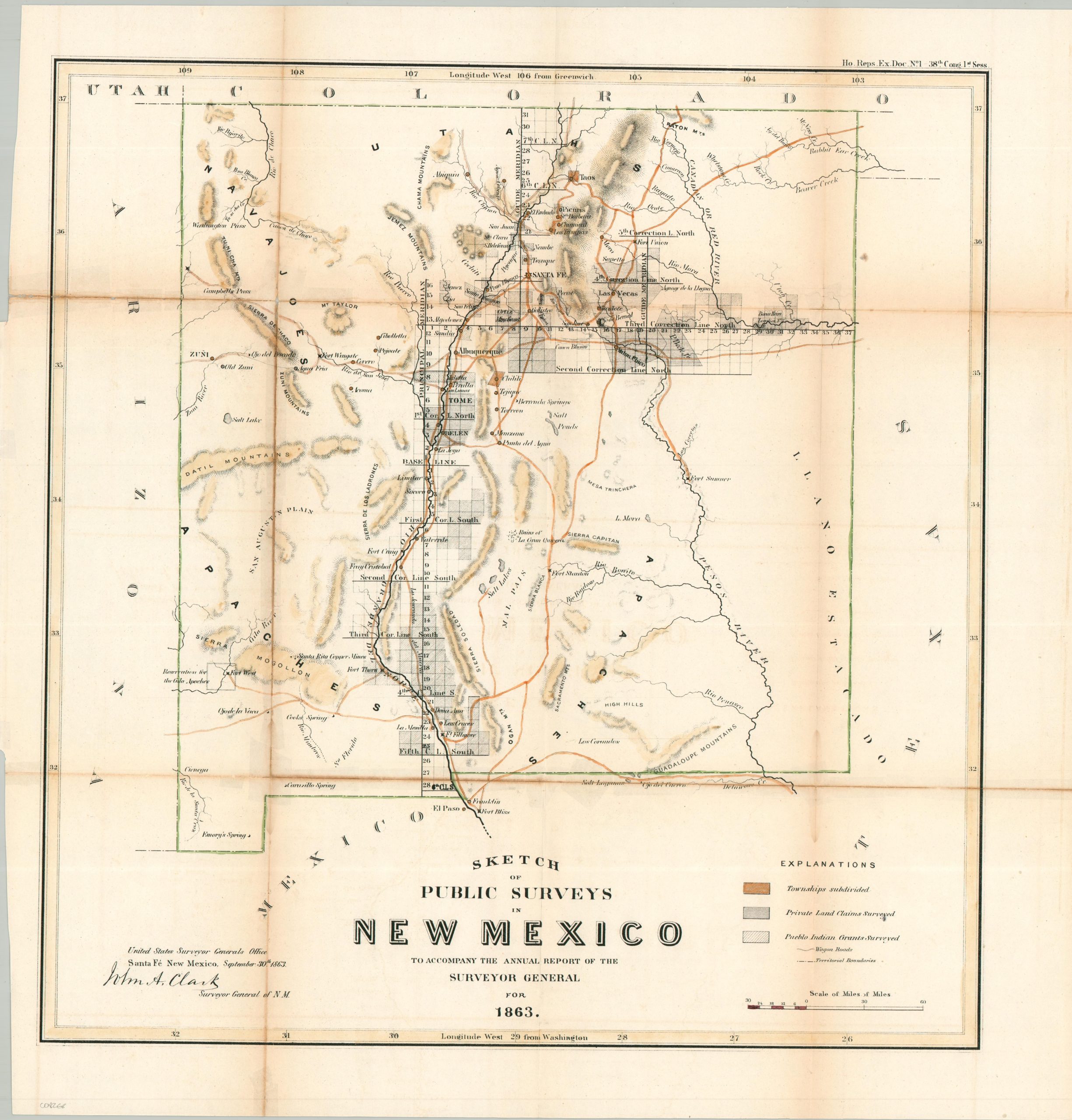
This finely detailed survey of the New Mexico Territory was compiled by John A. Clark, Surveyor General, to accompany his 1863 Annual Report. The map captures federal efforts to organize the ‘Wild West’ into a structured grid during a period of profound upheaval, as the Union sought to secure the territory following the recent Confederate invasion.
The progress of the rectangular survey system closely hugs the Rio Grande Valley, anchoring the map around the vital water sources supporting Taos, Santa Fe, and Albuquerque. Beyond the burgeoning townships, the image depicts the critical Santa Fe Trail and other wagon roads that served as lifelines for both commerce and military reinforcements. By labeling military forts alongside Indigenous territories, Clark’s map illustrates the contested nature of the frontier in 1863 – a landscape where federal authority was confirmed by the surveying process.
Map Details
Publication Date: 1863
Author: John A. Clark
Sheet Width (in): 16.8
Sheet Height (in): 20.2
Condition: B
Condition Description: Lithographed map with attractive modern hand color, printed on a thin sheet that's toned and brittle along old folds. Several splits repaired on the verso with archival material. Image remains intact and legible, with a nice antique patina.
$250.00
1 in stock