The Middle and Upper Mississippi River
$75.00
Mapping War Department improvements along the Upper and Middle Mississippi River.
1 in stock


Description
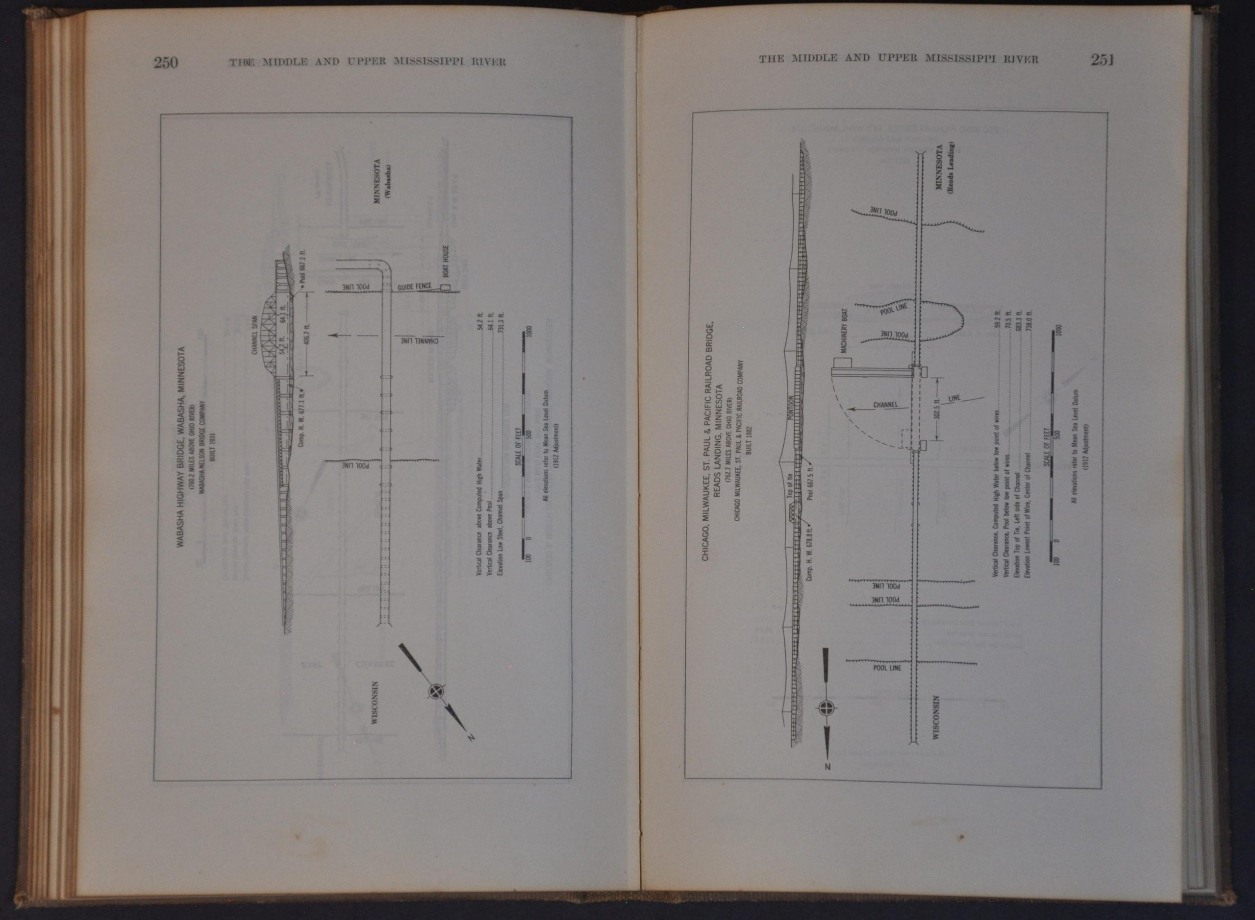
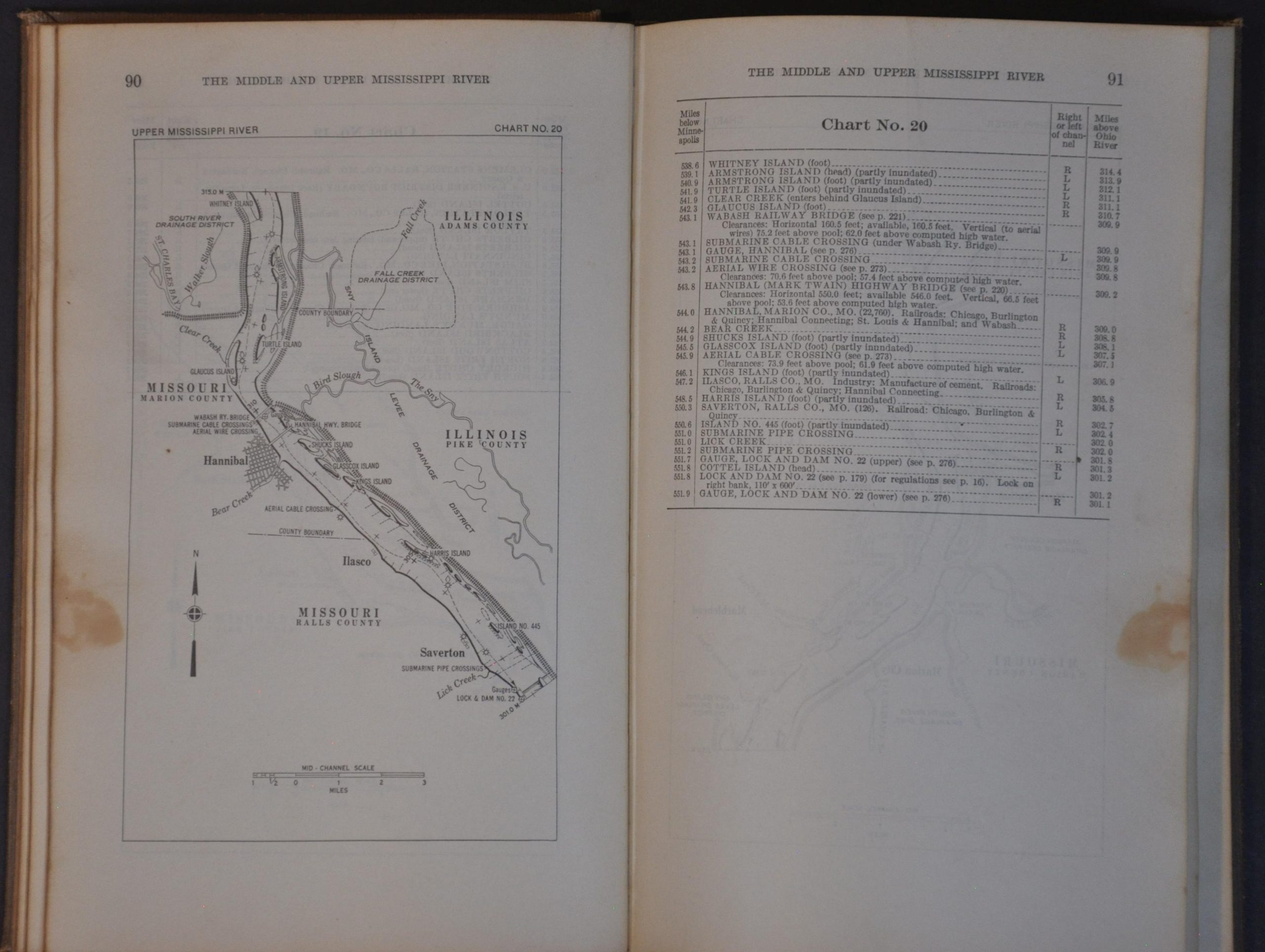
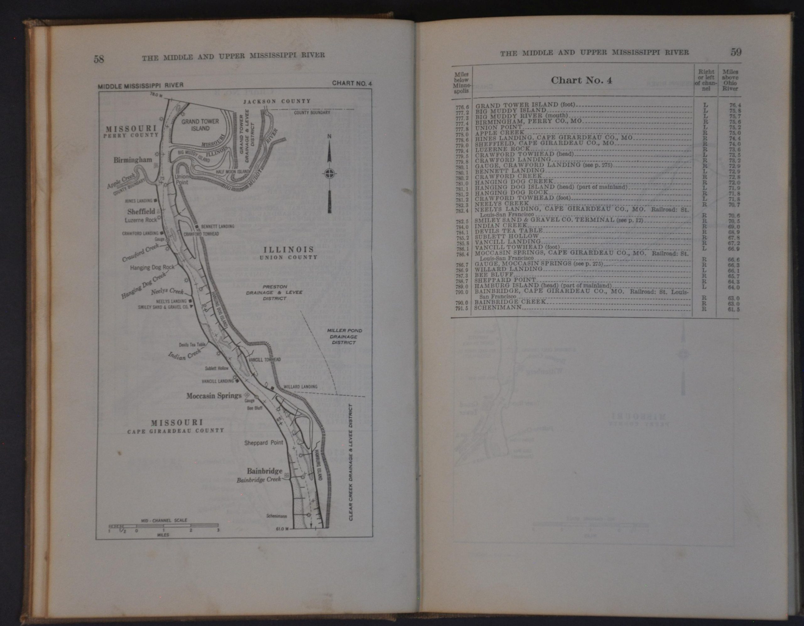
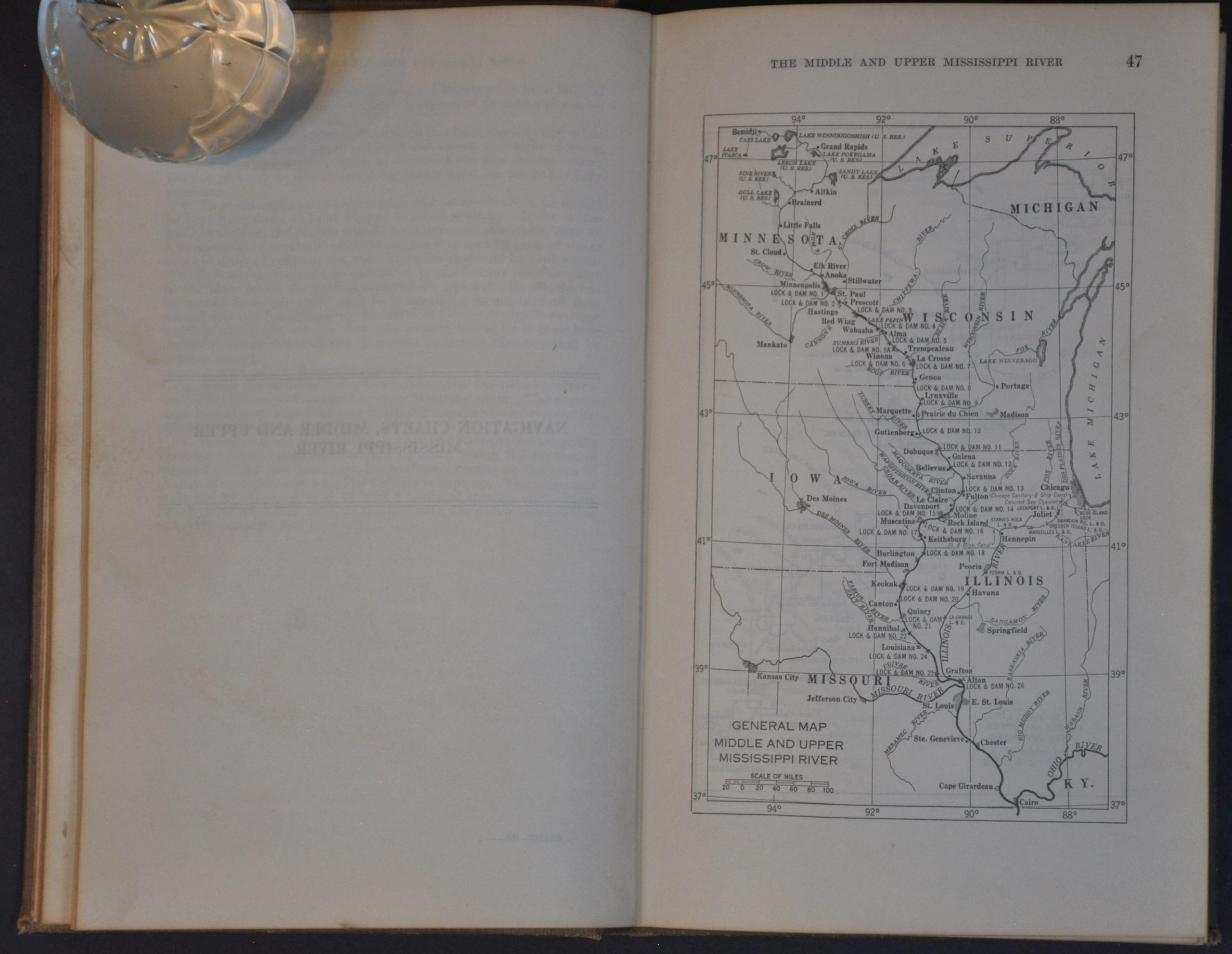
A War Department publication issued on the brink of America’s entry into World War II that covers the course of the Mississippi between the Ohio River at Cairo, IL and Minneapolis. A series of large-scale nautical charts identify navigational hazards, local industries, geographic features, relevant infrastructure, and more. Accompanying text offers invaluable navigational information, pilot regulations, fueling facilities, etc. Diagrams of bridges, locks, dams, and other Army Corps of Engineers responsibilities are also included.
Map Details
Publication Date: 1940
Author: U.S. Army Corps of Engineers
Sheet Width (in): 5.75
Sheet Height (in): 9.00
Condition: B+
Condition Description: 345 pp. volume bound in original full brown cloth boards. Covers and endpapers are heavily soiled and worn, though the contents (appear to be complete) are in good shape, showing just light toning and some occasional spotting along the fore edge. Good condition overall.
$75.00
1 in stock