Star Trek Maps
“The navigational charts of the five-year voyage of the starship Enterprise.”
Out of stock


Description
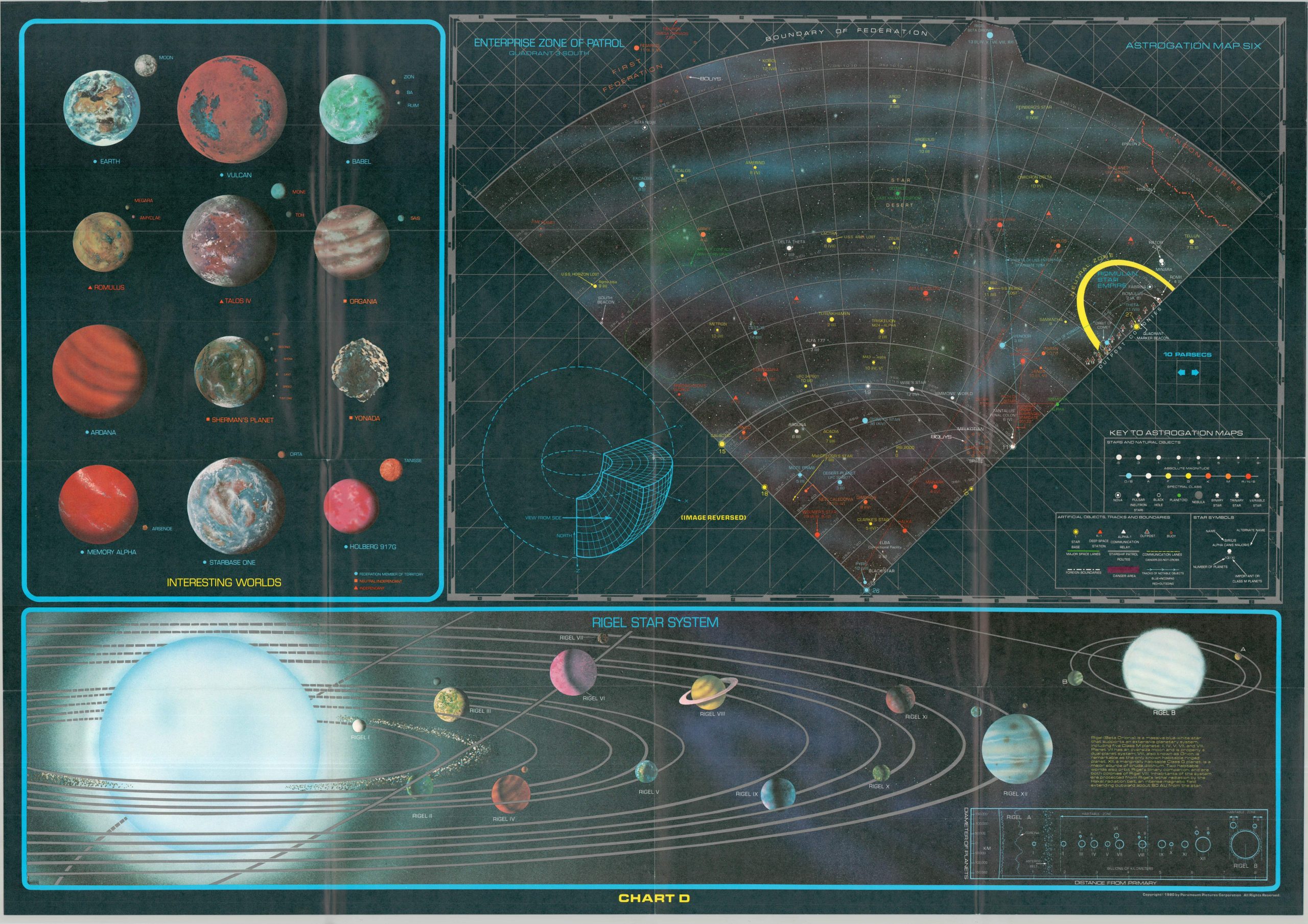
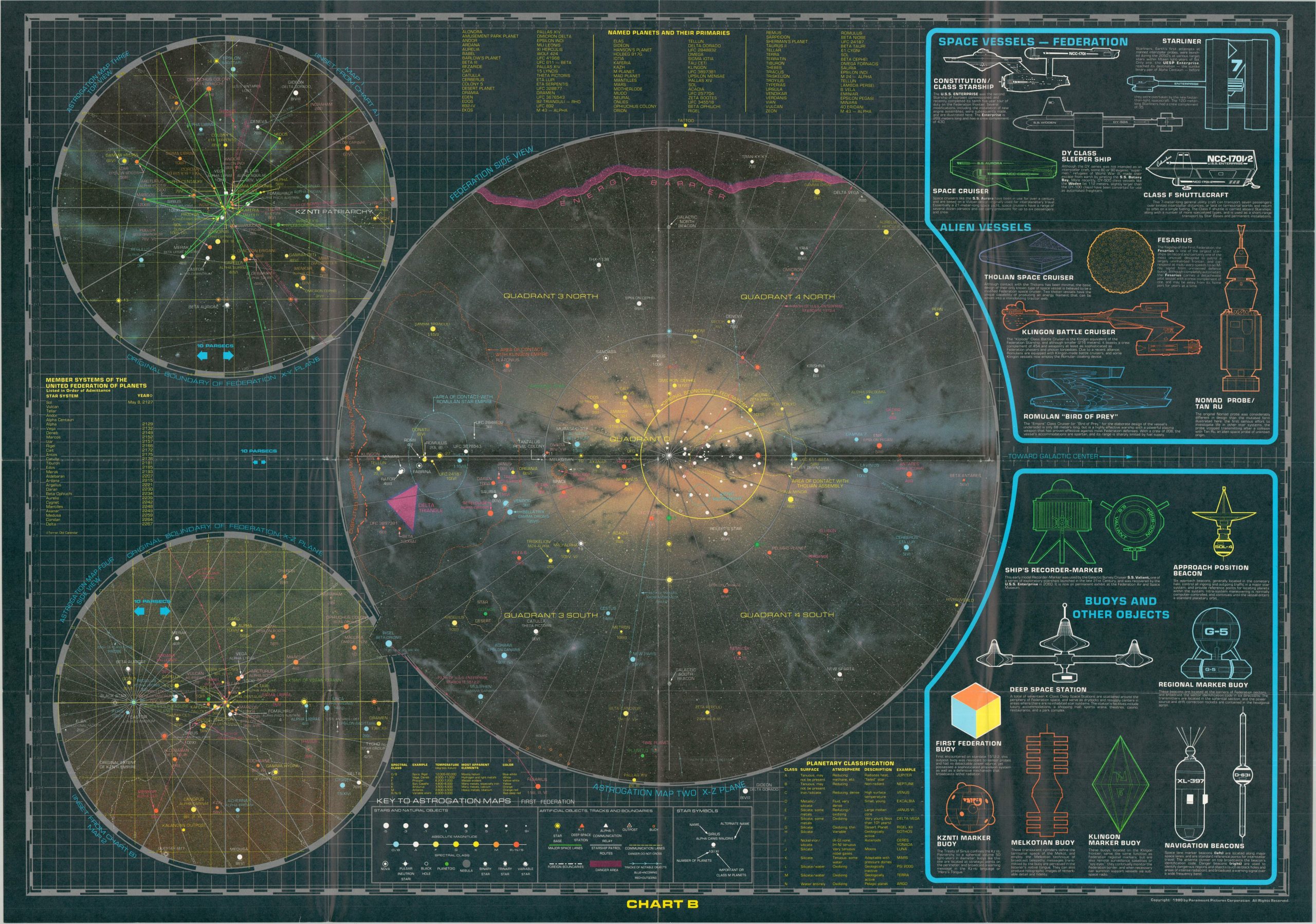
Climb aboard the USS Enterprise with this awesome pair of navigational charts detailing her journey across the universe during the original Star Trek series, which aired between 1965 and 1969. A tremendous amount of information, all canon, is presented across the four images. Star charts, or ‘astrogation maps,’ highlight interstellar navigation routes and the various types of celestial bodies, while accompanying diagrams attempt to explain the complex projection used to render three-dimensional space. The sheets also include illustrations of planets, ships, star systems, and other objects – all described in some detail with carefully researched text.
An instructional booklet that outlines the concept of interstellar travel (according to the Star Trek universe) is included to assist any aspiring Starfleet cadets. The maps and booklet were designed by a creative team led by Jeffrey Maynard, Michael McMaster, and Geoffrey Mandel. Published in 1980 by Bantam Books, under license from Paramount Pictures Corporation.
Map Details
Publication Date: 1980
Author: Jeffrey Maynard
Sheet Width (in): 42.75
Sheet Height (in): 29.25
Condition: A-
Condition Description: Two double sided sheets with their original stiff paper envelope. Creasing and wear along original folds, consistent with age, and small pinholes at fold joints. Includes the accompanying 'Introduction to Navigation' - a 31 pp. booklet measuring approximately 9.9" x 7" that contains basic information on interstellar travel across the Star Trek universe. Complete and in very good condition overall.
Out of stock