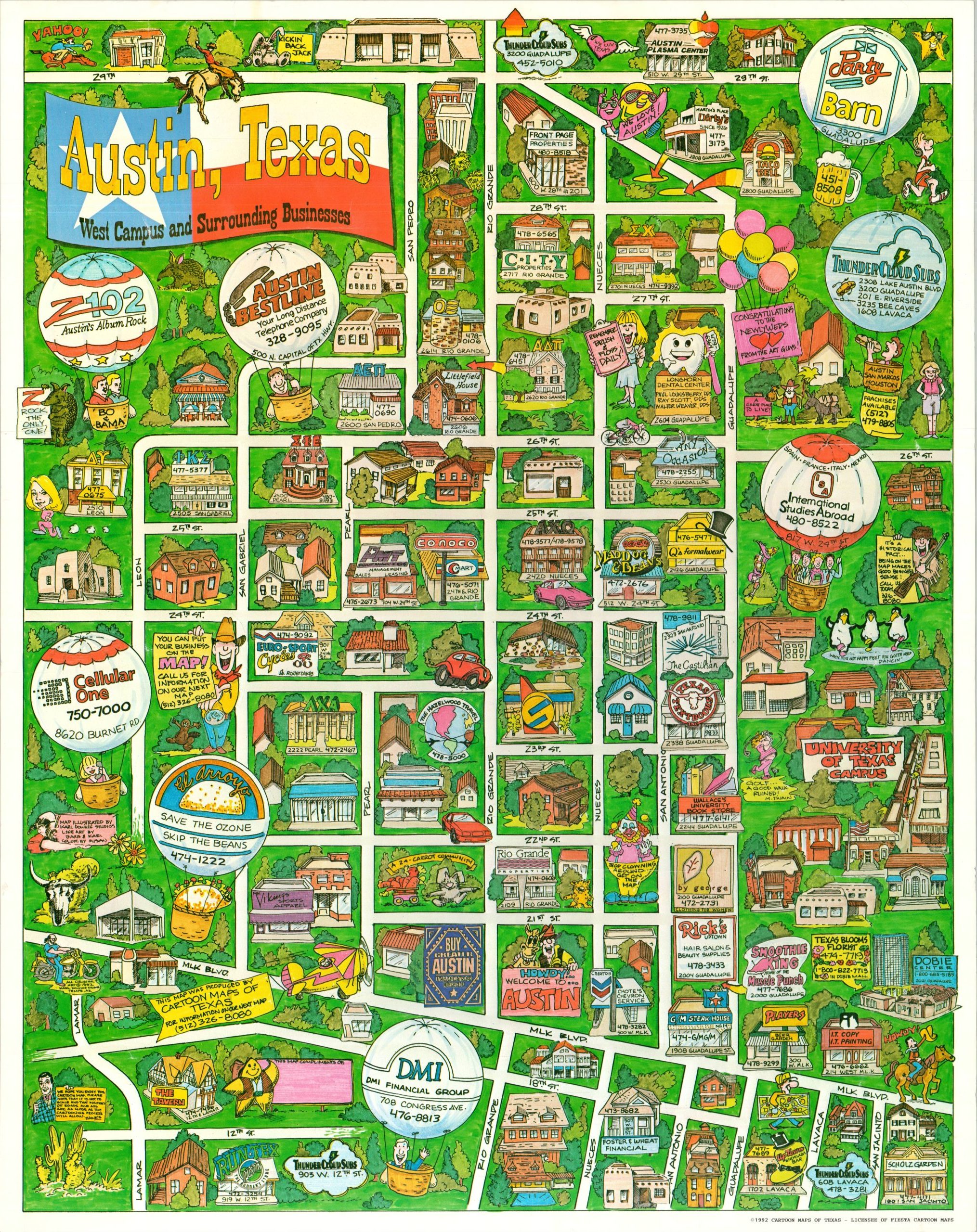
Austin, Texas West Campus and Surrounding Businesses
Rare poster map of Austin’s West University neighborhood during the early 1990s.
Out of stock
Description
This colorful poster map presents a popular commercial district in downtown Austin, Texas. A large portion of the University of Texas campus can be seen in the center right, while the rest of the image is bordered by 29th Street (north), Lamar/Leon (west), and MLK Boulevard (south). Dozens of local businesses are boldly promoted throughout, accessible by a clearly defined (and somewhat simplified) street grid.
Text in the lower left alludes to the distortion – “we hope you enjoy this cartoon map. Please note that it is not to scale and that positions of roads and ads are as close as the cartooning process will allow.” Other charming illustrations highlight the local cowboy culture, friendly attitude, and Wild West atmosphere of the ‘Live Music Capital of the World’ (a nickname adopted by city resolution the year prior to printing).
The artwork for the map was provided by Karl Dowhie Studios of Tempe, Arizona. Copyrighted and published in 1992 by Cartoon Maps of Texas, a licensee of Fiesta Cartoon Maps.
Map Details
Publication Date: 1992
Author: Karl Dowhie Studios
Sheet Width (in): 22
Sheet Height (in): 28
Condition: A-
Condition Description: Color printed poster map on a single-sided sheet of glossy paper. Moderately wrinkled, where previously rolled, and a few small closed tears along the upper edge (repaired on verso). Good to very good condition overall.
Out of stock