
Canyon Lake, Texas
$60.00
“Recreation, favorable fish and wildlife habitats are Extra Dividends derived from this project and others like it built and operated by the Corps of Engineers.” – Text, verso.
1 in stock
Description
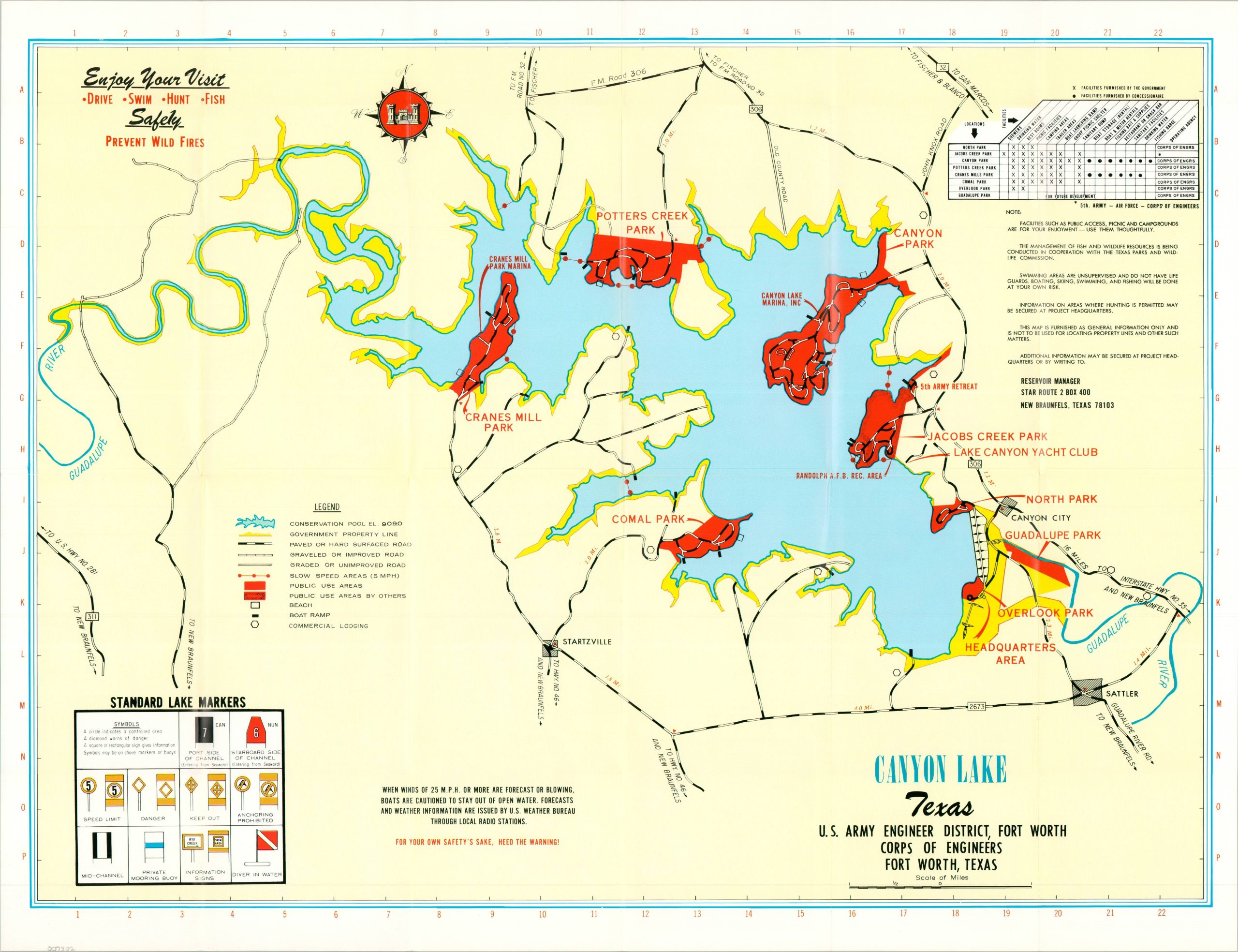
Major floods along Texas’s Guadalupe River during the late 1930s compelled the federal government to initiate a flood mitigation program (albeit slowly). A major component was the construction of Canyon Dam in Comal County. The ~6,800 ft. embankment dam was completed in 1964, creating the resulting reservoir named Canyon Lake.
This map was issued in 1975 by the administrative authority operating and maintaining the dam, the U.S. Army Corps of Engineers. A colorful image highlights public use areas in red and labels various transportation routes, areas of interest, and geographic features. Lists of facilities are provided in the upper right, with further descriptive text and photos on the verso.
Map Details
Publication Date: 1975
Author: U.S. Army Corps of Engineers
Sheet Width (in): 21.75
Sheet Height (in): 16.9
Condition: A
Condition Description: Double-sided brochure printed on glossy paper. Sharply creased along original folds, but in near fine condition overall.
$60.00
1 in stock