
Roman Empire and the Routes of the Travels of St. Paul
$95.00
Paul’s travels across the Eastern Mediterranean.
1 in stock
Description
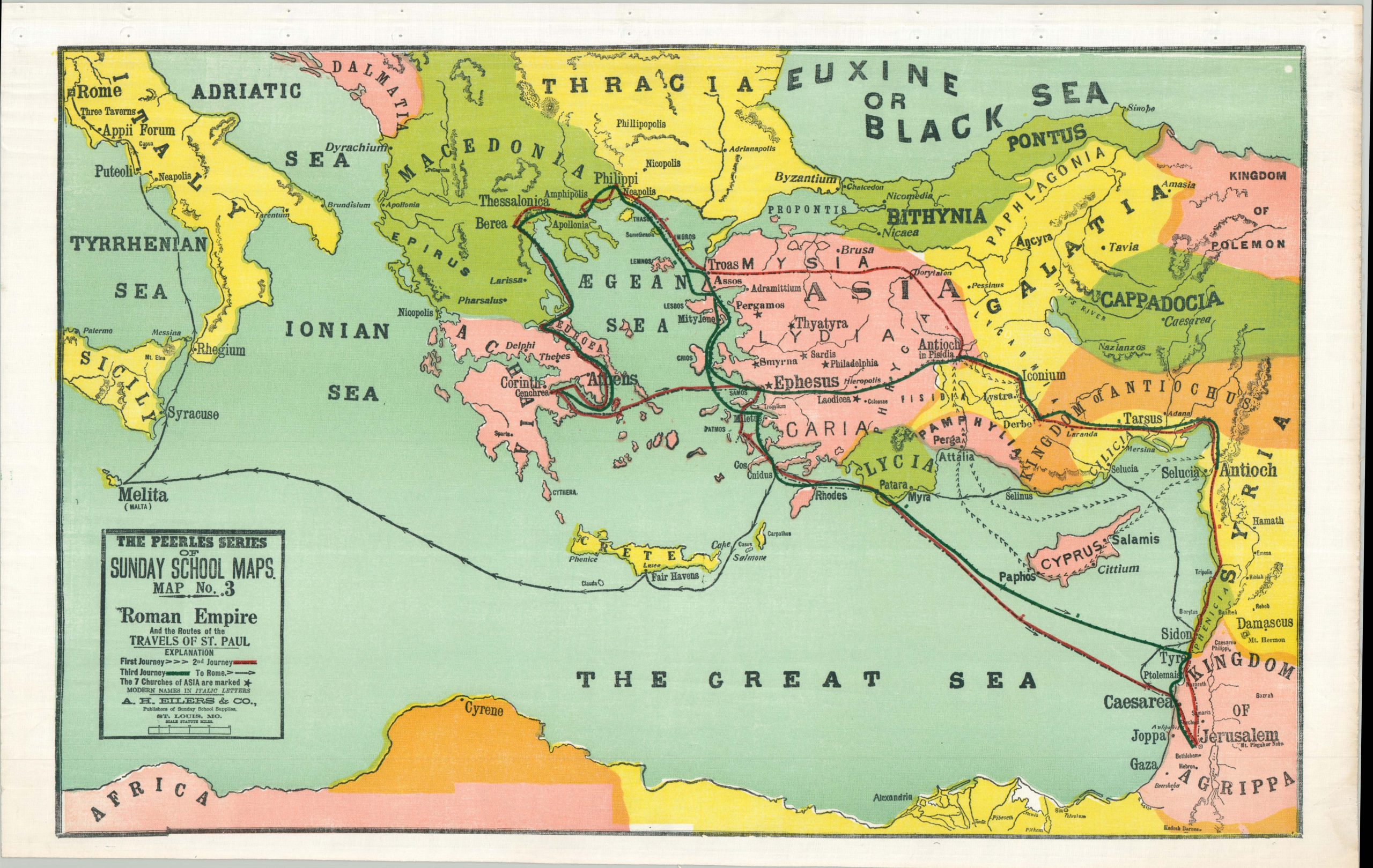
This colorful map highlights the extensive evangelical travels of Saint Paul during the first century A.D. According to Biblical sources, the famed apostle traveled approximately 10,000 miles across the Roman world, spreading the word of Jesus Christ everywhere he went. The routes of his four primary journeys are noted, with the final one ending in captivity in Rome. Various locations of interest are labeled and the Seven Churches of Asia, mentioned in the Book of Revelation, are marked with small black stars.
The sheet was published in the early 1900s by A.H. Eilers & Co. as Map No. 3 in the Peerless Series of Sunday School Maps. The company was originally established in St. Louis during the early 1870s as a bookseller and stationer, but soon transitioned to the production of material related to Sunday School education in the United States. Eilers produced a number of religiously themed materials, including collection envelopes, marriage certificates, ledgers, and wall maps in a variety of custom sizes and formats.
Map Details
Publication Date: c. 1910
Author: A.H. Eilers
Sheet Width (in): 28
Sheet Height (in): 17.5
Condition: A-
Condition Description: Color printed map (possibly silkscreen) on a sheet of waxed cloth. Formerly attached to a wooden roller, with creasing and holes along the upper margin as a result. Light wear elsewhere in the margins, consistent with age and use, including a bit of toning and creased corners. Blank on verso. Very good overall.
$95.00
1 in stock