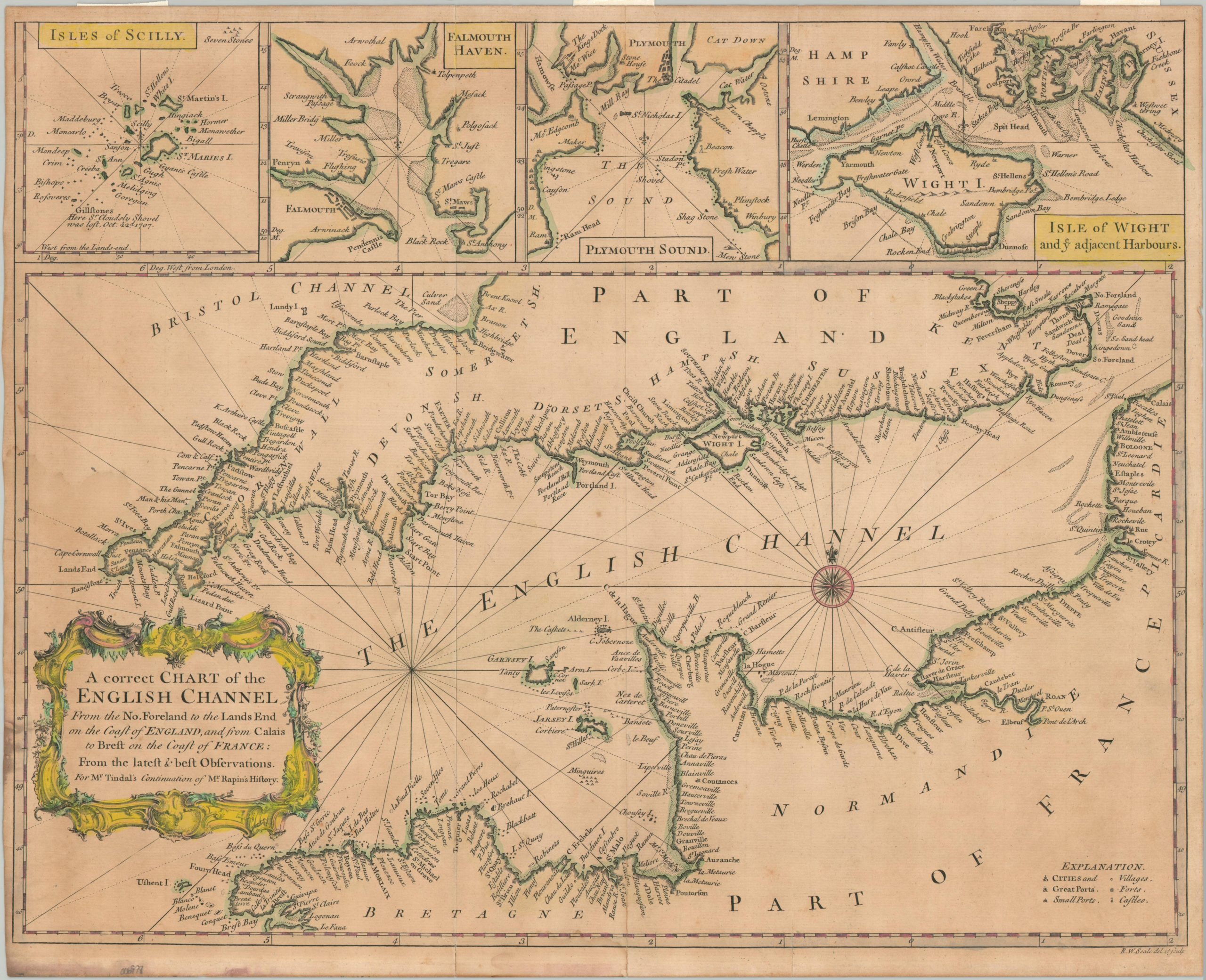
A Correct Chart of the English Channel from the No. Foreland to the Lands End…
$100.00
The English Channel during the War of Austrian Succession.
1 in stock
Description
This charming map of the English Channel was drawn and engraved by R.W. (Richard William) Seale for Nichols Tindal’s The History of England by Mr Rapin de Thoyras, published in London between 1744 and 1747. Dozens of towns, harbors, and geographic features are labeled along the French and English coastlines, though interior details are sparse. Insets along the upper edge show the Isles of Scilly (otherwise off the page) and strategically important harbors at Falmouth, Plymouth, and the Isle of Wight.
The War of Austrian Succession (1740-1748) pitted France and England against each other, reflecting their long-standing rivalry and competing global interests. France initially supported the challenge to Maria Theresa’s succession to the Habsburg throne, aiming to weaken Austria, while Britain championed Maria Theresa to counter French expansionism. By 1745, significant land battles had occurred in Europe, but the English Channel remained a critical strategic area, as reflected by a massive French invasion attempt on Britain in 1744 which was thwarted by severe storms in the Channel.
Map Details
Publication Date: c. 1745
Author: Richard William Seale
Sheet Width (in): 19.5
Sheet Height (in): 15
Condition: B
Condition Description: A heavily toned sheet shows a large, but minor damp stain in the lower left corner, with some additional darkening confined mostly to the margins (see scan). A few pieces of archival tape on the verso were previously matted and creased along old folds. About good condition overall.
$100.00
1 in stock