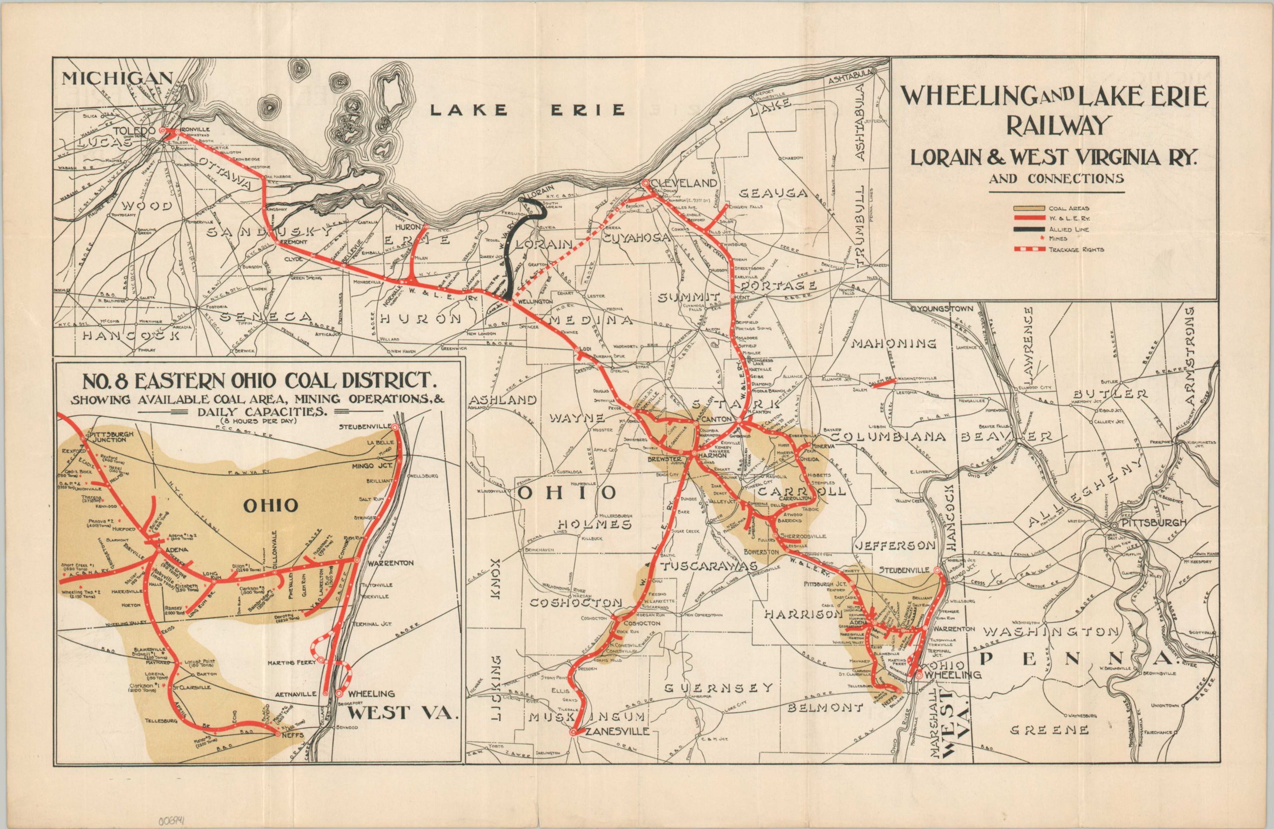
Wheeling and Lake Erie Railway Lorain & West Virginia Ry. and Connections
The height of the Wheeling and Lake Erie Railway.
Out of stock
Description
This uncommon map outlines the operations of the Wheeling and Lake Erie Railway across the state of Ohio, stretching from Wheeling in the east to Toledo in the West. The sheet can be dated to around 1916, based on the trackage rights over the Big Four to Cleveland (1914) and the Allied Line of the Lorain and West Virginia Railway. Coal fields are shaded in brown while mines are shown with small red stars.
An inset in the lower left shows the particularly productive region around Adena, noting total daily coal capacity for numerous mines operating in the area. Maher #9, west of Echo, was capable of producing 2,500 tons in eight hours!
Map Details
Publication Date: c. 1916
Author: Wheeling and Lake Erie Railway
Sheet Width (in): 18.1
Sheet Height (in): 11.75
Condition: A-
Condition Description: Moderate creasing and wrinkling along old folds and one marginal edge tear, repaired on the (blank) verso. Good to very good condition overall.
Out of stock