Oakland “Firestorm” Map October 20, 1991
$145.00
Documenting the devastation of the 1991 Tunnel Fire.
1 in stock

Description
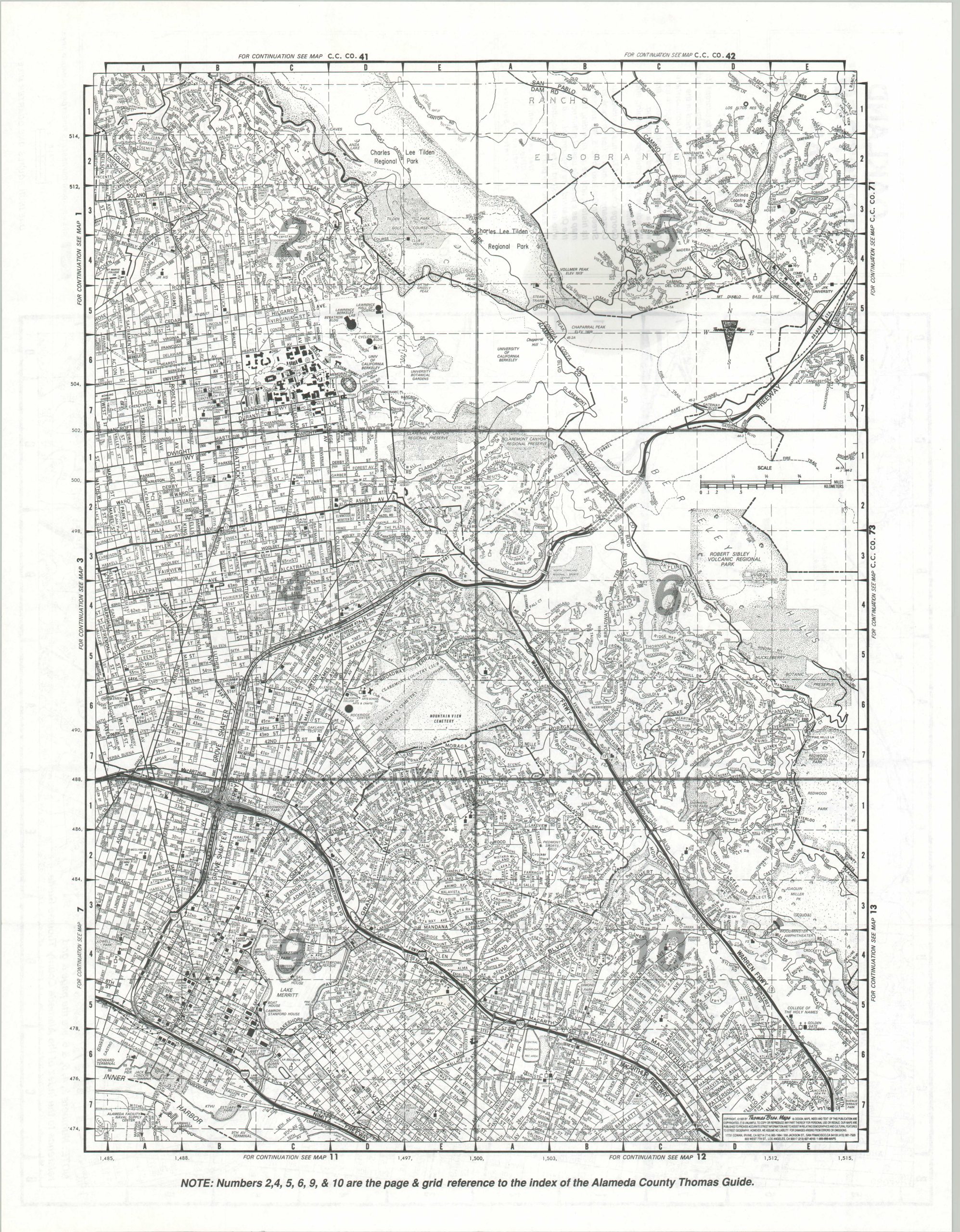
On Sunday, October 20th 1991, a previously contained brush fire reignited in the Berkeley Hills of northeast Oakland. Driven by winds exceeding 60 miles per hour, the blaze rapidly spread; crossing large freeways, consuming entire neighborhoods, and depositing ash across the entire Bay Area. By the time it was brought under full control on October 23rd, the Oakland Firestorm had killed twenty-five people and consumed nearly 3,000 homes across the 1,500+ acres of devastation.
This map of the burnt-out area (shaded in grey) was published shortly after the event by the Thomas Brothers Map Company. The CEO, Warren Wilson, was a survivor who lost his home on Hiller Drive. Text on the front panel indicates “possible useful reference to the Oakland Fire Department, and to others who are involved in re-development of the area and planning of its future.”
The image shows just how close the fire came to UC Berkeley and numerous densely populated areas. The verso presents a smaller-scale map of the region, with corresponding references to the Alameda County Thomas Guide (a bit of self-promotion never hurt).
Map Details
Publication Date: 1991
Author: Thomas Brothers
Sheet Width (in): 22.25
Sheet Height (in): 17.25
Condition: A-
Condition Description: Faint circular damp stain, about 3" in diameter, visible in the upper right. Otherwise in very good condition, with light wear along fold lines (as issued).
$145.00
1 in stock