
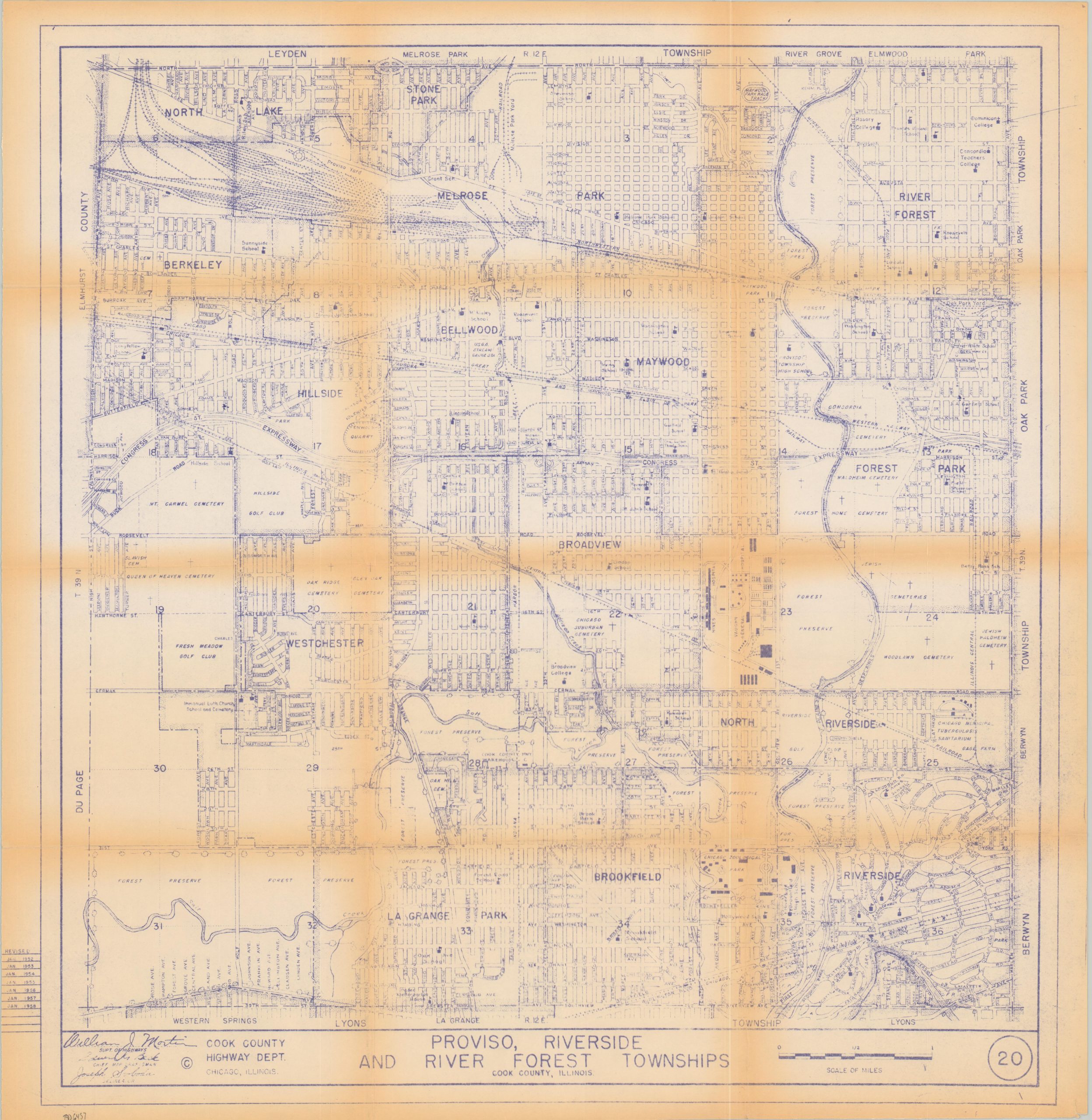
Proviso, Riverside and River Forest Townships
$145.00
Chicago’s western suburbs during the late 1950s.
1 in stock
Description
This informative map of several western Chicago suburbs was published by the Cook County Highway Department in 1958, according to a table of revisions in the lower left margin. In addition to primary transportation routes and notable geographic features, the image identifies the location of schools, cemeteries, major businesses, and large property owners. Of particular interest are the Chicago Municipal Tuberculosis Sanitarium (now part of Concordia College), Riverside (designed by Frederick Law Olmsted), the Chicago Zoological Park (today’s Brookfield Zoo), and the extensive Cook County Forest Preserves.
Map Details
Publication Date: 1958
Author: Cook County Highway Department
Sheet Width (in): 27.6
Sheet Height (in): 28.3
Condition: B+
Condition Description: Moderate toning along old fold lines (see scan). Printed on sturdy paper that's blank on the verso. Very good condition overall.
$145.00
1 in stock