
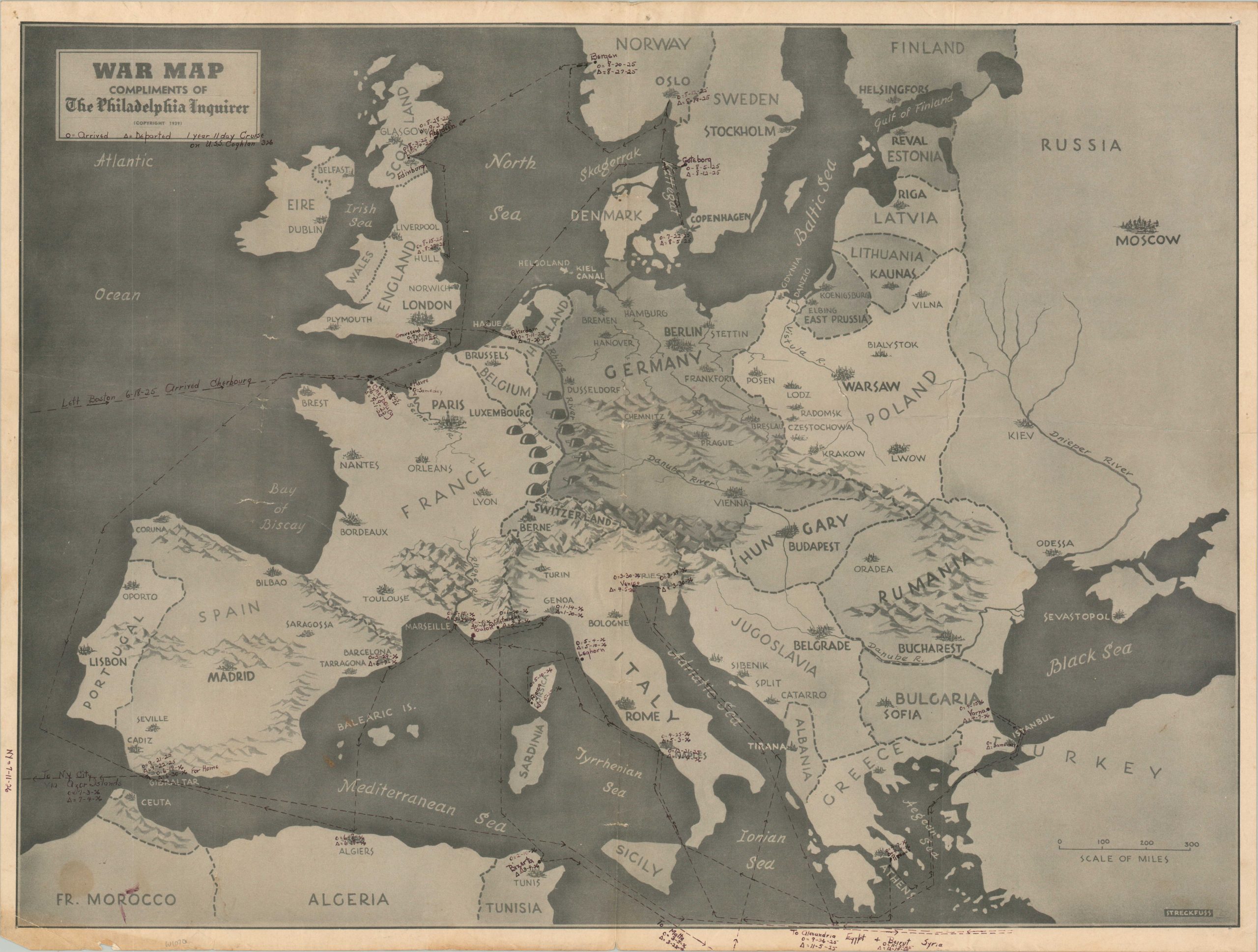
War Map Compliments of the Philadelphia Inquirer
A “1 year 11 day cruise on the U.S.S. Coghlan”
Out of stock
Description
This relatively straightforward pictorial relief map of Europe was designed by William Streckfuss and published in 1939 by the Philadelphia Inquirer. Contemporary political borders are outlined and primary cities are labeled. While the original intent was to educate an American audience on the conflict, then confined to the continent, a previous owner had different ideas. A fine black pen marks the route of the destroyer U.S.S. Coghlan (DDS-326) on its 1925 – 1926 cruise as part of U.S. Naval Forces Europe.
Between departing Boston on June 18th, 1925 and returning to New York City the following July 4th, the unnamed sailor steamed thousands of miles across the Atlantic, North, and Mediterranean Seas. Ports of call are labeled, along with their respective dates of arrival and departure. After the epic tour, the U.S.S. Coghlan served as a museum vessel at the Philadelphia Sesquicentennial Exposition, cruised with the Special Service Squadron off Nicaragua, and took part in the 1927 Presidential Fleet Review. In 1930, the ship was decommissioned and sold as scrap as part of the London Naval Treaty. An interesting and scarce relic from the much reduced American Navy of the interwar period.
Map Details
Publication Date: 1939
Author: William Streckfuss
Sheet Width (in): 29.1
Sheet Height (in): 21.9
Condition: B+
Condition Description: Black and white printed map with numerous annotations made in black ink. Creasing along fold lines and wear/soiling visible in the margins, concentrated in the lower left. Creased lower left corner and a quarter sized damp stain nearby (see scan). Good condition overall. Blank on verso.
Out of stock