
[Great Japan Map]
$600.00
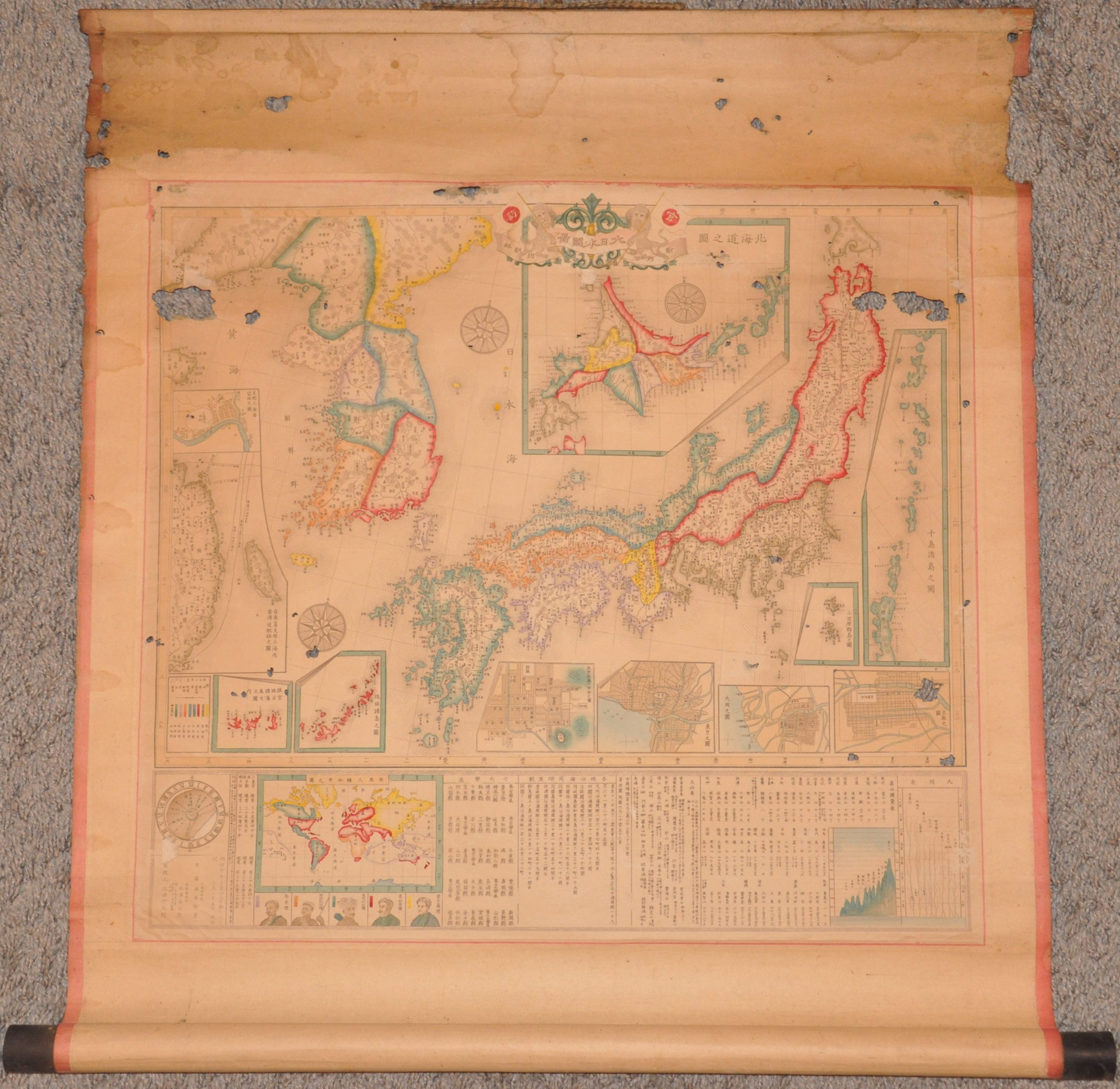
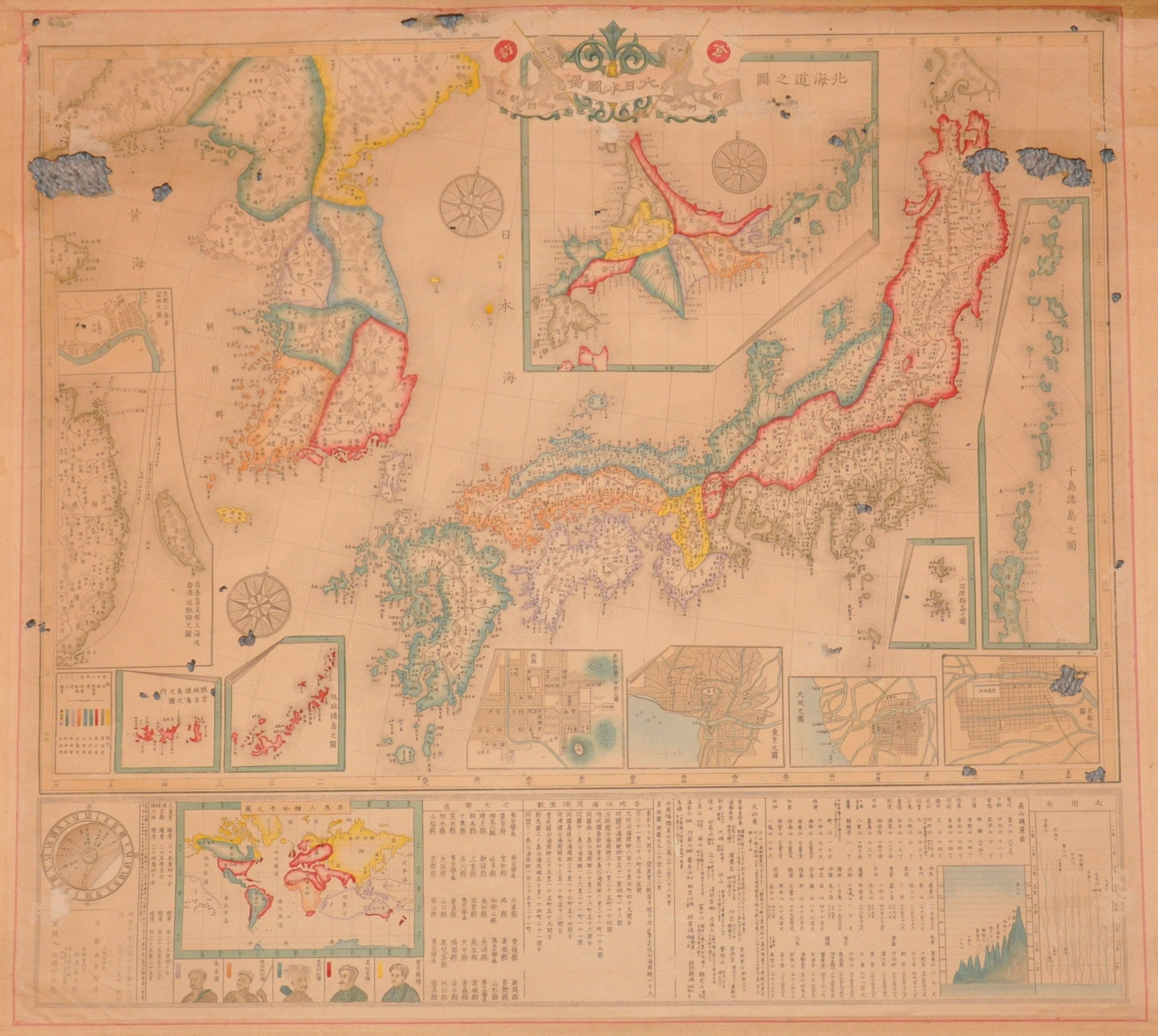
Incorporating Western cartographic conventions into maps of the early Meiji Era.
1 in stock

Description
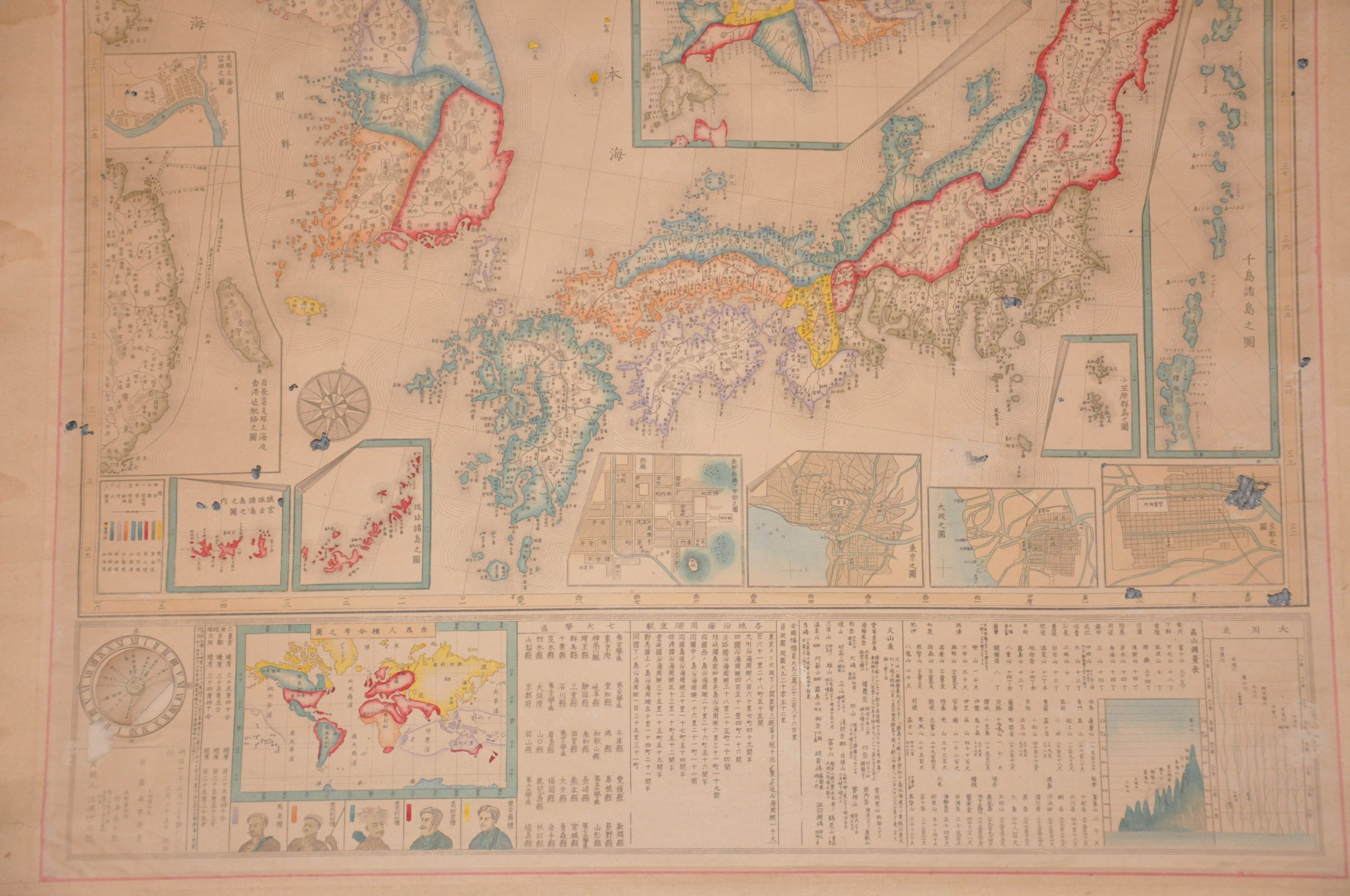
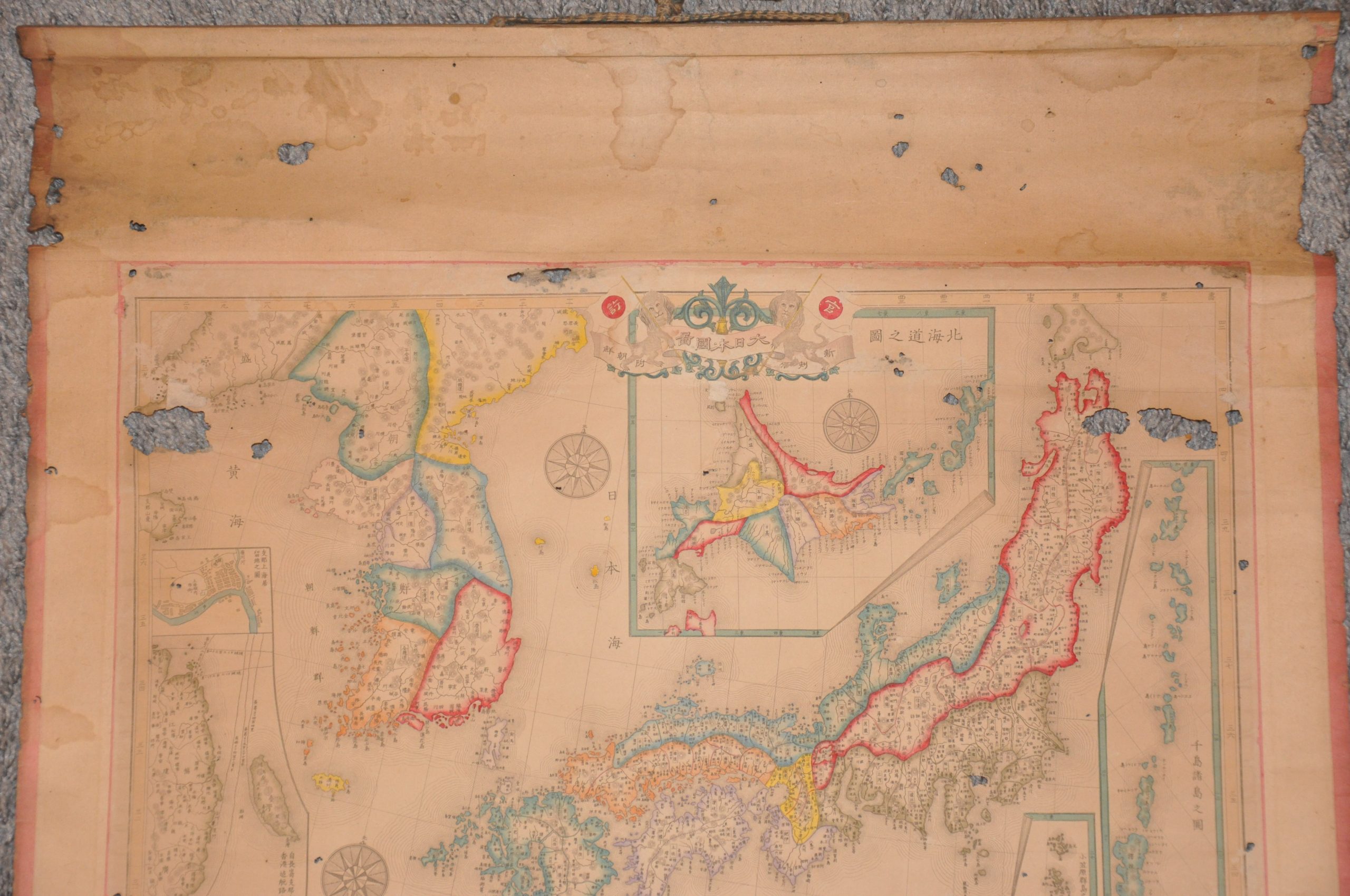
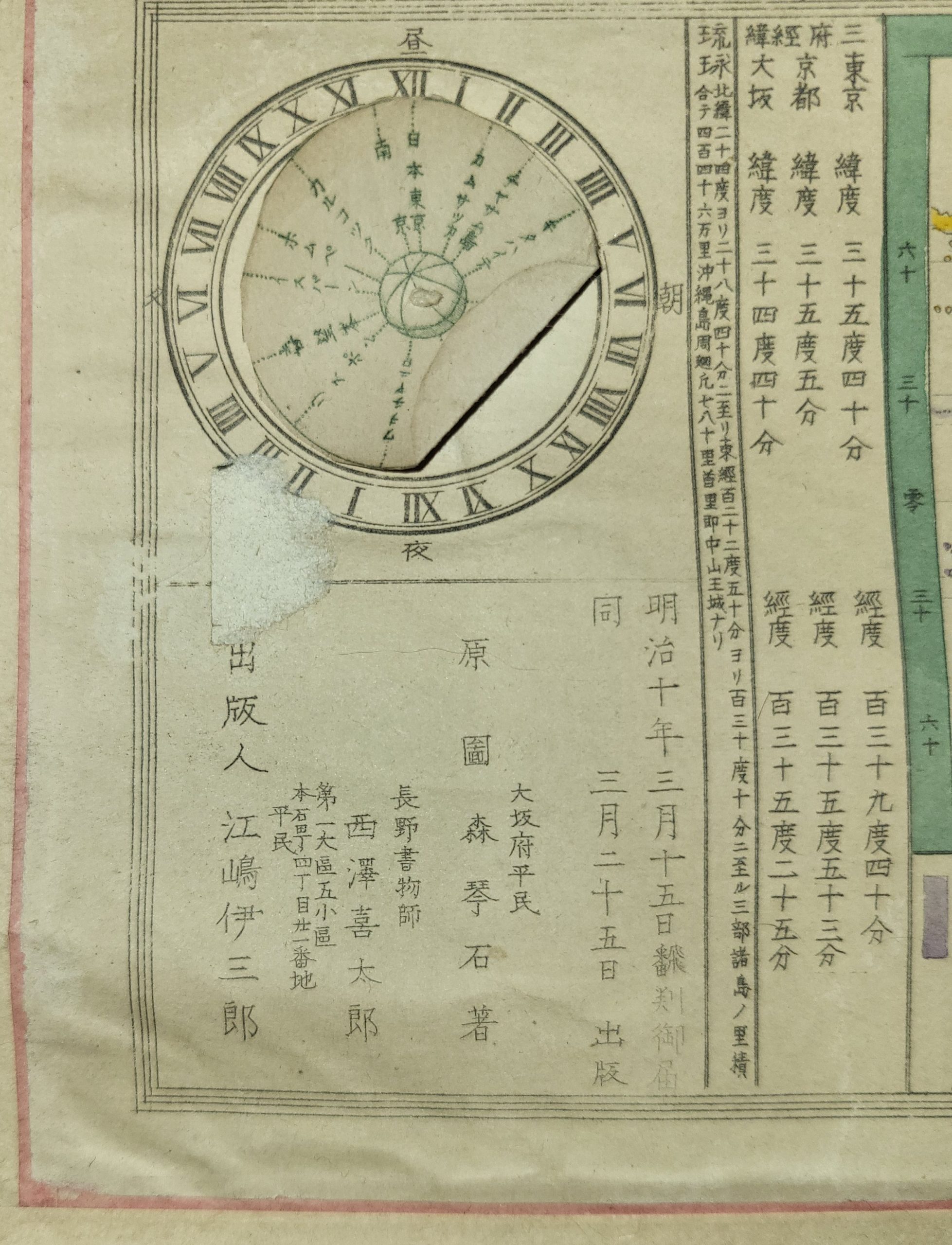
This official government-issued map of the early Japanese Empire was published in 1877 (Meiji 10). The boldly colored design is an impressive exhibition of imperial power and ambition, topped with the state flag officially adopted only seven years earlier. Korea’s inclusion within the territorial sphere of Japanese influence is notable considering the recent signing of the Japan–Korea Treaty of 1876. Another hotly disputed region was the Kuril Islands, pictured in an inset in the center-right. Other insets show Hokkaido, the Ryukyu Islands, the route to Shanghai, the Bonin Islands, and major urban centers (Kyoto, Tokyo, Osaka, and the future site of Nagano).
The composite image, designed for public display, is remarkable for its replication of well-known Western cartographic devices. This was likely a deliberate effort to reflect modernization efforts that were typical of the Meiji Era. Specific examples, apart from the overall composition and symbols used, include a comparative chart of mountains and rivers, spinning volvelle, a map of global races, statistical data, and decorative elements like ‘curled’ inset borders, a title cartouche, and compass roses.
Map Details
Publication Date: 1877
Author: Mori Kinseki?
Sheet Width (in): 22.6
Sheet Height (in): 23.5
Condition: B-
Condition Description: Woodblock map with original hand color, mounted on upper and lower wooden rollers with a string for hanging. Several spots of image loss from worming, concentrated near the top of the sheet. The worst areas affected are in the upper corners. Spots of damp staining visible along the top and left margins, with scattered soiling in a few spots as well. Between fair and good condition overall.
$600.00
1 in stock