
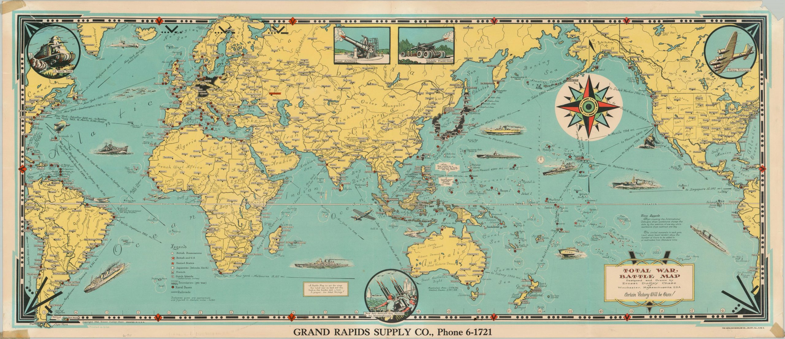
Total War Battle Map
V for Victory!
Out of stock
Description
This spectacular patriotic pictorial map presents the world at war, centered on the Pacific Theater. German and Japanese countries and occupational regions are colored in black (though not Italy) and a legend identifies the locations of Allied naval bases, colonial possessions, railroads, and political boundaries. America’s vehicles of war prowl the seas, including submarines, fighter planes, transports, warships, and PT boats. Inset illustrations show further military hardware in the form of (somewhat inaccurate) tanks, coastal batteries, mobile artillery, anti-aircraft, and the Flying Fortress.
Annotations throughout the map provide information on the International Date Line, distances across the Pacific, and geographic features to aid the audience in comprehending the geopolitical situation of the war. A brief poem also alludes to hidden symbolism around the edges of the sheet – “A Battle Map to set the stage For “total war” on land and sea, And, in the border, just a hint – A prayer – for total Victory!” (The repeated symbol, three dots and a dash, is Morse Code for the letter V.)
Designed by the talented Ernest Dudley Chase of Winchester, Massachusetts and published in 1942, just months after America’s entry into the war. This particular example was distributed by the Grand Rapids Supply Company.
Map Details
Publication Date: 1942
Author: Ernest Dudley Chase
Sheet Width (in): 36.5
Sheet Height (in): 15.75
Condition: B
Condition Description: Old cellophane tape present in each of the corners (confined predominantly to the margins). Tears in the upper corners have resulted in a small chip (right) and a large irregular tear (left), repaired on verso. Creasing along originally issued fold lines and scattered spotting visible in the lower center of the image. Between fair and good condition overall. Blank on verso.
Out of stock