
Plan der Stadt Pforzheim
$450.00
Recording the destruction of Pforzheim by the RAF.
1 in stock
Description
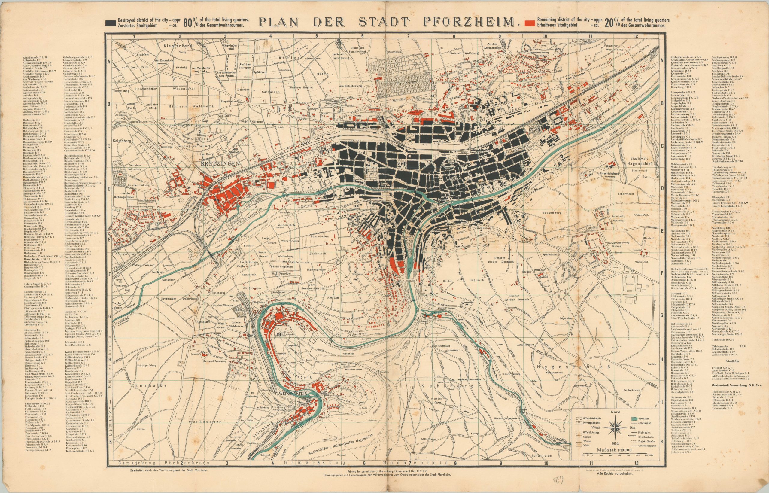
This uncommon street plan highlights the tremendous devastation inflicted upon the German city of Pforzheim during World War II. A base map designed by the town surveying office has been updated to show the success of a massive R.A.F bombing raid that took place on February 23, 1945. That night, nearly 400 planes dropped a mix of high-explosive and incendiary munitions that killed almost a third of the city’s inhabitants. Heavy black ink denotes the destroyed district of the city center – covering approximately 80% of the total living quarters, according to the text at the top of the page. The red color emphasizes the remaining habitable areas, confined largely to the adjacent suburbs of Brutzingen and Dill.
Text at the bottom of the page notes the map was “printed by permission of the military Government Det. G2 E2”, indicating it was likely issued by the U.S. War Department (Pforzheim was in the American zone of occupation) in mid to late 1945. Printed in Karlsruhe by Kunstlerbund Karlsruhe G.m.b.H. As of April 2024, WorldCat notes copies in six libraries, only two of which are in the United States (BYU and the University of Minnesota). OCLC# 367550504
Map Details
Publication Date: c. 1945
Author: Kunstlerbund Karlsruhe G.m.b.H.
Sheet Width (in): 32.75
Sheet Height (in): 21
Condition: B
Condition Description: Moderate to heavy spotting visible throughout the image, concentrated on the right side and along old fold lines. Wear along the outer edges of the sheet, including chipped corners, soiling, and separation along fold lines. Further separation visible at fold intersections. Between fair and good condition overall. Blank on verso.
$450.00
1 in stock