
The City of Charleston, South Carolina
$195.00
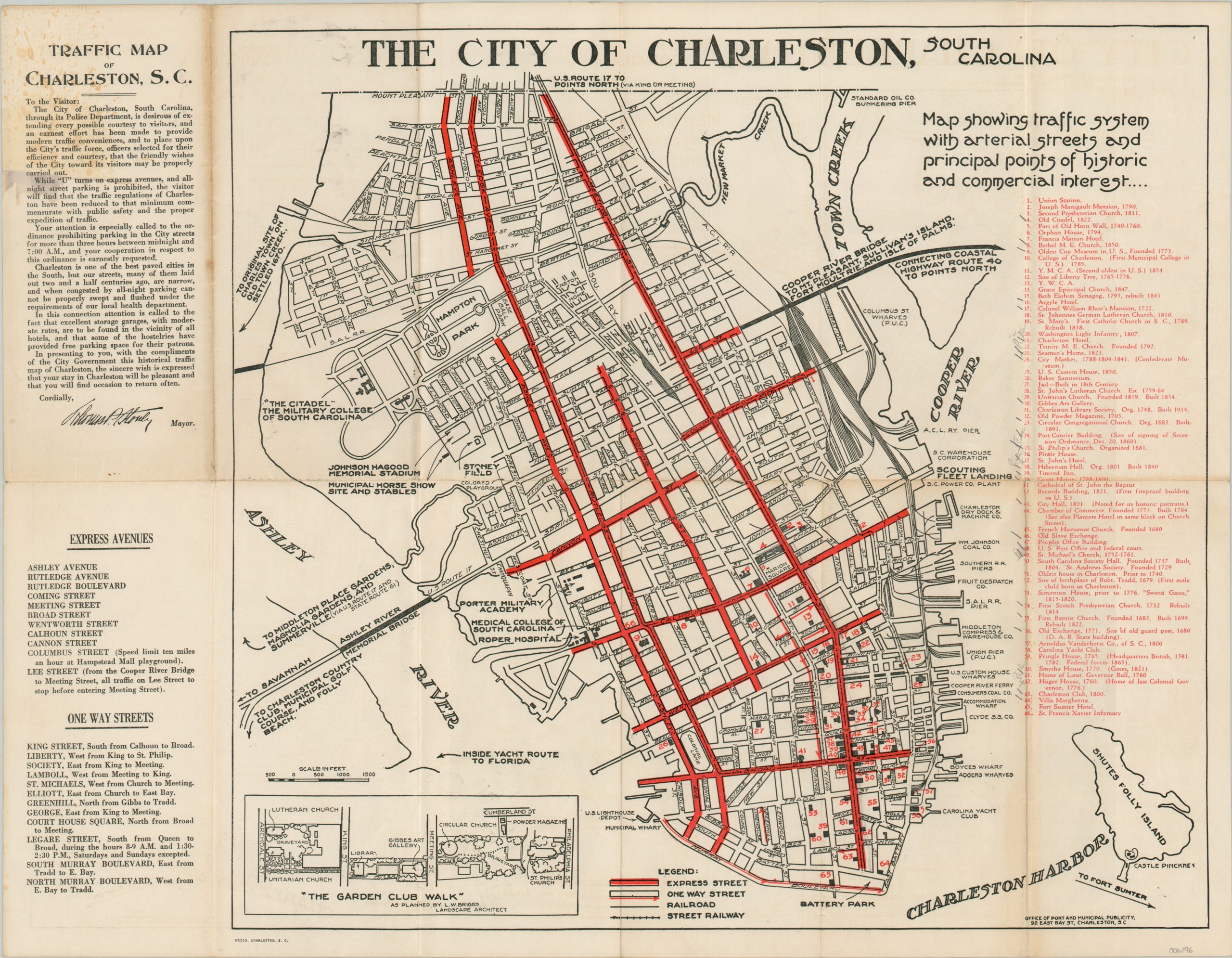
Informative traffic map of Charleston, South Carolina.
1 in stock
Description
“In presenting to you, with the compliments of the City Government this historical traffic map of Charleston, the sincere wish is expressed that your stay in Charleston will be pleasant and that you will find occasion to return often. Cordially, Thomas P. Stoney, Mayor.” – Text, upper left.
This fascinating map of Charleston, South Carolina was distributed by the Office of Port and Municipal Publicity around 1930, shortly after the opening of the Cooper River Bridge. This important thoroughfare, combined with the recent completion of the Ashley River Memorial Bridge (1926) led to an explosion of automobile tourism to ‘The Holy City.’ Motorists were still acclimating to the novel form of travel and their inexperience, combined with Charleston’s historic narrow roads, offered a recipe for terrible traffic congestion. Express streets (where overnight parking and U-turns are prohibited) are highlighted in red, while one-way streets are noted with arrows pointing in their respective directions. Both are listed in the lower left.
Nearby, an inset map shows “The Garden Club Walk” as planned by landscape architect L.W. Briggs and introduced the same year as publication. Various locations of interest are outlined and labeled throughout the image, including The Citadel, Battery Park, the Medical College of South Carolina, and Roper Hospital. Furthermore, over sixty different historic sites are numbered and keyed in red on the right side of the page. Apparently, a previous owner made a valiant attempt to visit them all!
Printed in Charleston by Wecco, likely in 1930 to commemorate the city’s 250th anniversary. The Cooper Bridge opened in 1929 and Stoney was replaced as mayor in 1932.
Map Details
Publication Date: c. 1930
Author: Office of Port and Municipal Publicity
Sheet Width (in): 21.75
Sheet Height (in): 17
Condition: B+
Condition Description: Moderate toning and several spots of soiling visible in the upper left, some of which enters the image but most just affecting the text. Creasing and wear along old fold lines and penciled annotations next to the key on the right side. Printed on paper with an interesting airplane watermark.
$195.00
1 in stock