
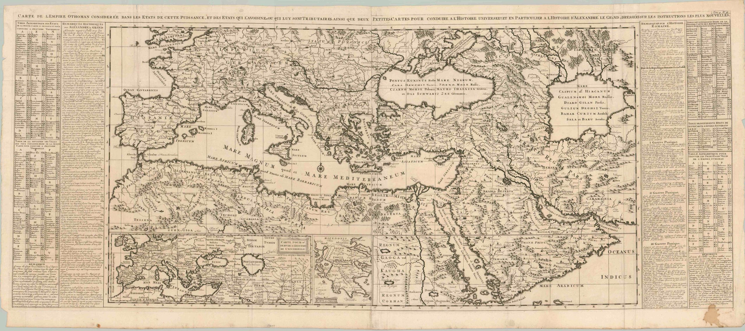
Carte de L’Empire Othoman Consideree dans les Etats de Cette Puissance, et des etats qui Luy Sont Tributaries, ainsi que Deux Petites Cartes pour Conduire a L’Histoire Universelle et en Particulier a l’Histoire d’Alexandre le Grand Dressee sur les Instructions les Plus Nouvelles.
$400.00
Comparing empires of the Mediterranean.
1 in stock
Description
“Map of the Ottoman Empire Considered in the States of This Power, and the States Tributary to It, as well as Two Small Maps to Conduct Universal History and in Particular to the History of Alexander the Great Drawn with the Newest Instructions” – Approximate title translation.
This spectacular two-sheet map covers the entirety of the Mediterranean and much of the Middle East, North Africa, Central Asia, and Southern Europe. Scores of toponyms identify a fascinating variety of settlements and geographic features, both ancient and contemporary. Many of these places are keyed in the two tables on either side of the sheet. The detailed central image was designed to illustrate the breadth of the Ottoman Empire near its height, one of the handful of European maps to do so because of the longstanding animosity between East and West. Comparisons are made to the historical conquests of Alexander the Great, which are outlined in two inset maps in the lower left. Blocks of text on either side describe the history of Alexander’s brief reign and remarks on the Roman Empire.
The copperplate-engraved sheet was originally published in Paris as part of Henri Abraham Chatelain’s important Atlas Historique. This monumental seven-volume set was first issued in Amsterdam between 1705 and 1720, but was re-printed in numerous in several subsequent editions until the late 1730s. The scholarly, but approachable, work was aimed at a broad audience, eager for new information during the Age of Enlightenment. The breadth of content offers of a nuanced synthesis of geography, cosmography, history, religion, ethnology, and political science. The descriptive text (in French) and skillfully engraved maps, diagrams, and illustrations provide a fascinating window into the world of the early 18th century.
Map Details
Publication Date: c. 1719
Author: Henri Abraham Chatelain
Sheet Width (in): 49
Sheet Height (in): 20.4
Condition: B
Condition Description: Two copperplate engraved sheets adjoined down a central seam, as issued, that shows some moderate darkening near the bottom, probably as a result of the original plate strike. Heavy wrinkling and creasing along old vertical fold lines, concentrated most heavily in the upper left. A large irregular stain in the lower right, confined to the margin and text. Other scattered spots, small pinholes at fold intersections, and minor signs of wear and age. About good condition overall. Issued on strong, watermarked paper that is blank on the verso
$400.00
1 in stock