
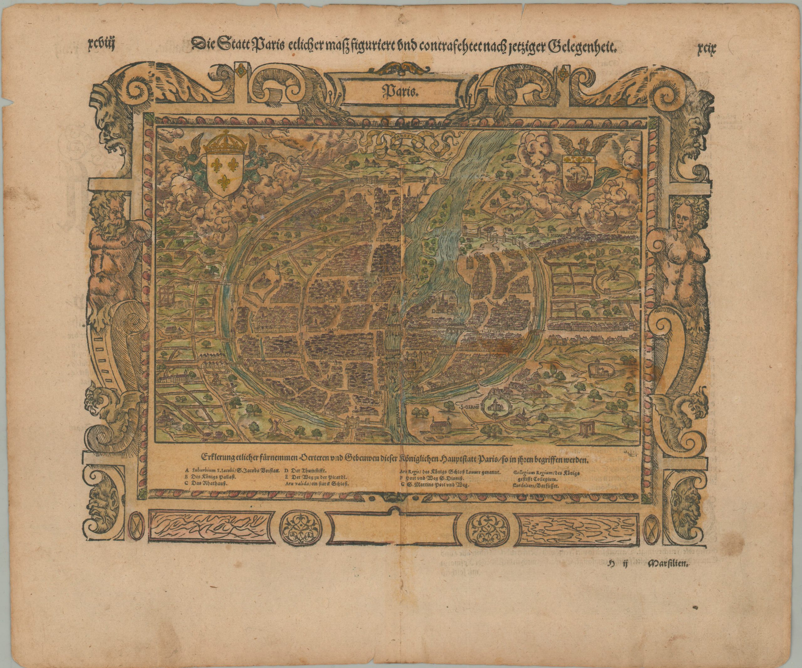
Die Statt Paris…
$425.00
Beautiful view of Paris in the 16th century.
1 in stock
Description
The middle of the 16th century saw tremendous leaps in the advancements of cartography. New maps were added to updated editions of Ptolemy’s Geographia, reflecting the latest in discovery and navigation. Sebastian Munster, an influential German scholar, published such an example in 1540, where he was the first to add separate maps of each continent (Asia, Africa, Europe, and America). Four years later he would similarly modernize Ptolemy’s Cosmographia with maps from Geographia, in addition to entirely new sheets.
This attractive and elaborate woodcut plan of Paris was published in a German-language edition of Munster’s Cosmographia around 1580. The image is oriented with east at the top and depicts the city surrounded by medieval walls and bisected by the Seine. Over ten different locations of interest are numbered and identified in the legend at the bottom of the scene. Examples include the Cordeliers Convent and the iconic College of Paris. Other points of interest are carefully labeled using inlaid letterpress. An elaborate decorative border and the coats of arms of France (upper left) and Paris (upper right) can also be seen.
Sources: Columbia University; University of St. Andrews
Map Details
Publication Date: c. 1580
Author: Sebastian Munster
Sheet Width (in): 16.2
Sheet Height (in): 13.6
Condition: B+
Condition Description: Moderate soiling and wear along the outer edges of the sheet, including several small tears (confined to the margins) and a small spot in the lower right. Old repairs along the centerfold. Between good and very good overall.
$425.00
1 in stock