
The Canadian West
THE LAST WEST – now available for sale!
Out of stock
Description
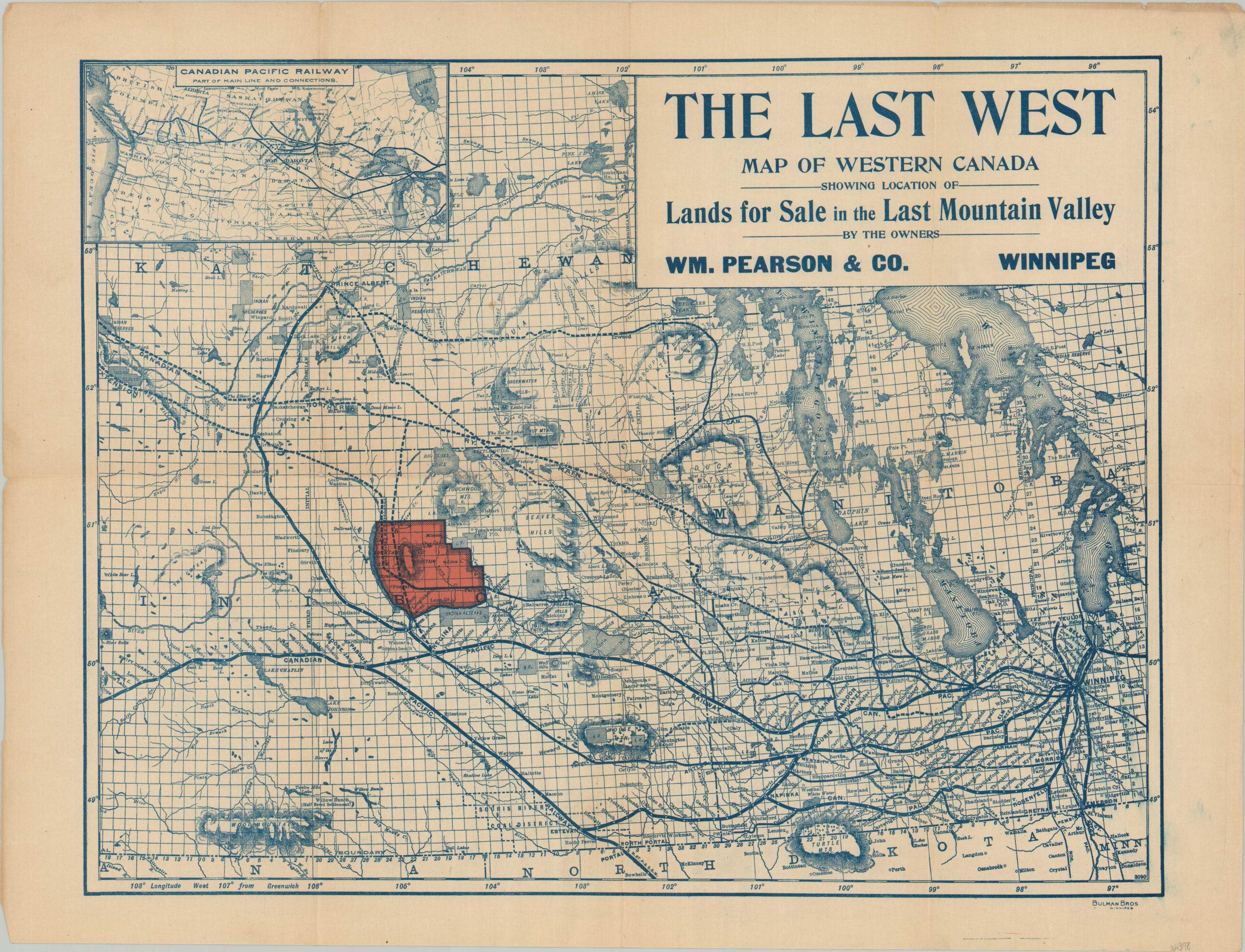
This exciting and ephemeral map was issued around 1903 by William Pearson & Co. to promote the sale of company lands in Saskatchewan’s Last Mountain Valley. Pearson was a local businessman from Winnipeg who invested heavily in the region and distributed maps and literature widely to encourage emigration and tourism.
Bright red color highlights a large parcel bounded loosely by Jumping Deer Creek, the Qu’Appelle River, and Last Mountain Lake. A tempting proposed extension of the Canadian Pacific Railway is shown bisecting the territory, allowing for access to the ever-expanding network of rails emanating from Winnipeg. The entire C.P.R. system can be seen in an inset in the upper left. Numerous Indian Reservations (I.R.s) are dotted throughout the image.
Topography is depicted in hachure and an interesting variety of place names, geographic features, and locations of interest are labeled throughout the image. Of note is the ‘Half Breed Settlement’ established at Willow Bunch – the location of a Metis community forced to emigrate from Manitoba.
Sources: Metis History; Village of Govan History
Map Details
Publication Date: c. 1903
Author: William Pearson & Co.
Sheet Width (in): 20.25
Sheet Height (in): 15.25
Condition: B+
Condition Description: Printed on thin paper that's creased and shows moderate wear along originally issued fold lines. Minor wear around the outer edges of the sheet and some ink offsetting visible in the upper right corner. Good to very good overall.
Out of stock