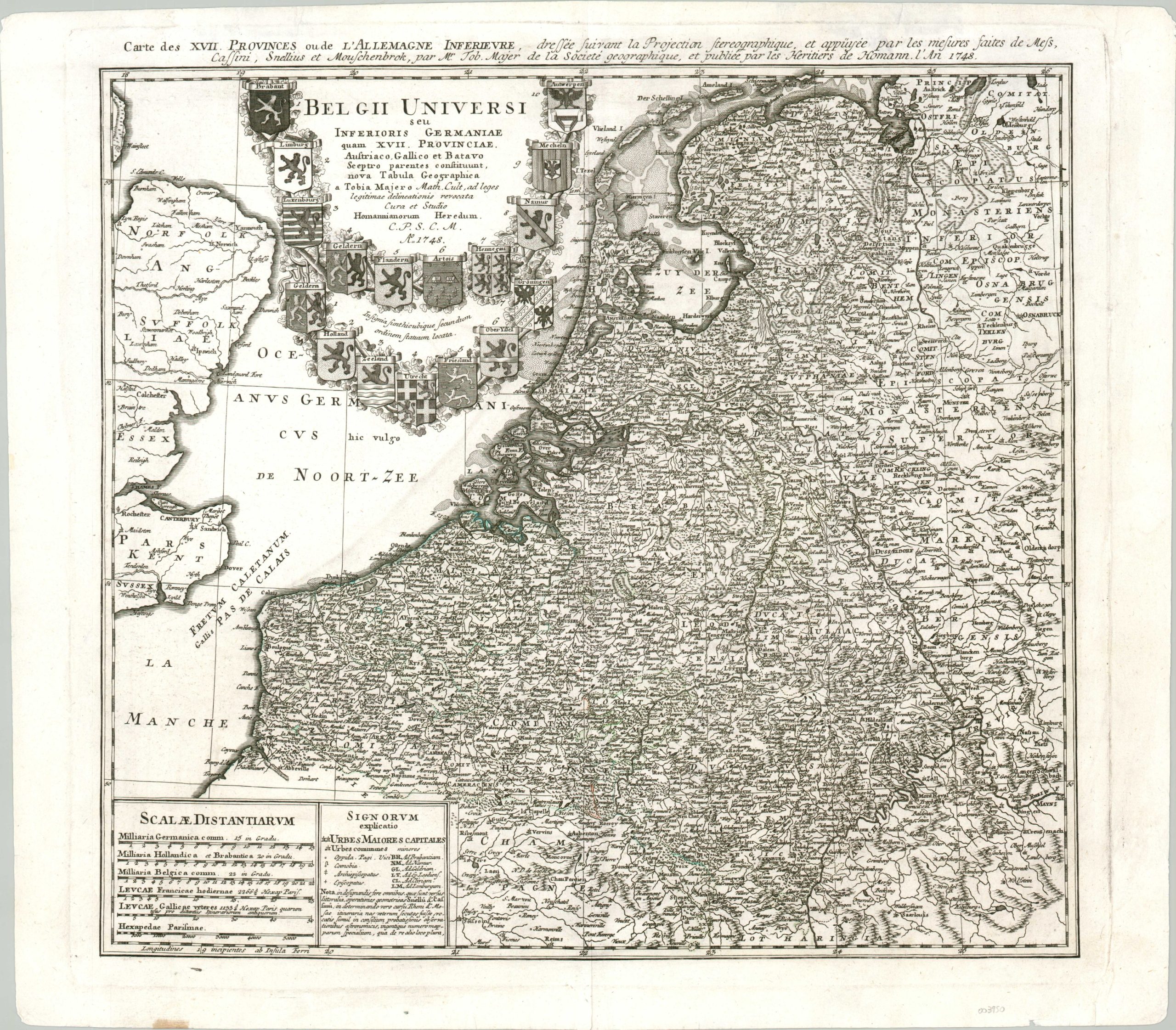
Belgii Universi seu Inferioris Germaniae…
A historic look at the Hapsburg Netherlands.
Out of stock
Description
This attractive copperplate engraved map shows the extent of the Seventeen Provinces of the Hapsburg Netherlands in the modern-day countries of France, Luxembourg, Belgium, and the Netherlands, as well as a portion of eastern England. The coats of arms of each province can be seen around the title cartouche, though by the time of publication seven provinces in the north had seceded to become the Dutch Republic (1581).
Geographic features are depicted pictorially and labeled along with settlements and regional polities. A legend in the lower-left identifies the symbols and abbreviations used throughout, while the adjacent distance scale reflects the various regional interests.
The map was published in Nuremberg by the Homann Heirs in 1748. The timing was especially propitious, as the War of Austrian Succession ended that same year with the Treaty of Aix-la-Chapelle. The agreement saw the Netherlands returned from France to the Austrian Hapsburg Empire under Maria Theresa, who in turn had to cede Silesia to Prussia. France, exhausted and broke after the campaign, suffered serious financial distress as a result. The resulting general discontent with the peace would encourage the Diplomatic Revolution of 1756 and the Seven Years’ War.
Map Details
Publication Date: 1748
Author: Homann Heirs
Sheet Width (in): 23.6
Sheet Height (in): 20.6
Condition: A-
Condition Description: Moderate wear visible in the outer margins, including a few small tears that have been repaired on the verso, some light creasing, and small chips in the corners. Overall in very good condition - a bold impression on a clean sheet.
Out of stock