Oceanica
$75.00
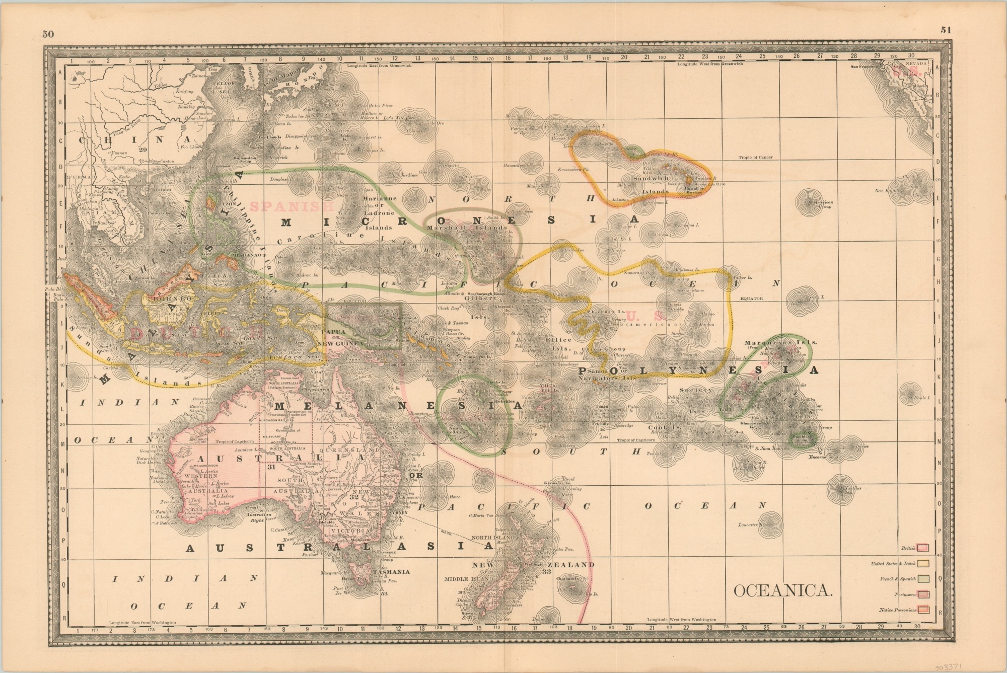
Imperialism across the South Pacific at the end of the 19th century.
1 in stock
Description
This fascinating map of the South Pacific covers the entirety of the vast ocean territory between the coast of China and California. Broad regional distinctions are then further subdivided into various zones of occupation, colored according to the legend in the lower right corner.
Native possessions, highlighted in orange, are relatively limited. Notable examples include ongoing conflicts in the Dutch East Indies, territory gained during the Philippine Revolution, and the independent kingdom of Hawaii on the eve of its annexation by the United States.
The map was published in Chicago by Rand McNally in 1896.
Map Details
Publication Date: 1896
Author: Rand McNally
Sheet Width (in): 21.25
Sheet Height (in): 14
Condition: A-
Condition Description: A bit of faint damp staining in the upper right, confined to the margin, but otherwise in fine condition overall.
$75.00
1 in stock